
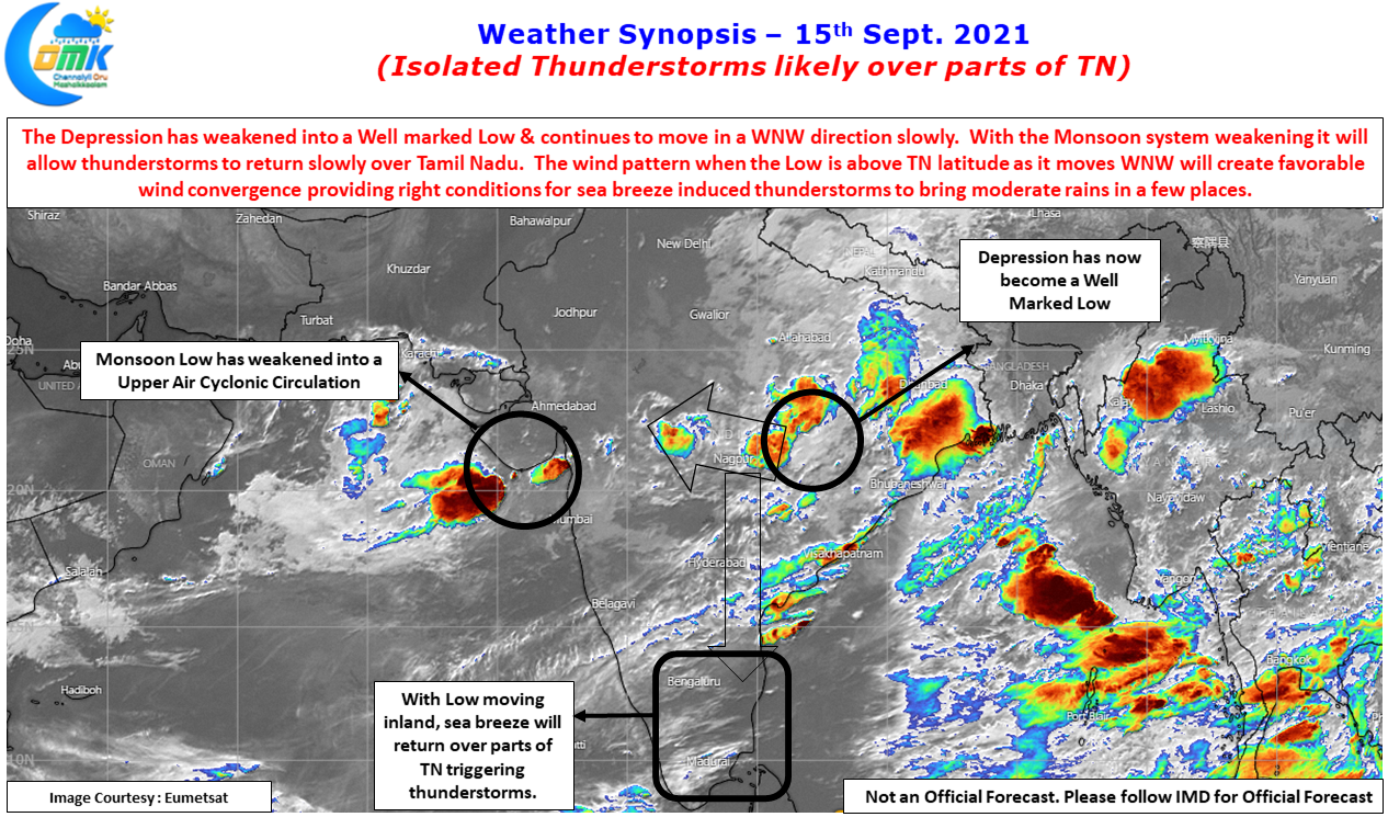
Yesterday’s Depression over Odisha & adjoining Chhattisgarh has weakened into a Well Marked Low today morning as it continues to track in a WNW direction towards the plains of Central India. In the meanwhile on the other side of the Monsoon trough the Low over Gujarat & adjoining regions has become an Upper Air Cyclonic Circulation as it continues to give rains over the region. The Satellite image which was looking an active Monsoon day over the Indian Sub Continent is slowly seeing the effect of the weakening disturbances.
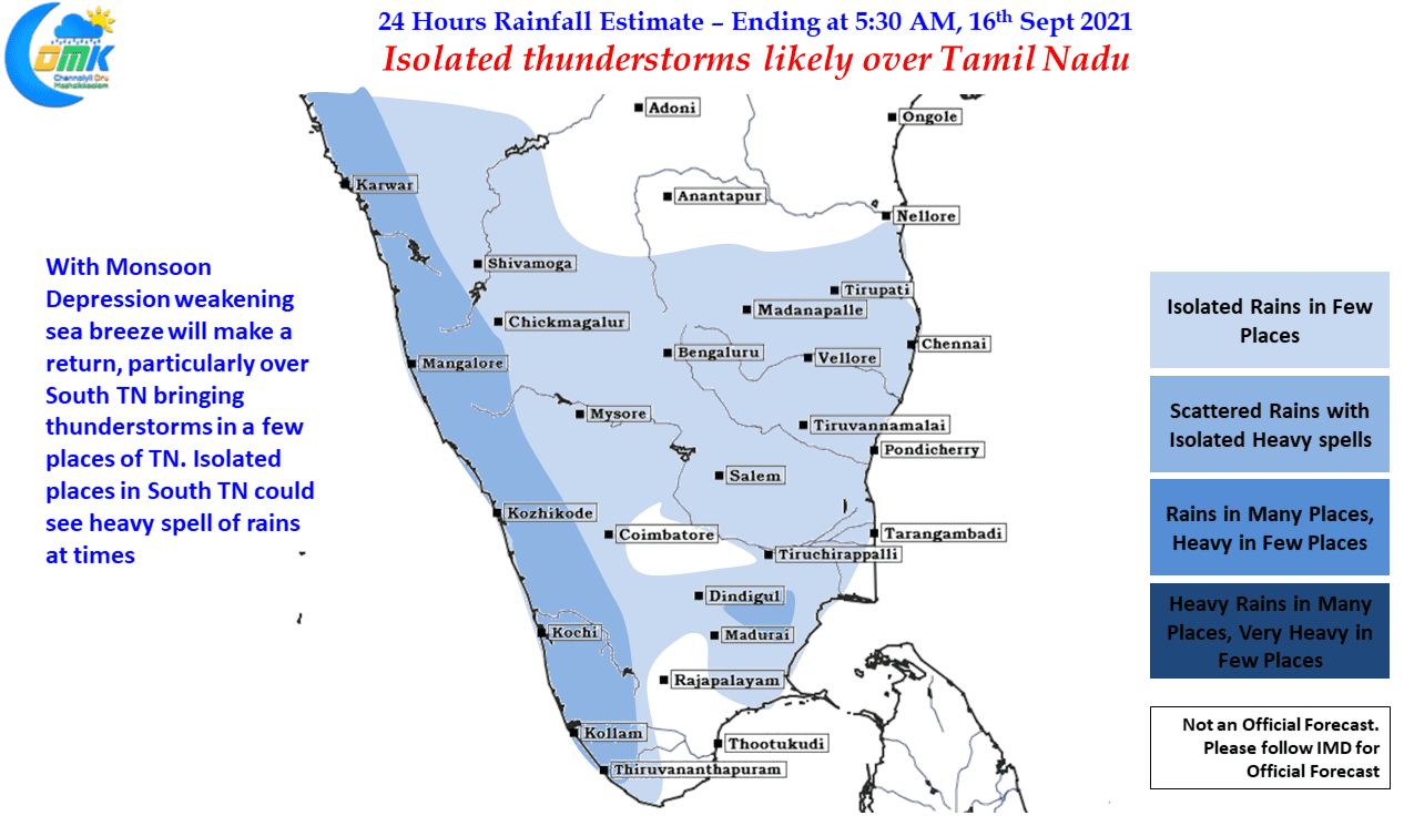
This weakening of the disturbances along with the further movement inland opens up the thunderstorm window once again for the leeward areas of Tamil Nadu. Unlike the past week or so which did not see any major influence of sea breeze over the coastal areas of Tamil Nadu due to stronger westerlies, weather models indicate some parts of Tamil Nadu to come under the influence of lower level wind convergence triggered by the return of sea breeze. This is likely to bring back thunderstorms once again over a few parts of Tamil Nadu for the next few days though unlike break in monsoon period these thunderstorms will not be widespread & extremely heavy.
In particular today parts of South TN may benefit from the returning sea breeze with one or two places in the usual suspect list around Pattukottai / Pudukottai / Sivagangai belt could see heavy spells at times as thunderstorms intensify under the influence of downwind pseudo wind convergence at 1.5 kms altitude triggered by the High peaks of Western Ghats like Anaimudi, Kolukku malai etc. Chance for Chennai & suburbs also looks good though it could be extremely isolated compared to South TN where wind convergence effect may amplify the sea breeze triggered instability.