
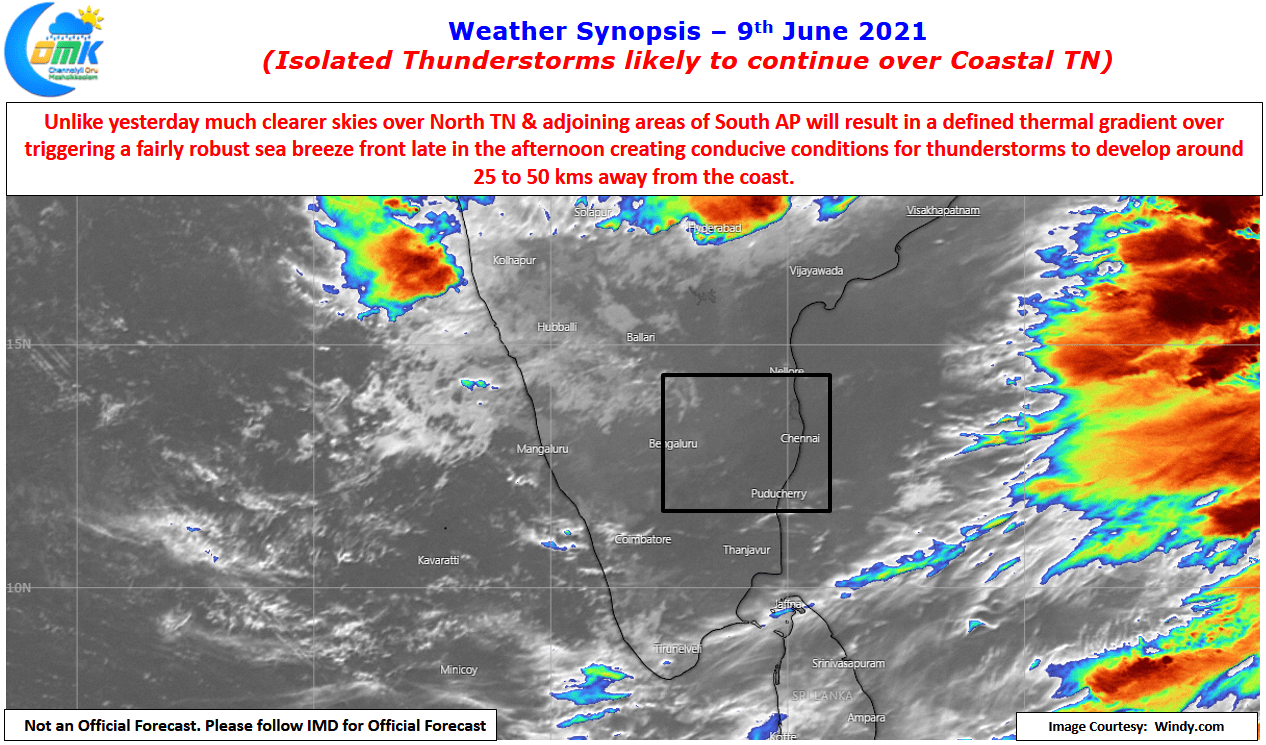
Monday saw Chennai and suburbs hit by some high intensity thunderstorms as conducive conditions set by sea breeze intrusion brought it heavy spells of rains over many parts of the city & suburbs. Yesterday saw parts of South TN, Delta and Cuddalore dts record late afternoon / evening thunderstorms triggered by weak wind convergence & aided by the presence of sea breeze intrusion. Crucially the cloudy skies during the early part of the day from remant thunderstorms over North TN & adjoining areas of South AP meant weak thermal gradient over North Coastal TN preventing a proper sea breeze to be formed.
While we talk of swinging pendulum between west coast & east coast, Monsoon Rains & Thunderstorms, often we forget that there is a pendulum within this pendulum in the form of oscillating sea breeze front / surface level westerlies. It is once again a fine balance in terms of the right thermal gradient & wind gradient for these thunderstorms to develop along the Chennai Coast. It goes without saying that the Chennai thunderstorm equation is far more complex than what appears to be on the outside.

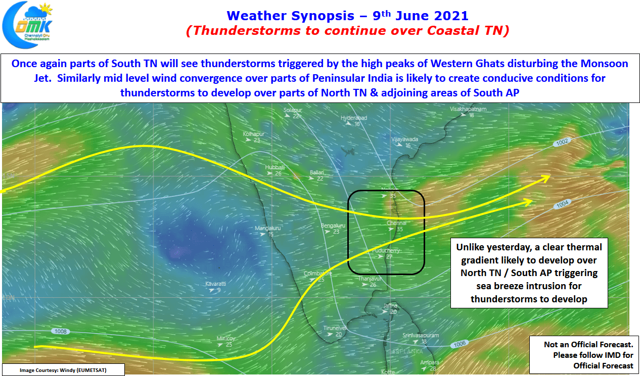
In the meanwhile while Bay gets ready to churn a Monsoon low that is likely to give a fillip to Southwest Monsoon over the next week or two today once again coastal areas of Tamil Nadu is likely to see conducive conditions for thunderstorms to develop through sea breeze intrusion. Additionally a weak mid level convergence seen over North TN & South AP areas could make some of these thunderstorms develop intensity later in the evening bringing one more day of possible rains for Chennai & Suburbs.