
Last couple of days have seen isolated thunderstorm activity over Tamil Nadu. While South TN recorded moderate rains earlier this week yesterday saw few places in West Interior TN and Central TN record isolated rains. Bengaluru recorded its first spell of Summer Rains with more expected today.

While rains have been mostly confined to a few places the interplay between the Easterlies & the Westerlies triggered by the dipping Sub Tropical Trough has meant temperatures have stayed under control with most places near normal and in the case of Northwest Interior TN slightly lower than normal as well. South Tamil Nadu though remains an exception remaining fairly hot though even there the temperatures are lower compared to mid week when places like Madurai AP crossed 38ºC.

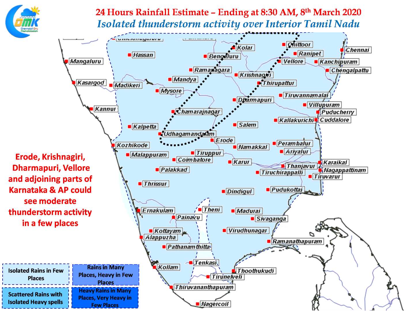
As we had mentioned in our post a couple of days back the thunderstorms have been slowly climbing North as the Westerly trough moves further east dragging the induced circulation / Low Pressure Area along with it. Today once again Northwest Interior TN and adjoining parts of Karnataka and South AP will enjoy moderate thunderstorm activity.
Places to the West & Northwest of Chennai may enjoy a good spell of sharp thunderstorm activity but its a billion dollar question if the city would enjoy any spell.