

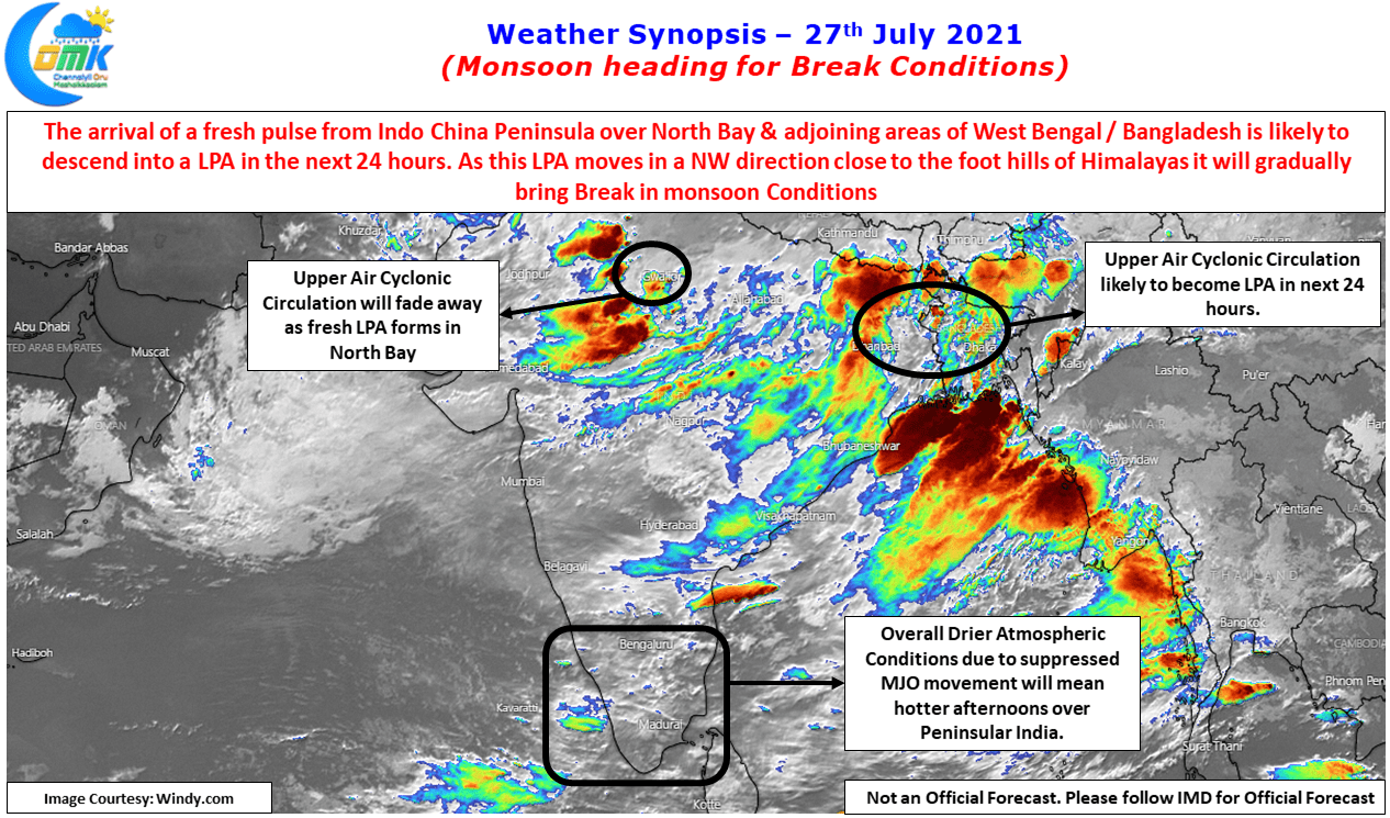
The last couple of days has seen the return of thunderstorms in a few places over Tamil Nadu. Sunday late night saw intense thunderstorms over parts of Tiruvallur district with the remnant storms moving over the Northern suburbs of Chennai. A few hours earlier on Sunday evening moderate thunderstorm activity happened over parts of Tiruvannamalai, Villuppuram & adjoining areas of Pondicherry as well. Last night many parts of Chennai saw light to moderate rains happen as interior thunderstorms crossed coast influenced by strong westerlies. While these may not exactly reflect the classic “Break in Monsoon” Conditions as westerlies are still strong there are a couple of circulations in the Northern parts of the country.
Nevertheless things though are falling in place for another spell of Break in Monsoon though with an Upper Air Cyclonic Circulation, courtesy a West moving pulse from Indo China peninsula is seen over the North Bay area & adjoining areas of West Bengal & Bangladesh. This is likely to descend into a LPA in the next 24 hours and gradually move in a NW direction dragging the monsoon trough closer to the foothills in the process.
It might be pertinent to point out here the role of these LPAs’ in the creation & cessation of Break in Monsoon conditions as well. When a LPA forms in extreme North / Northwest Bay & moves in a NW direction along the foothills of Himalayas, it pulls up the monsoon trough along with it triggering Break in Monsoon conditions during the process. Similarly a UAC descending into an LPA over the Central Bay pulls down the monsoon trough towards it bringing an end to the Break in Monsoon conditions. While yes large scale dynamics indeed influence these break in monsoon conditions, a close observation of the LPA formation will give an idea on the creation & cessation of Break in Monsoon conditions.
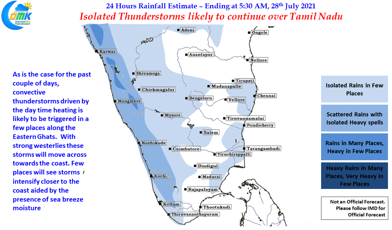
Today once again weather models promise isolated thunderstorm activity triggered by day time heating across Peninsular India. While there exists two circulations over the Indian Sub Continent the overall suppressed phase of MJO, which now lies over the West Pacific means widespread active monsoon conditions seen the last week has reduced. This has also resulted in drier than normal atmospheric conditions over Peninsular India providing an opportunity for the convective thunderstorms develop along the Eastern Ghats through a combination of day time heating lifting the air particles & the orographic lift provided by the Eastern Ghats. In an interesting point the presence of weak sea breeze along the coast enhances some of these thunderstorms as they near the coast bringing isolated heavy spells of rains when the pass the coast from west to east.