
Following Weather as an enthusiast requires a lot of patience at the best of the times. When things don’t go as per expectations it tends to become stressful as well. But the key is to retain objectivity at all times so that personal bias does not set into our thinking. When personal bias sets in the inferences become subjective in the process losing focus on the inferences. As the saying goes in Bhagavad Gita எது நடந்ததோ அது நன்றாகவே நடந்தது. எது நடக்கின்றதோ அது நன்றாகவே நடக்கின்றது. எது நடக்க இருக்கின்றதோ அதுவும் நன்றாகவே நடக்கும். As weather bloggers our responsibilities lie in inferring weather patterns to the best of our knowledge rather than bringing personal bias & prejudice into it thereby clouding our thinking.

While parts of Chennai recorded light to moderate spell of rains yesterday morning, particularly along the coast interior parts of Tamil Nadu saw thunderstorms move in later in the afternoon indicating the strengthening of Easterlies. Satellite images indicate a batch of thunderstorms to the Northeast of Chennai along the latitude of Nellore. This is where the Dry Line Boundary is currently prevailing. As the day progresses this batch of storms will possibly cross the coast between Nellore & Chennai.

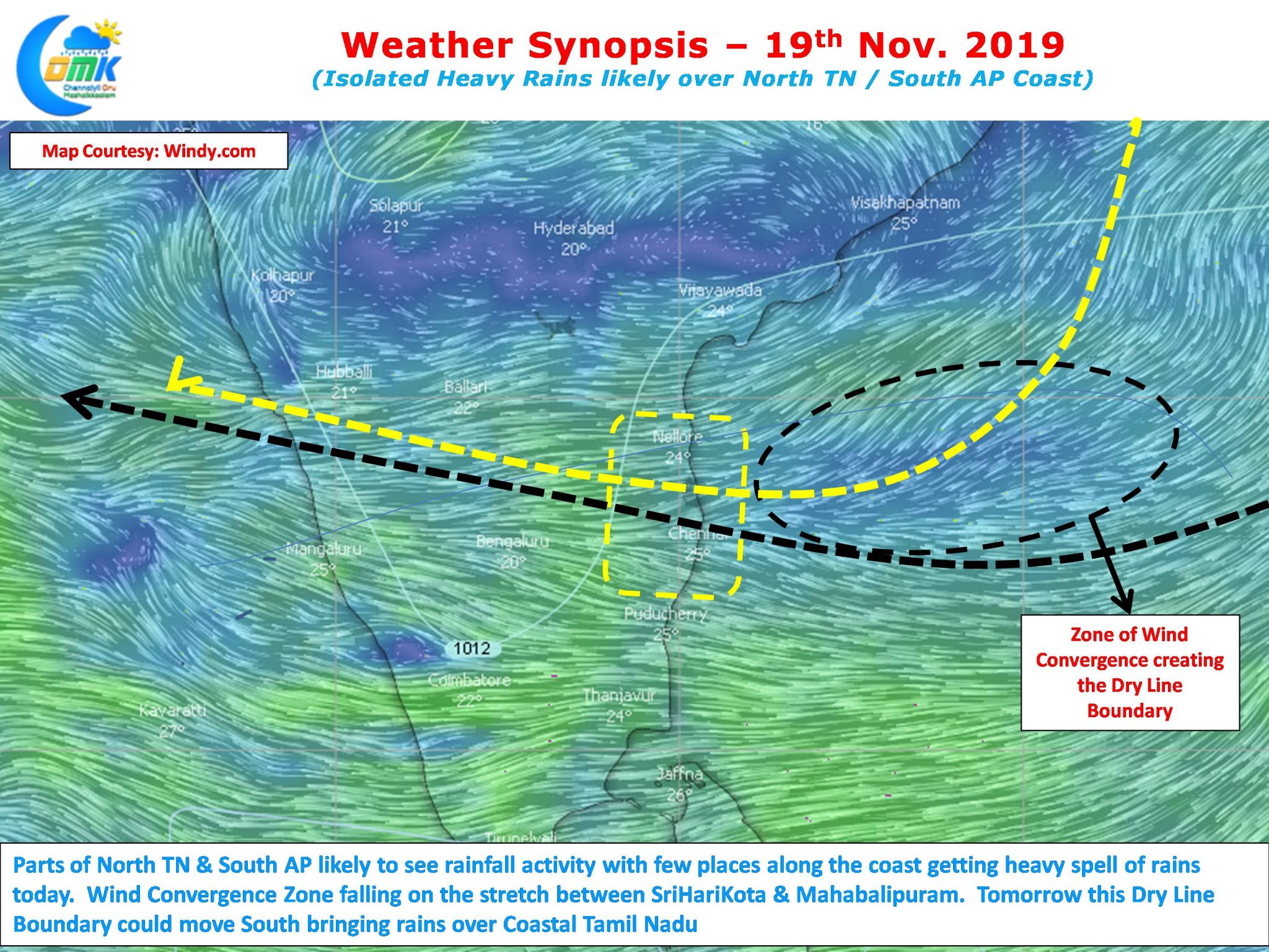
The wind convergence zone lies roughly around Chennai latitude today indicating the dry line boundary. This wind convergence zone roughly is likely to be over Sriharikota & Mahabalipuram. Weather models indicate the heaviest spell of rains are likely to happen just North of Chennai coast today. A slight shift to South in this wind pattern could mean more places in North Coastal TN may receive good rains. As this dry line boundary zone shifts south tomorrow we could see more places of Coastal TN record good spell of rains.