
Thunderstorms continue to pick up in intensity over many parts of Tamil Nadu, interestingly yesterday evening the pattern of thunderstorms indicated the weakening of westerlies, with many places closer to the Ghats coming under rains. Parts of Tiruppur dt saw good rains which typically happens as the Westerlies weaken. North Tamil Nadu though was understandably quiet after the early morning rampage around North Chennai & adjoining city areas.
If the early morning thunderstorms over Chennai gave some goose bump moments for bloggers due to the shear uniqueness of the timing & development the mid morning thunderstorms over the Delta areas seeded doubts whether it was Southwest Monsoon time or Northeast Monsoon time. As the day progressed the action shifted further west indicative of the shifting convergence zone.

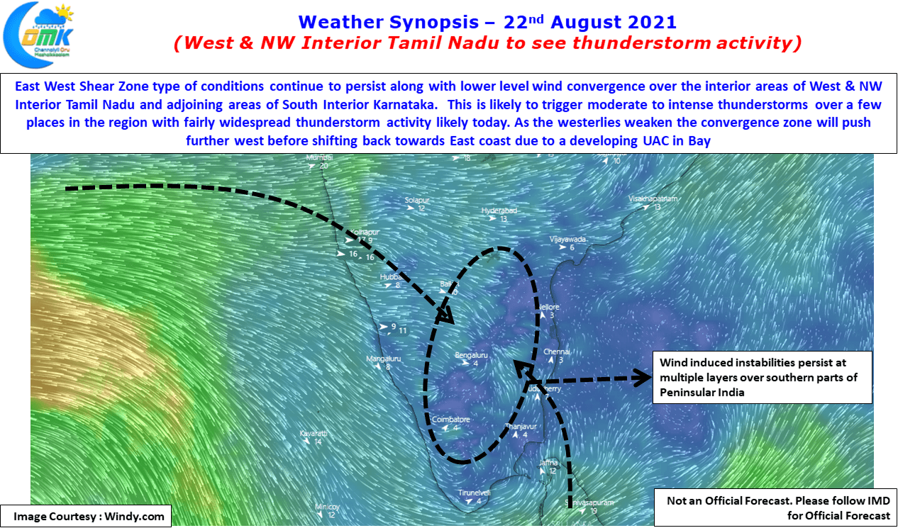
Weather models indicate wind induced instabilities to persist over the southern parts of Peninsular India with different types of instabilities prevailing at various levels. On the one hand at mid tropospheric levels the East West Shear Zone type of conditions continue to persist over parts of Tamil Nadu & adjoining interior areas of Karnataka & Andhra Pradesh. While lower level wind convergence which was seen closer to the East coast on Friday night is now expected to shift further to the west for a couple of days. In the meanwhile there appears to be a weak UAC developing in Bay as well which needs to be kept a watch on for further progress.
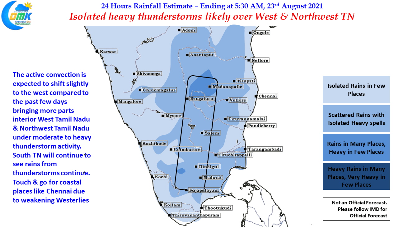
All in all conditions look good for thunderstorms to continue over the interior areas of Tamil Nadu, Karnataka & Andhra Pradesh. Interestingly August has been poor so far over South Interior Karnataka & adjoining parts of Rayalaseema region, this could be covered in the coming week or so. As far as Tamil Nadu goes today, west & northwest interior parts of Tamil Nadu could see isolated heavy thunderstorm activity while parts of South TN & adjoining areas of delta districts will see thunderstorms continue today too. In the meanwhile due to changing wind patterns it could be touch & go for places like Chennai, though this situation is going to be only for a couple of days before things pick up for the good.