
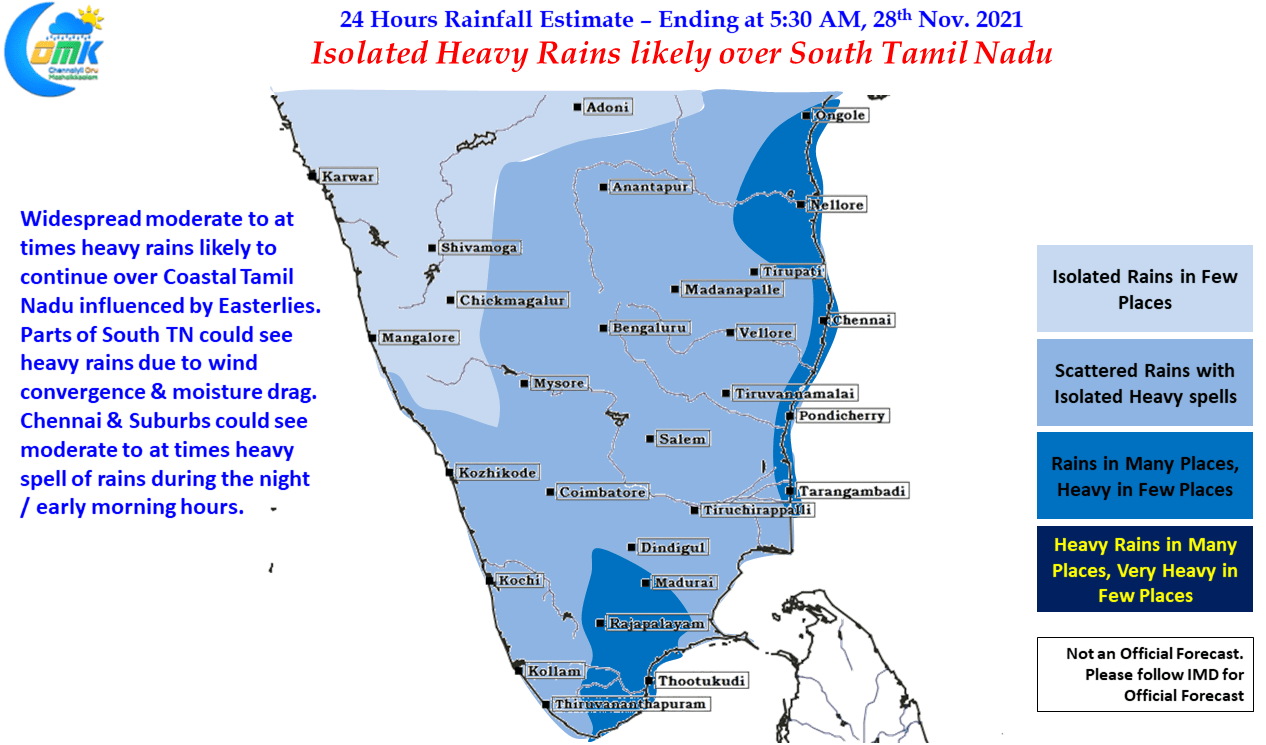
Saturday saw some respite from the previous day’s heavy rains over Chennai & surroundings while parts of Delta & adjoining areas did get some rains overall the impact was much lesser than the earlier days & also less than model estimates as well. While rains did eventually return over Chennai & suburbs later in the evening / night the spells were mostly moderate. Nevertheless it will take more than a couple of days of dry weather for the city to see water logging completely fade away. The early morning hours saw moderate to heavy rains over southern suburbs of Chennai & adjoining areas of Chengalpattu which continued at the time of posting as well.
While it is still not yet time to say “This spell of Rains are Over” but we can surely say it cannot get any worse from the current spell of rains as far as Chennai goes.
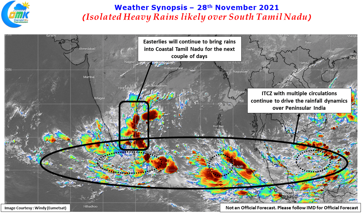
Looking at the wind chart it is clear ITCZ is still driving the moisture in to Peninsular India safely transporting the weak MJO triggered pulses from South China Sea to Bay of Bengal. The biggest difference between say couple of days back and the next 24 to 48 hours is possibly the reduction of dry line thunderstorms which will gradually fade away as Easterlies streamline with the help of ITCZ & its multiple circulations, one of which is likely to move into Arabian Sea further enhancing the Easterlies.
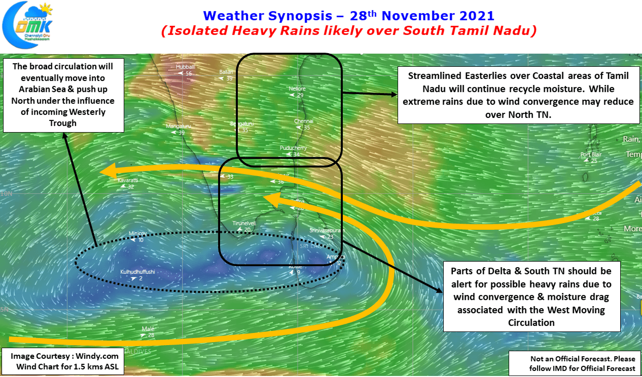
South Tamil Nadu though should remain on alert for the next day or two as two factors could potentially trigger heavy rains over the regions & also places along the Western Ghats. The weak wind convergence provided by the elongated circulation that now straddles Comorin Sea & Sri Lanka is likely to create conducive conditions for heavy rains. Additionally the moisture drag created by this west moving circulation which is expected to shift into Arabian Sea will trigger heavy to very heavy rains over one or two places along the Western Ghats.
As far as Chennai goes today we might see moderate rains once again which could be heavy at times, particularly during the night & early morning hours but the overall theme for the next few days will be gradual reduction in rains. But please note it does not mean a complete stop of rains. In the meanwhile it is time to keep a tab on Far East for possible developments to the next LPA that could influence weather over Tamil Nadu later this week.