
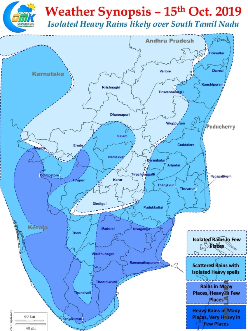
In a news that is likely to bring joy not only to the weather bloggers but also to farmers & all the citizens of Tamil Nadu the Easterlies induced Rains checked i n over Tamil Nadu. Coastal areas of Tamil Nadu started receiving spells of rains around midnight which continued till the wee hours. As is the case during the first spell of Easterly rains the spells were scattered with few places getting heavy spells while a few missed out completely.
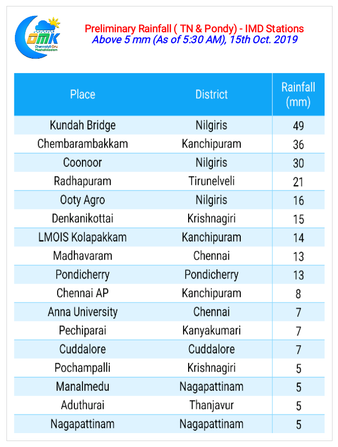
Chennai also received its share of rains though the city areas seem to have missed out mostly. While the IMD observatory at Nungambakkam recorded only 0.2 mm up to 5:30 AM, 15th Oct. the IMD Observatory at Chennai Airport recorded 8 mm. Chembarambakkam possibly recorded the highest among the IMD weather stations around Chennai getting nearly 4 cms of rains while a private weather station maintained by weather Blogger Ashwin recorded more than 7 cms during the same period.

Rains are likely to continue today as well due to favorable conditions in the form of strong Easterlies. Coastal Areas once again will receive rains late in the evening / night. Unlike yesterday where the rains were scattered today / tonight we could see more places get rains and also with a slight increase in intensity. As remnant moisture travels inland from East to West few places in the interior areas could get spell or two of thunderstorms.

Isolated places in South Tamil Nadu though could record heavy rains due to the trough extending over Lacadive / Comorin Sea area. A developing circulation currently lying over Arabian Sea which models are giving a weak chance of developing is seen pulling the strings over the trough giving an opportunity for isolated heavy rains over South TN & parts of Kerala along the Western Ghats.
Chennai & suburbs stand a good chance for receiving moderate rains . One or two places stand a chance for heavy spells at times around Midnight.