

Southwest Monsoon has be behaving like a wildly swinging pendulum with this year’s intra seasonal oscillation showing a great deal of variance in terms of behavior compared to the usual pattern. There have been many days this season where the leeward side of Coastal Tamil Nadu & the windward side of West Coast of India both getting moderate to heavy rains as a combination of strong monsoon surge & wind induced instabilities triggered separate set of conducive conditions for rains.
Yesterday saw parts of North Tamil Nadu record moderate rains including Chennai which benefitted from fast moving thunderstorms moving West to East. While overall the temperatures had shown an increase across the state due to the reduction in temperatures the evening rains did indeed bring a cheer to Chennai and surrounding places. The fast moving thunderstorms yesterday were also an indication of the strengthening westerlies as many places recorded rains in spells last 10 to 15 minutes though some of the places were witness to multiple spells.
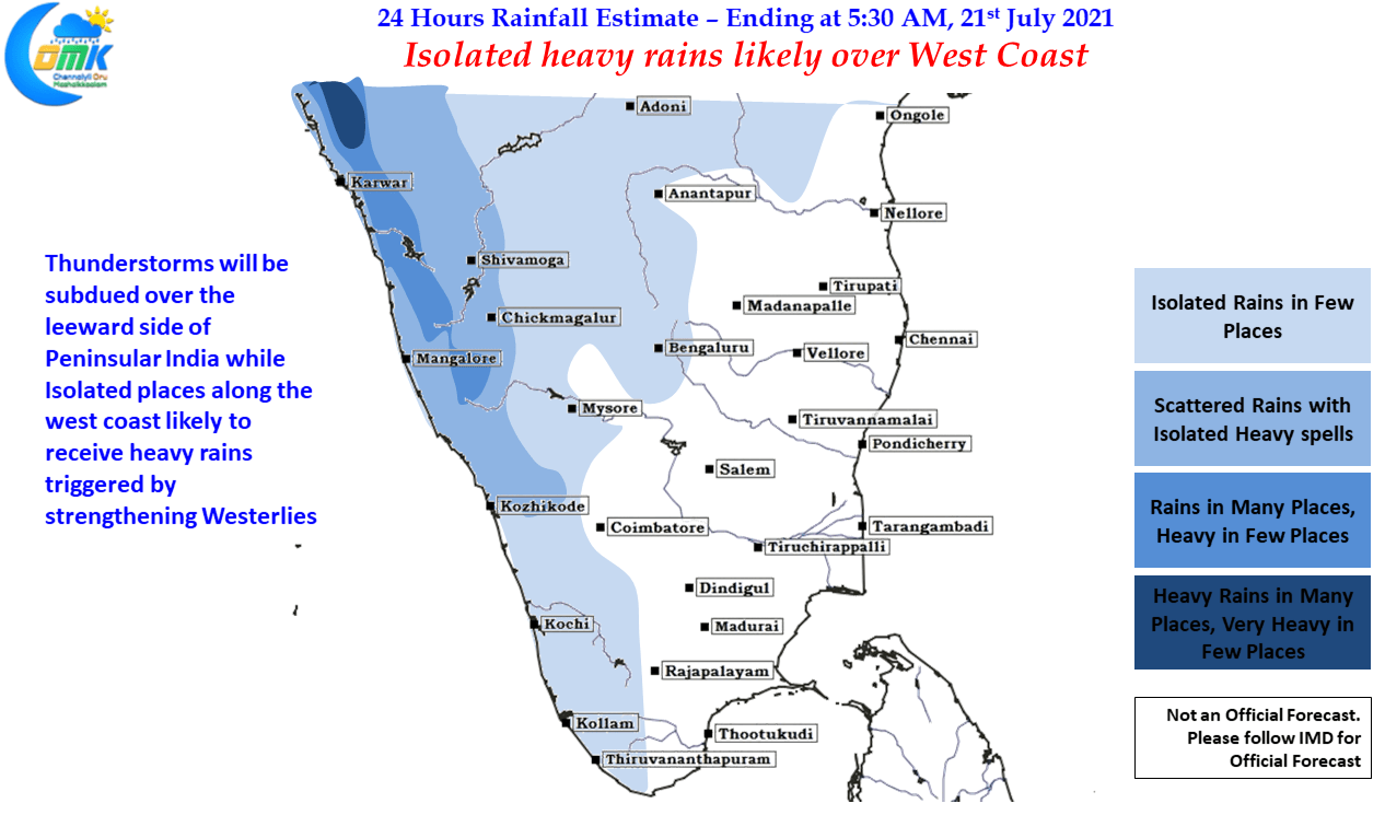
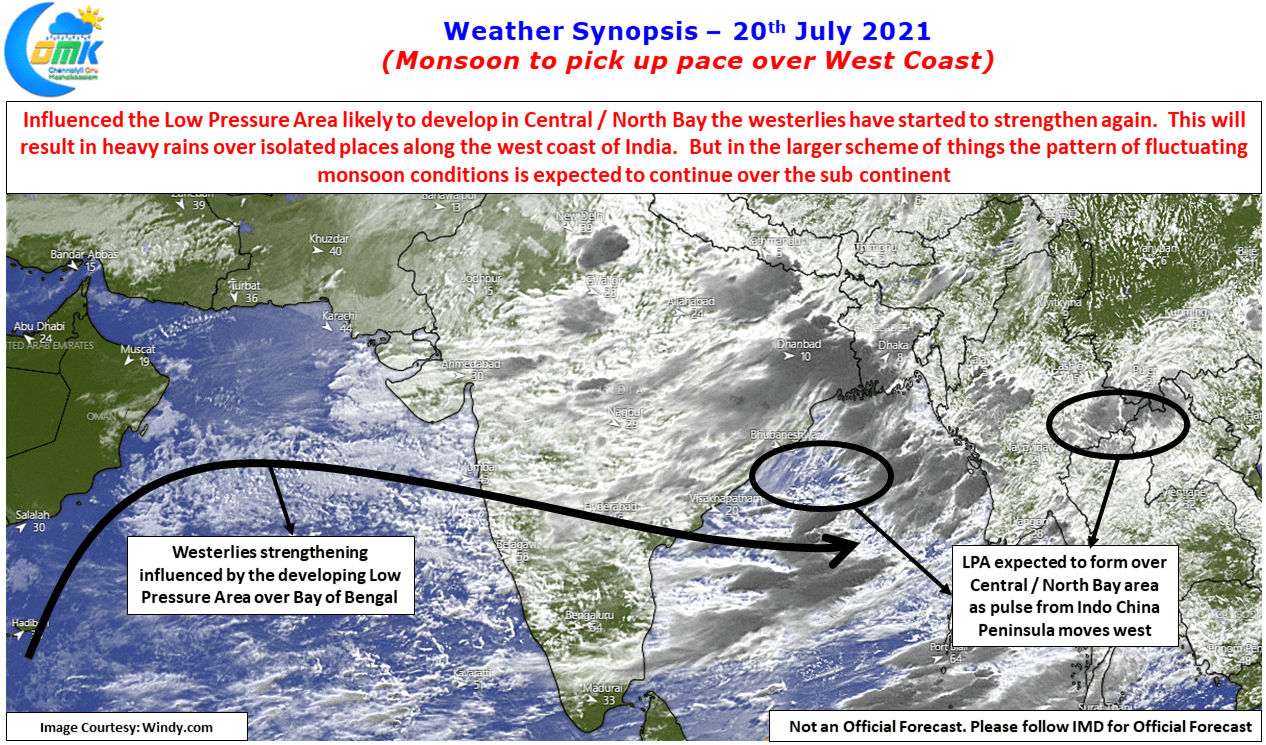
In the meanwhile a combination of home grown circulation & an incoming pulse from Indo China peninsula is likely to trigger a Low Pressure Area over Central / North bay areas of Bay of Bengal in the next 48 hours or so. This developing low pressure area will bring forth an uptick in the westerlies and once again heavy rains over a few places along the west coast & the Western Ghats. Meanwhile the leeward side places like Chennai will have to wait for this spell of Monsoon to slow down and if the weather models are picking up the right trend then possibly one more follow up low towards early next week before another bout of Break in Monsoon conditions kicks in. This Intra seasonal variation has already robbed the first half of July while it appears even August may see similar fate putting pressure on some of the core monsoon areas.