
Since the start of Northeast monsoon season if one were to look at all the IMD stations along the coast of Tamil Nadu between Chennai and Adirampattinam we will see the three delta stations namely Adirampattinam, Nagapattinam & Karaikal having the most negative anomaly indicating how NEM 2022 has been relatively weak over the core delta region. Though TNSDMA rain gauge network does indicate it is better than the IMD stations indicate considering the accuracy levels of the IMD stations and the TNSDMA network it may make sense to lean towards the trend picked up by the IMD stations rather than the TNSDMA network.
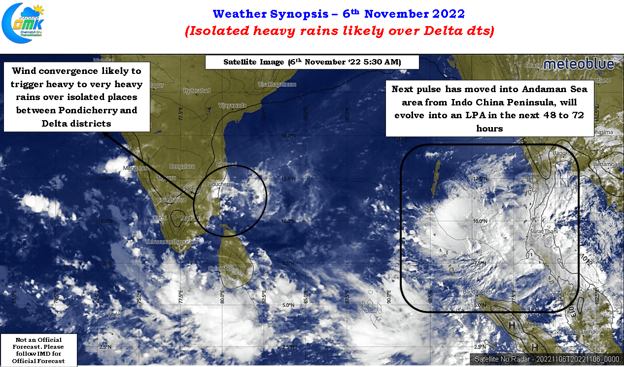
All this could potentially change though with weather models indicating rainfall activity picking up pace next week with the development of a Low Pressure Area over the south bay area. Satellite images does indicate a fresh pulse has entered from the Indo China Peninsula into Andaman Sea near Banda Aceh and is likely to strengthen into an LPA over the next 48 to 72 hours or so. This is likely to move in a WNW direction towards coastal Tamil Nadu middle of next week. While there is some slight inconsistency in the potential high impact zones there is no ambiguity in coastal Tamil Nadu coming under another widespread rainfall episode next week. Tomorrow’s COMK post will be a detailed one on what to expect next week with the benefit of one more day’s model data and updates.
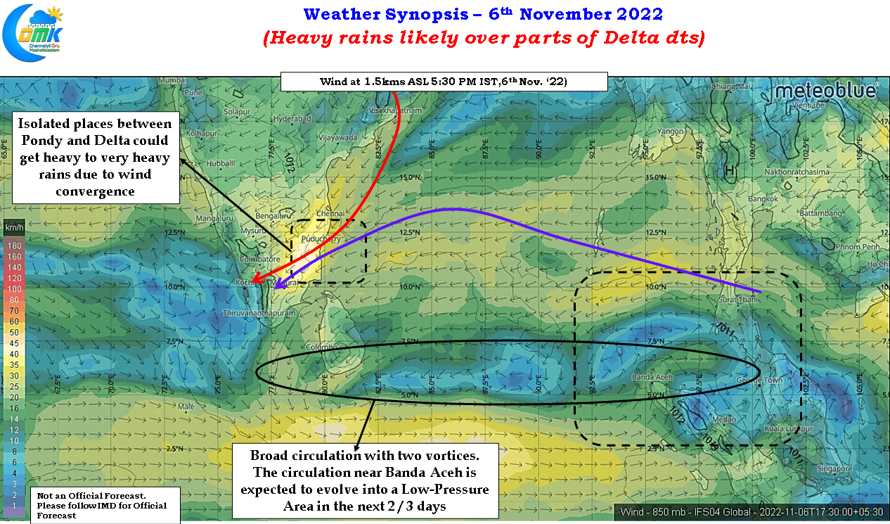
Wind charts indicate a broad circulation over the Equatorial bay with two distinct vortices, the western end a weak remnant of the earlier trough of low and the eastern end a fresh pulse that has moved into Bay of Bengal from Indo China peninsula. Weather models are consistent about the the vortex in the eastern end developing into a LPA with the western vortex fading away. But we could potentially see the LPA move in a WNW direction to the same location as where the trough of low developed.
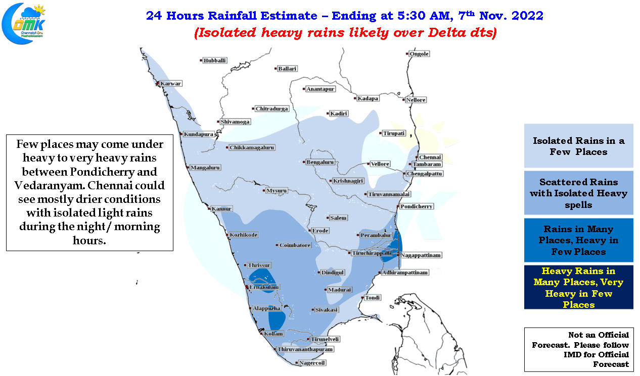
In the meanwhile today weather models indicate a zone of wind convergence between Pondicherry and delta districts which could potentially bring heavy to very heavy rains over one or two places in this belt. As the LPA develops over the eastern parts of Bay of Bengal we might see a slight reduction in rains over coastal TN for the next 48 hours from tomorrow though isolated light to moderate rains will continue. Later half of the week is the one to watch out for, tomorrow’s COMK post will be about what to expect and where to expect. Chennai and suburbs may be relatively dry with some isolated showers during the night hours, the general trend is a quieter window before the arrival of next active phase of rains