

Thunderstorms continued to persist over Tamil Nadu with the first 3 days of the Northeast Monsoon season providing an accumulated rainfall of 42 mm which is nearly 1/4th of the October average for Tamil Nadu & Pondicherry. The 1st 3 days long term average rainfall is 13.9 mm so in effect the 1st 3 days of October has brought in nearly 3 times the normal rainfall. With weather models indicating thunderstorms to continue for the next few days though there could be ebbs & flows in how intense each day turns out to be based on atmospheric conditions, things look good for the interiors to catch up some good numbers before the Northeast Monsoon onset post which coastal areas may benefit more.
Looking at the satellite images it is quite clear we are at the cusp of seasonal change with most parts of the country dry except for the areas coming under the influence of a disturbance. For e.g. southern parts of Peninsular India under the influence of an Upper Air Cyclonic Circulation off the coast of TN & Sri Lanka. Parts of East & NE India under the influence of the lingering LPA that is meandering to the end of its life cycle. Wind charts also indicate North India to come under the influence of strengthening dry Continental Air from the NW which will kickstart the withdrawal of Southwest Monsoon.
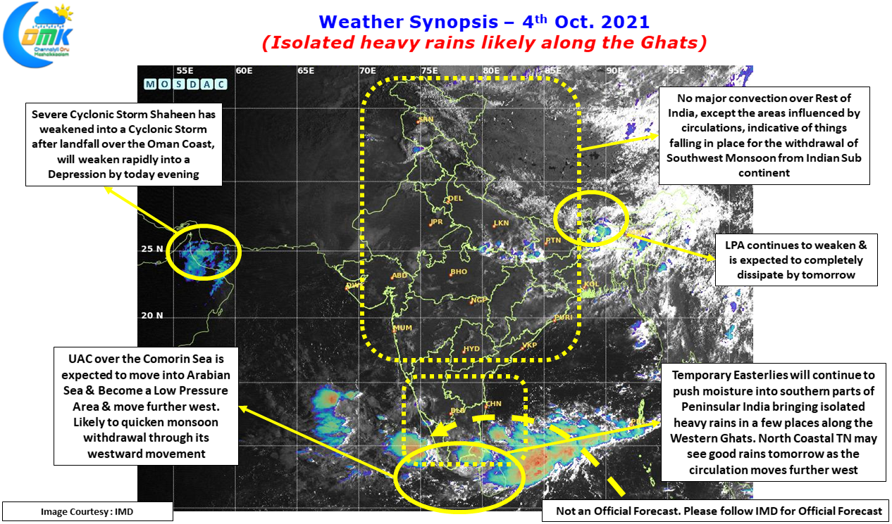
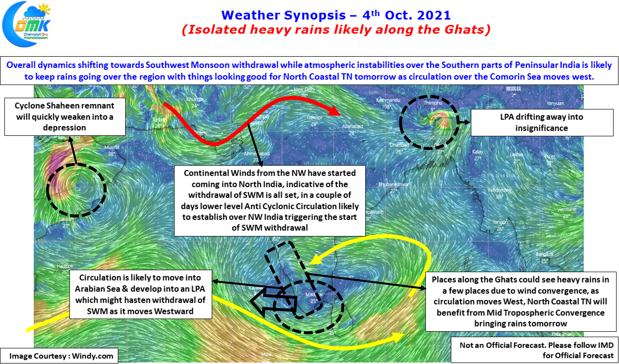
In this context it is pertinent to keep an eye on the circulation over Comorin Sea as it is expected to move into Arabian Sea & possibly develop into an LPA. While it moves further west as an LPA there is a possibility it could hasten the withdrawal of Southwest Monsoon by dragging the continental winds from North towards Peninsular India. Before that the circulation will continue to help thunderstorms develop over southern parts of Peninsular India keeping the rainfall meter ticking in the region.
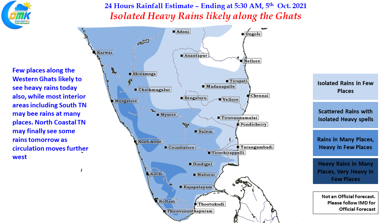
Under the influence of the circulation there could be a weak convergence along the Western Ghats which could trigger isolated heavy rains in a few places particularly over the Eastern Slopes. Along with this parts of South TN & Central TN also could see moderate thunderstorm activity in a few places. Chennai has been so far missing in action but that could change tomorrow as North Coastal TN may benefit once the circulation moves little more west into the open waters of Arabian Sea as it is likely to trigger favorable mid tropospheric wind convergence over North Coastal Tamil Nadu giving a window rains for places like Chennai.