
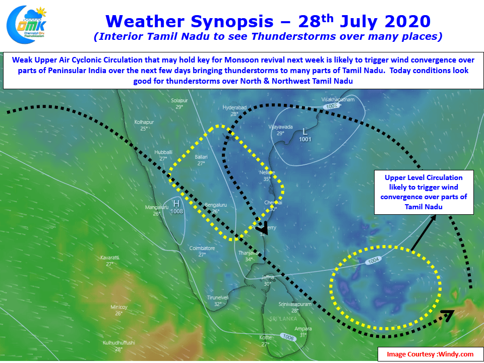
Last few days have seen fairly good thunderstorm activity over Tamil Nadu with yesterday seeing thunderstorms over parts of Erode, Coimbatore dts in West TN while around midnight many places in Delta districts got moderate rains under the influence of an Upper Air Cyclonic Circulation developing in Bay.
This developing circulation is likely to play dual characters over the course of next two weeks. As the famous dialogue from Kamalhassan goes in the move Viswaroopam, Am a Hero & a Villain this UAC is likely to act as a hero for the leeward areas of Tamil Nadu bringing thunderstorms for the next few days before possibly deepening into a Monsoon low and becoming a hero for Monsoon revival over West Coast early next week.
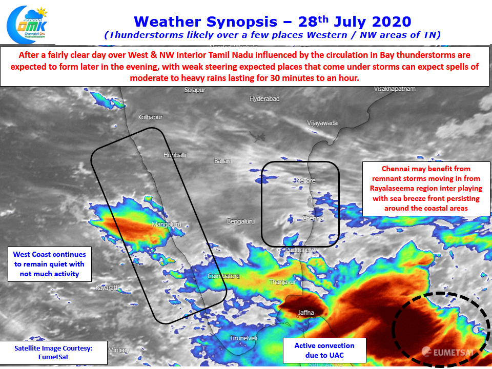
Once again confirming weather is a dynamic world and nothing remains stationary in this ever evolving world of dynamics. The active convection off Sri Lanka is an indication of the developing dynamics with the UAC which is likely to create wind convergence today over parts of Tamil Nadu & adjacent areas of Andhra Pradesh & South Interior Karnataka bringing in moderate to intense thunderstorms over isolated places. With weak steering winds seen places under storms will see rains persist for 30 – 45 minutes becoming heavy at times.
As the remnant storms from Rayalaseema move in from NW a possible interplay between the persisting sea breeze front and the incoming storms could trigger some thunderstorms around places like Chennai bringing a possibility of moderate spell of rains to the Western & Northern suburbs of Chennai, hopefully they will make the journey to the coast bringing rains to city areas as well.
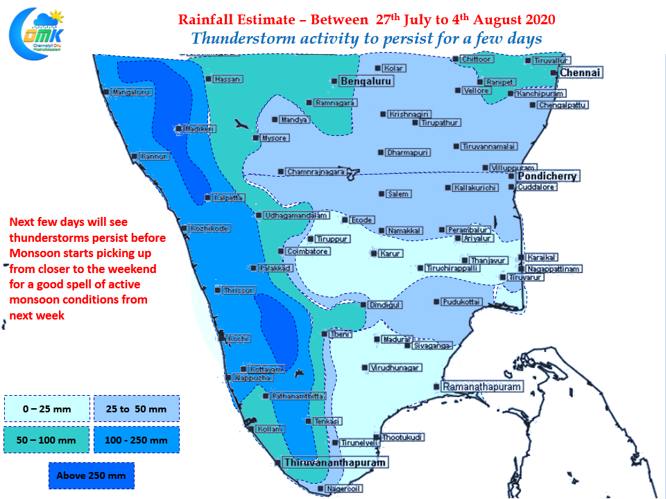
As has been the case today we will be carrying the weekly rainfall outlook for Tamil Nadu. The early part of the week is likely to see a continuation of last week’s thunderstorm activity before monsoon dynamics picks up from weekend early next week for a possible seasonal surge.