
After a few days of very dull conditions on the rain front yesterday saw the rains return over many parts of Interior Tamil Nadu. Places in Tiruchirappalli, Dindigul, Madurai, Virudhunagar, Erode & Salem districts saw isolated moderate to heavy rains bringing relief to the people at these places. Coastal areas though continue to remain under smog attack instead of rain attack with pollution levels remaining very high in places like Chennai.

In the meanwhile Cyclone Bulbul has intensified into Severe Cyclonic storm and is likely to continue its intensification over the next 24 hours or so as it heads in a Northwest direction towards Odisha coast. Weather models indicate the cyclone to start weakening from tomorrow as it gradually starts taking a Northward movement towards Head Bay.

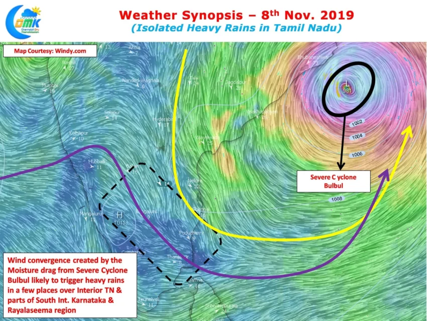
Its not all lost for Tamil Nadu even though Cyclone Bulbul is heading towards North Bay. With Bulbul creating a Moisture drag across Peninsular India and an associated wind convergence. This wind convergence is likely to trigger thunderstorms in the interior parts of Tamil Nadu with isolated places getting fairly heavy spells later in the evening.

While weather models indicate coastal areas are unlikely to get any major spell. There is a possibility the coastal stretch between Pondicherry & Pudukottai could get moderate to heavy rains in one or two places due to the above mentioned wind convergence.
Chennai & suburbs may see isolated short spells of sharp showers at times later in the evening in one or two places.