
Yesterday saw the return of thunderstorm activity for Tamil Nadu, albeit as a weak activity, over parts of Cuddalore, Villupuram, Perambalur & Ariyalur districts along with isolated early morning activity in the delta districts today morning. Jayamkondam in Ariyalur district recorded 26 mm while Kudavasal in Tiruvarur district recorded 27 mm till 5:30 in the morning today. 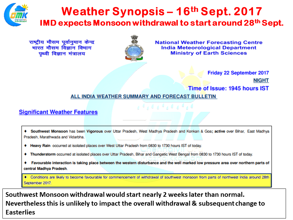
On a slightly larger scale of things IMD is expecting the withdrawal process of Southwest Monsoon to start from around 28th September after possibly the current phase of rains / favorable conditions under the influence of the Well Marked Low Pressure area over MP ends. Under normal context the withdrawal over Punjab, Rajasthan etc starts around 15th September this year we are likely to see a two week delay in this. Though this is unlikely to impact the overall withdrawal process as many years we have seen Monsoon withdraw faster from the rest of the country even though the process started late.
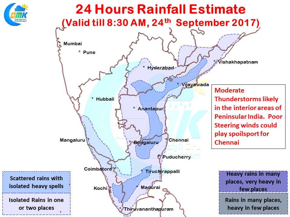
Wind pattern is conducive once again today for some thunderstorm activity to happen over the interior areas of Peninsular India with possibly areas to the west & southwest of Chennai likely to see good activity along with may be the districts of Dindigul / Tiruchirappalli / Perambalur etc. Reminiscent of the first fortnight thunderstorm activity in August the steering winds are expected to be very poor for the coastal areas to get major benefit though thanks to the remnant moisture available in the atmosphere an active sea breeze front could trigger localized developments along Coastal Tamil Nadu including places close to Chennai.
Powered by WPeMatico