
Yesterday saw most of Tamil Nadu go through a fairly hot day as clearer skies brought in an increase in temperature with the state seeing its 1st 40°C in almost a week as Madurai & Tiruttani recorded crossed the 40°C mark. Chennai Meenambakkam recorded 39°C which was 1.7°C above normal for this time of the year. Fairly strong Westerlies over the last few days meant the effect of sea breeze was delayed and possibly negligible as well.
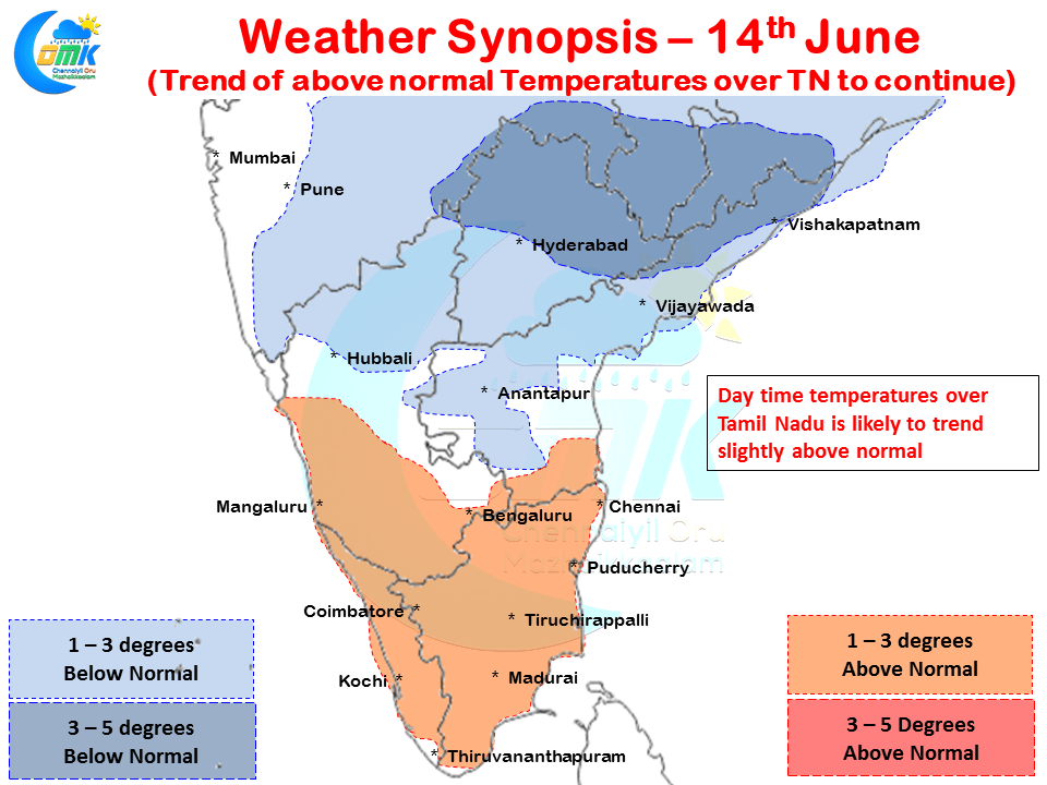
Today also most parts of Tamil Nadu is likely to see a hot day with day time maximum temperatures staying a degree or two above normal. Thanks to the presence of an Upper Air Cyclonic Circulation over South Chhattisgarh most parts of Northern Deccan Plateau areas could see a fairly comfortable day in terms of temperatures under possibly cloudy skies.

Numerical Models indicate possibly a robust sea breeze front to move in over North Coastal Tamil Nadu which is likely to trigger some evening thunderstorms over the region. Additionally a lower level convergence is also indicated by the wind charts which could provide the necessary instability as well required for the storms to develop. Considering the Westerlies are still fairly strong we are likely to see fast moving thunderstorms which could possibly give isolated moderate rains in a few areas around North Coastal Tamil Nadu. These thunderstorms are likely to form around 50 – 75 kms from the coast line, depending on luck we could possibly see Chennai also get a few spells of evening showers.
Powered by WPeMatico