

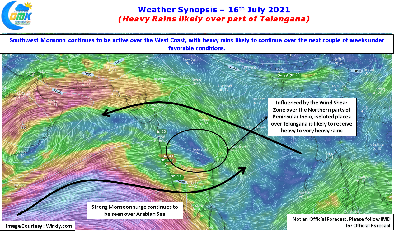
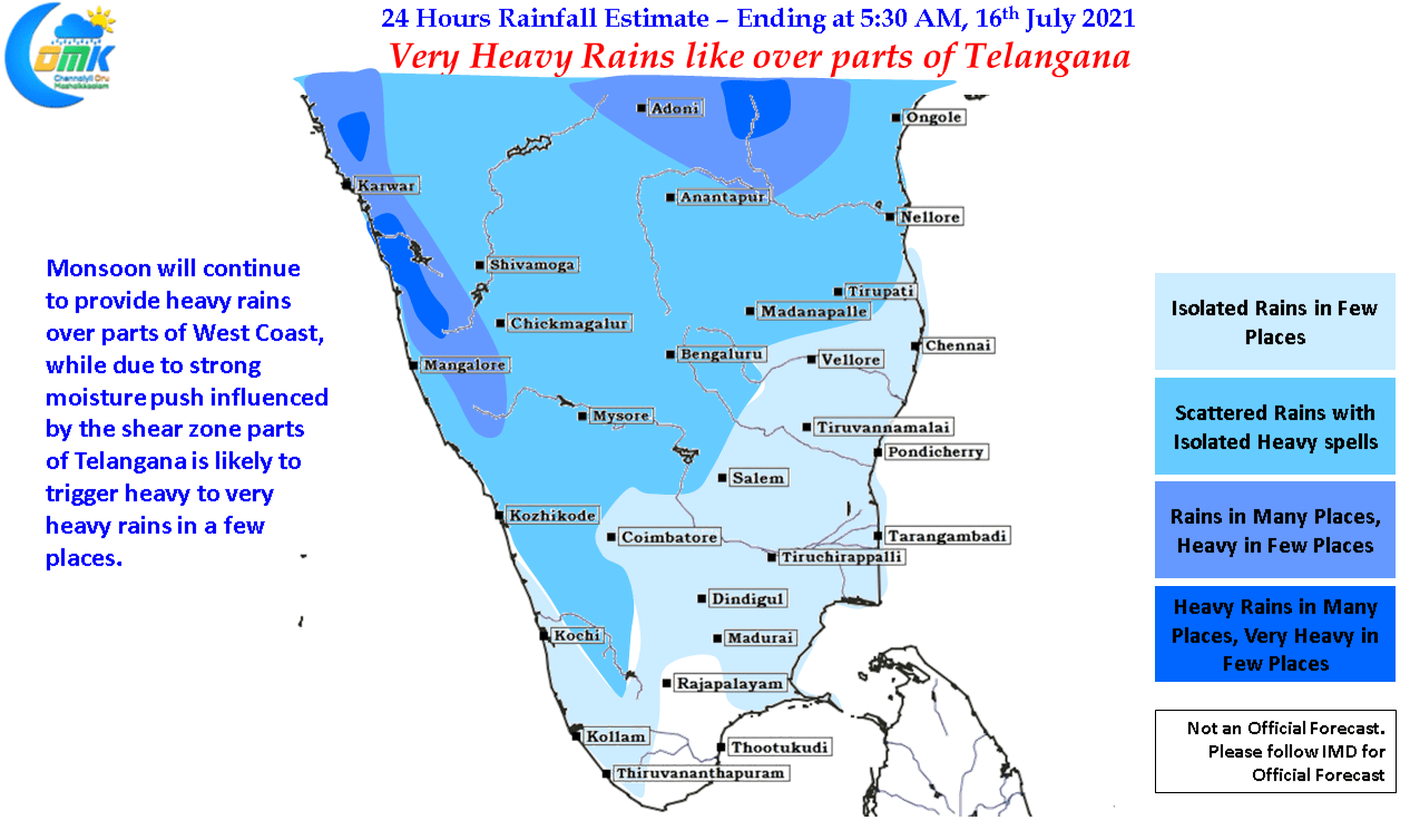
Southwest Monsoon continues to remain active over the West Coast with some parts of South Konkan, Coastal Karnataka & adjoining areas of Western Ghats. Though there are some concerns over whether the southern parts of Peninsular India will remain as active as the northern parts of Peninsular India. Seasonal outlooks though have been consistently hinting at a relatively poor Monsoon performance for Kerala & the Ghats of Tamil Nadu.
The presence of a shear zone over the Northern parts of Peninsular India is acting like a wedge dividing up the active and slightly less active rainfall zones over the West Coast. The shear zone is also enhancing the rains over parts of Deccan Plateau in Telangana & Interior Karnataka. Parts of Telangana has already been receiving good rains already & weather models indicate heavy to very heavy rains in a few places today as well influenced by the shear zone.
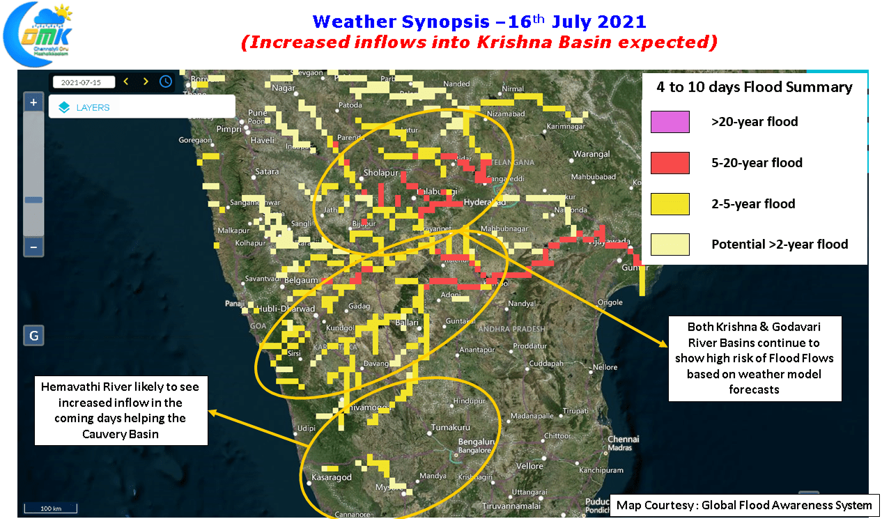
The rains over the West Coast with some heavy spells of rains over the interior areas of Deccan Plateau is possibly bringing forth a possibility of increased inflows into the Krishna River Basin as rapidly increasing soil moisture levels is likely to increase run offs into the river thereby increasing the inflows into the basin as we get closer to August. While there indeed remains if Cauvery Basin will replicate its performance of the past couple of years in terms of inflows & early filling up dams like Kabini the rains over the Ghats over Karnataka is likely to trigger increased inflows into Hemavathi river. part of the Cauvery Basin, as it has some of its catchment areas close to the Thunga / Bhadra catchment areas in Chickmagalur / Hassan dts. Yesterday little more than 1 TMC outflow is being sent out of Kabini on the back of good inflows triggered by the rains at Wayanad. Though the worry of poor monsoon for Cauvery catchment areas over Wayanad & Kodagu remains the overall basin could possibly end up with a good year overall.