
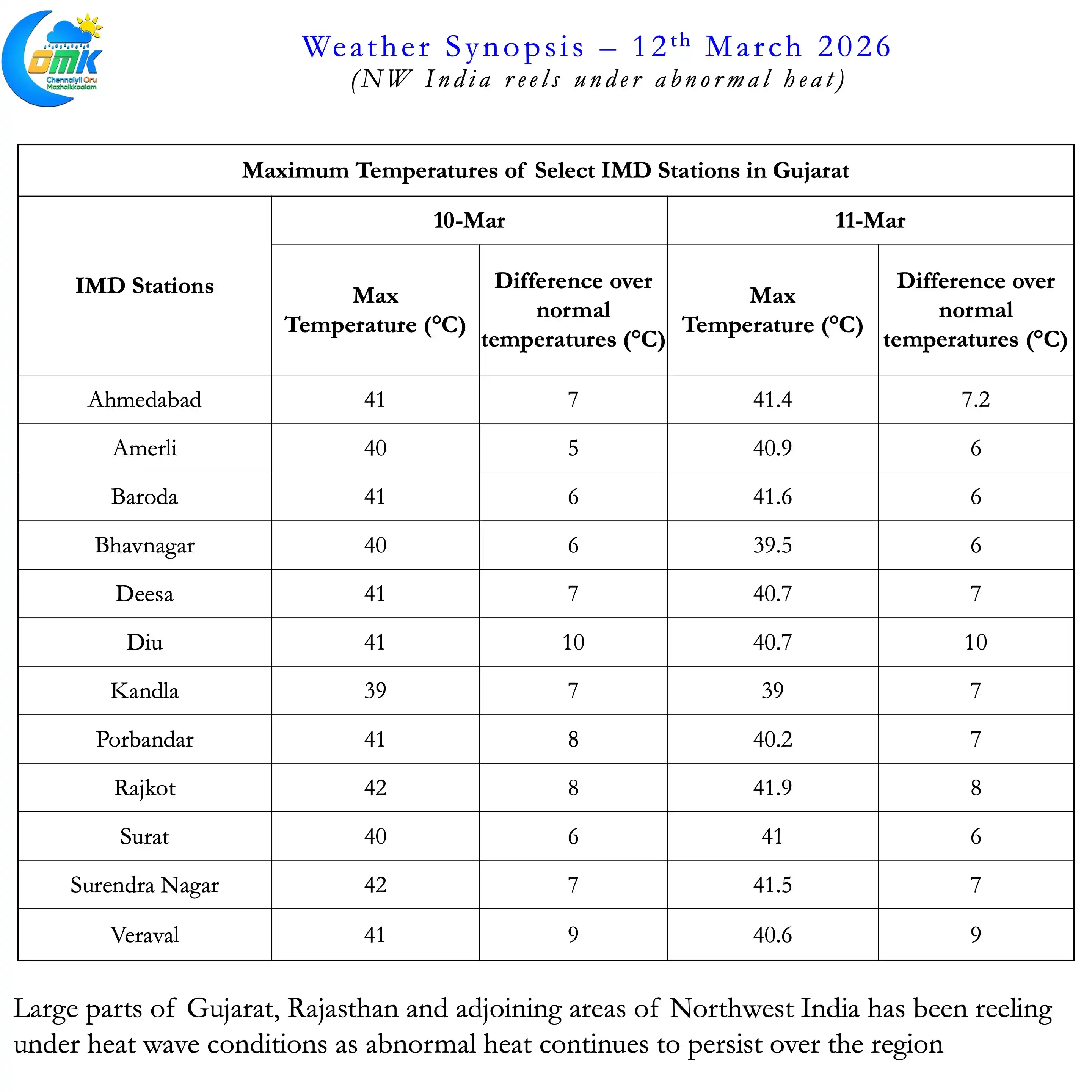
The fist heatwave of the year 2026 over the Indian Sub continent has unfolded over parts of Gujarat and adjoining areas of NW India. Many IMD stations in the state has recorded 6 / 7°C above normal temperatures for the past couple of days. Over the past couple of days weak Easterly activity meant Peninsular India saw some respite from the afternoon heat.
Sub seasonal ensembles indicate over the next few days abnormal heat may continue over NW India. While heatwave conditions may abate from tomorrow overall abnormal heat may persist. Models also indicate potential interaction between Mid Latitude Westerly Trough and low level Easterlies. The arrival of western disturbance could respite from the heat for NW India.
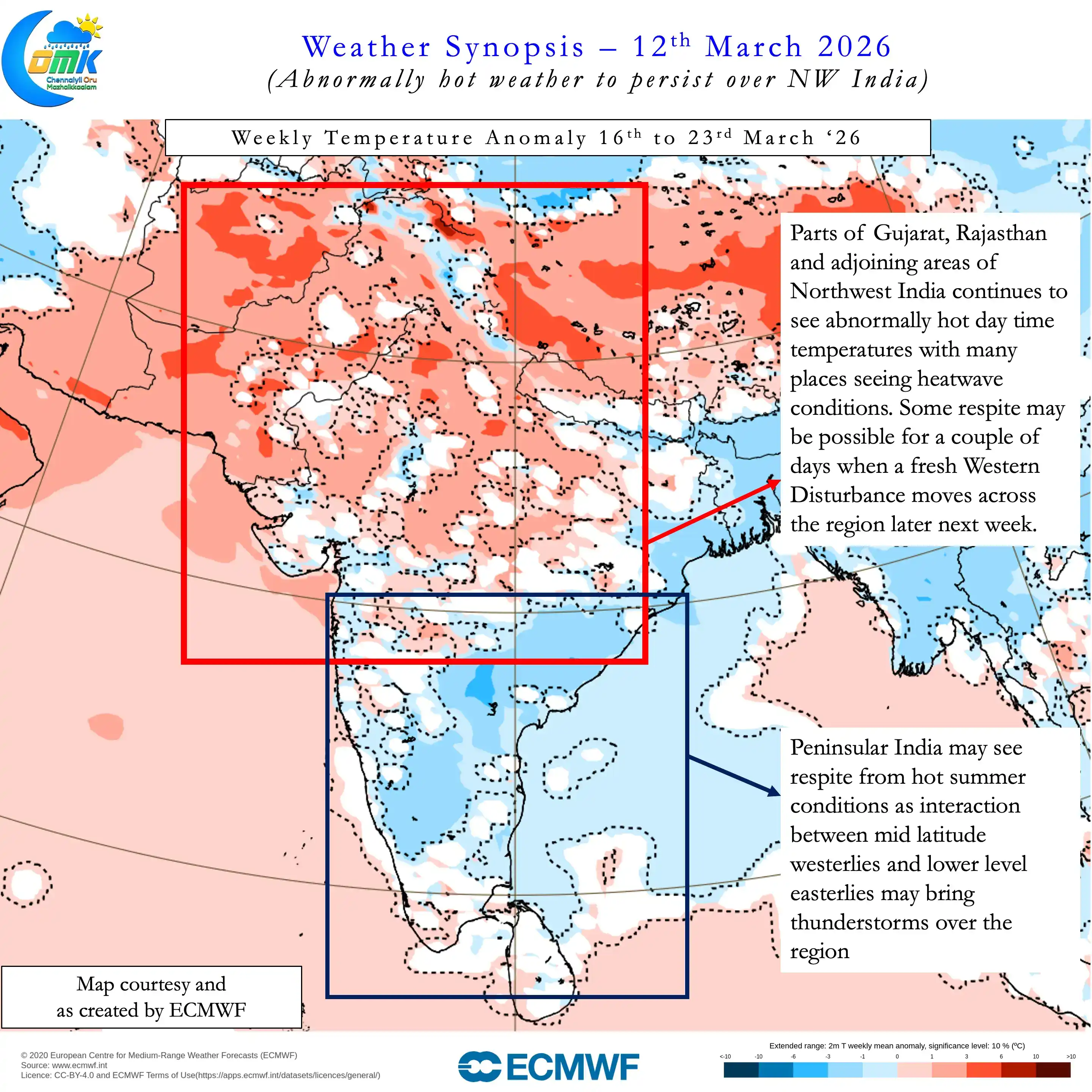
The interaction though may open a window for thunderstorms over Peninsular India. Interior areas of Peninsular India from NW India all the way to Odisha across AP & TS states may see rains during this period. Rest of Peninsular India may see some rains, cloudy skies and respite from heat. How much rains may happen is still a question mark. We may get clarity early next week on the thunderstorm impact from this interaction.
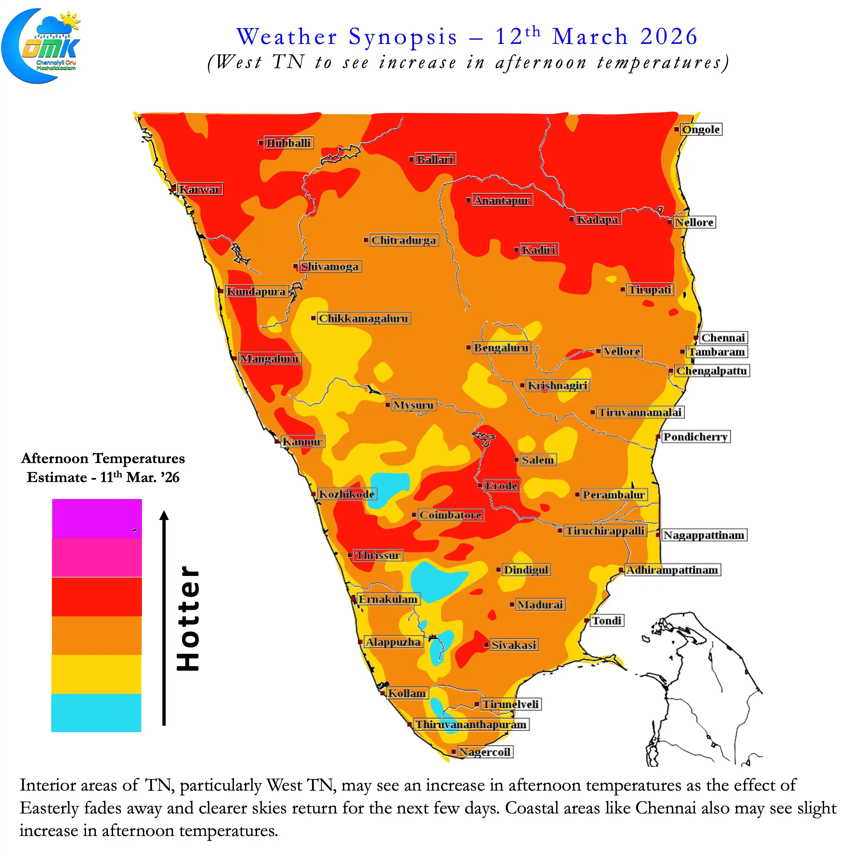
Meanwhile over the next few days heat may return back over interior areas of TN. In particular West TN may see some increase compared to the past couple of days. But it may not be as bad as last week when the temperatures stayed a couple of degrees above normal.