

After more than 3 weeks the daily rainfall chart for TN & PDC showed a positive anomaly on 18th November. The last day to show positive anomaly during NEM 2025 prior to this was 23rd October. The LPA earlier this week that had its genesis over Southwest Bay pretty much broke the dry spell. With the negative anomaly at 6% overall for TN & PDC and many districts in deficit there is a sense of anxiety. An anxiety of a failed monsoon this year.
Cyclones are one of the best examples of butterfly effect. A small change in conditions like genesis location / ridge position etc could alter the dynamics drastically. This is one of the reasons why Ensembles are favoured by Meteorological community worldwide for cyclone tracking. More so when we are looking slightly further ahead when small changes can alter end results drastically. A degree in latitude / longitude is about 111 km on the ground. It is not a surprise to say half a degree difference in genesis could change the landfall location by 100s of kms.
Last year we had a post on how 2nd fortnight of November and 1st fortnight of December tends to favour Tamil Nadu. This was a week before Cyclonic Storm Fengal formed and made landfall near Pondicherry. Just like this year there was some anxiety though not as much as now about possible failed Northeast Monsoon. Though no two weather events are the same past events can give us an idea on probabilities.
Today’s post is in a way going to be like how ML models behave. They use past data from many decades to recreate weather forecasts based on the current conditions. Over the past 3 / 4 days we weather models have been consistently indicating a possible LPA in South Bay. The path and intensity though continues to swing wildly. Not only is it swinging widely between models but also in the same model over different initial conditions. To a common man this may be confusing. It is also one of the reasons why we never advocate people to use apps like Windy unless they are serious weather observers.

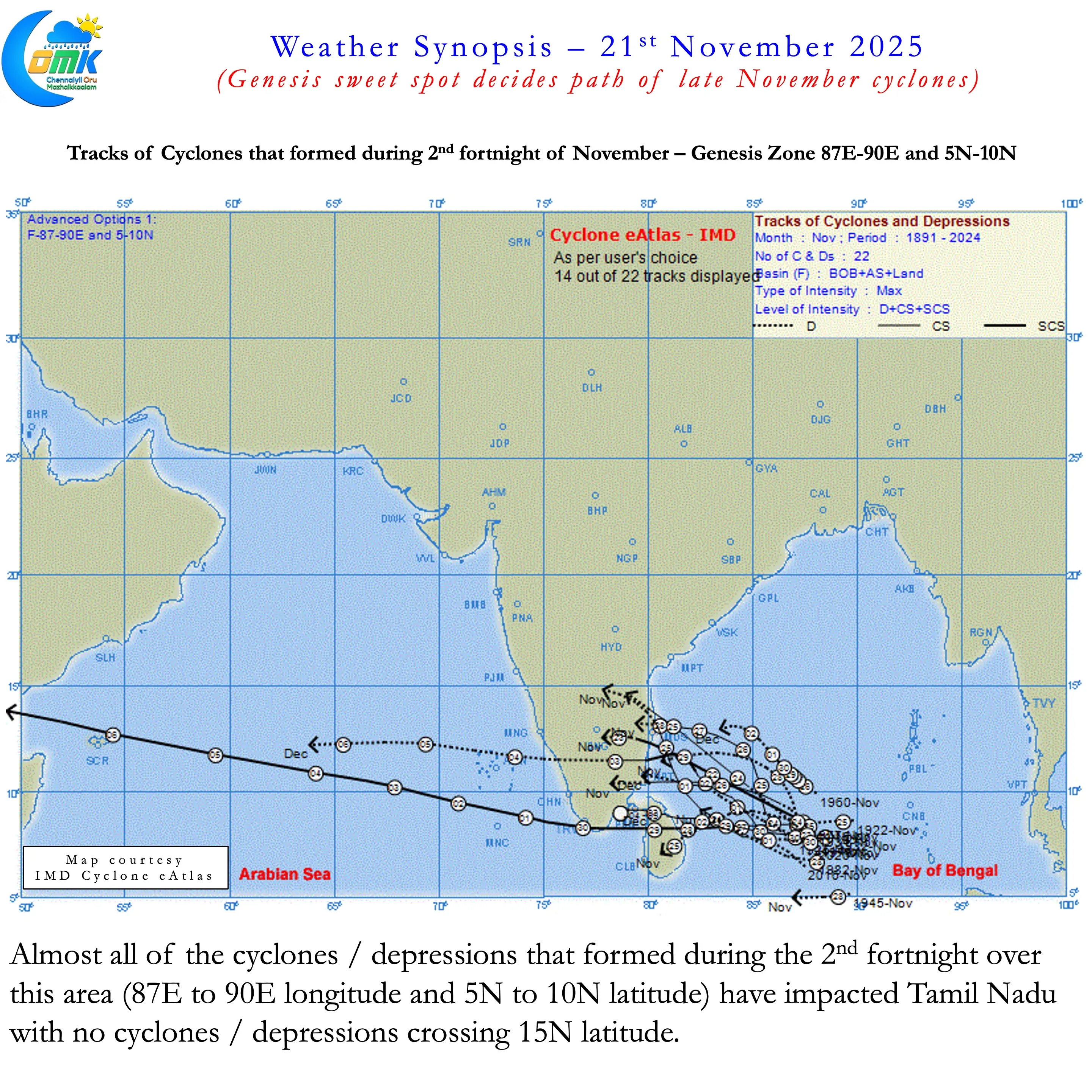
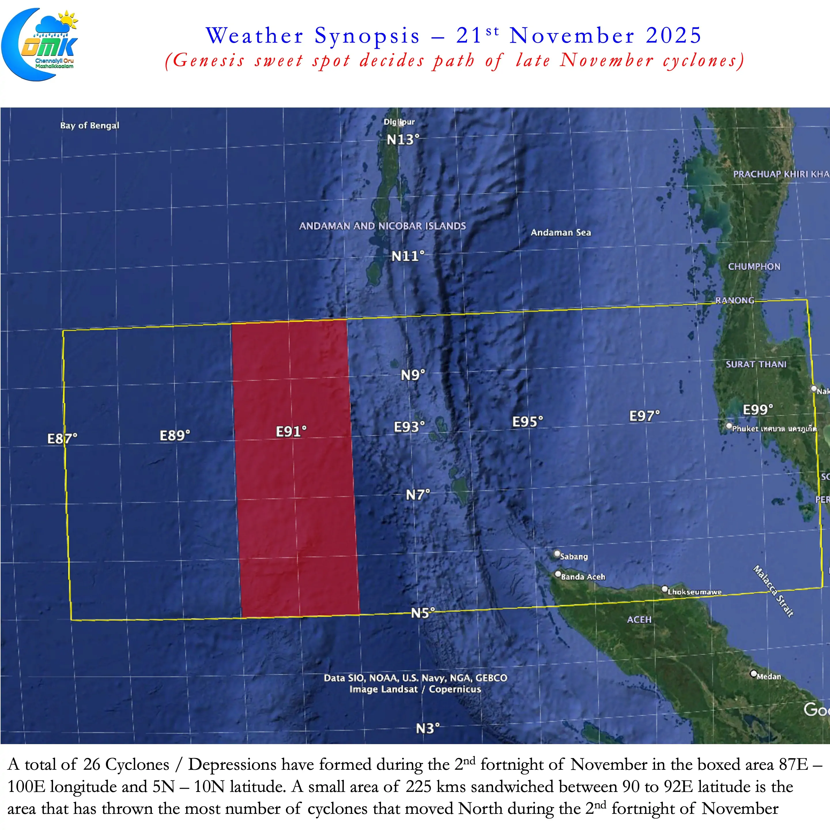
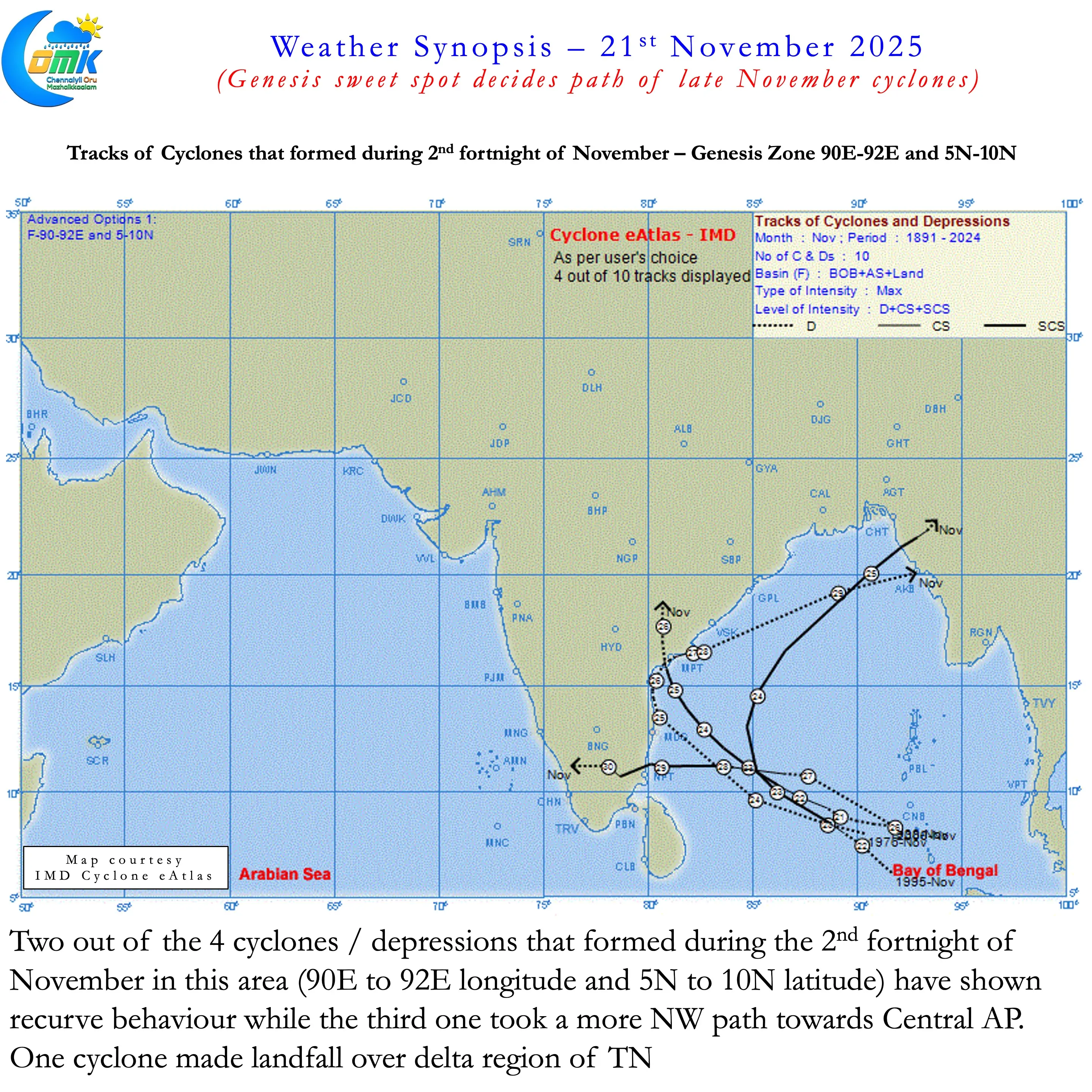
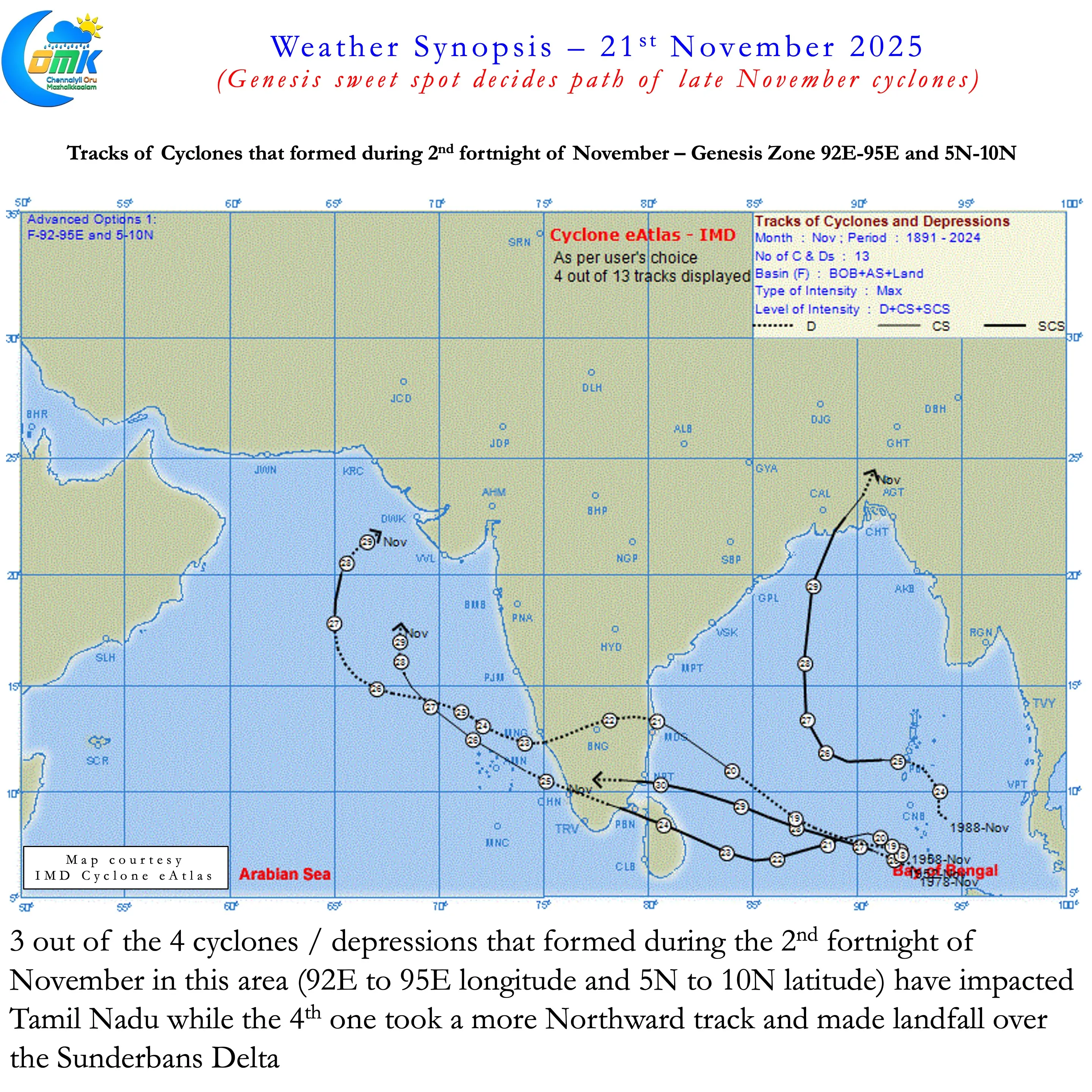
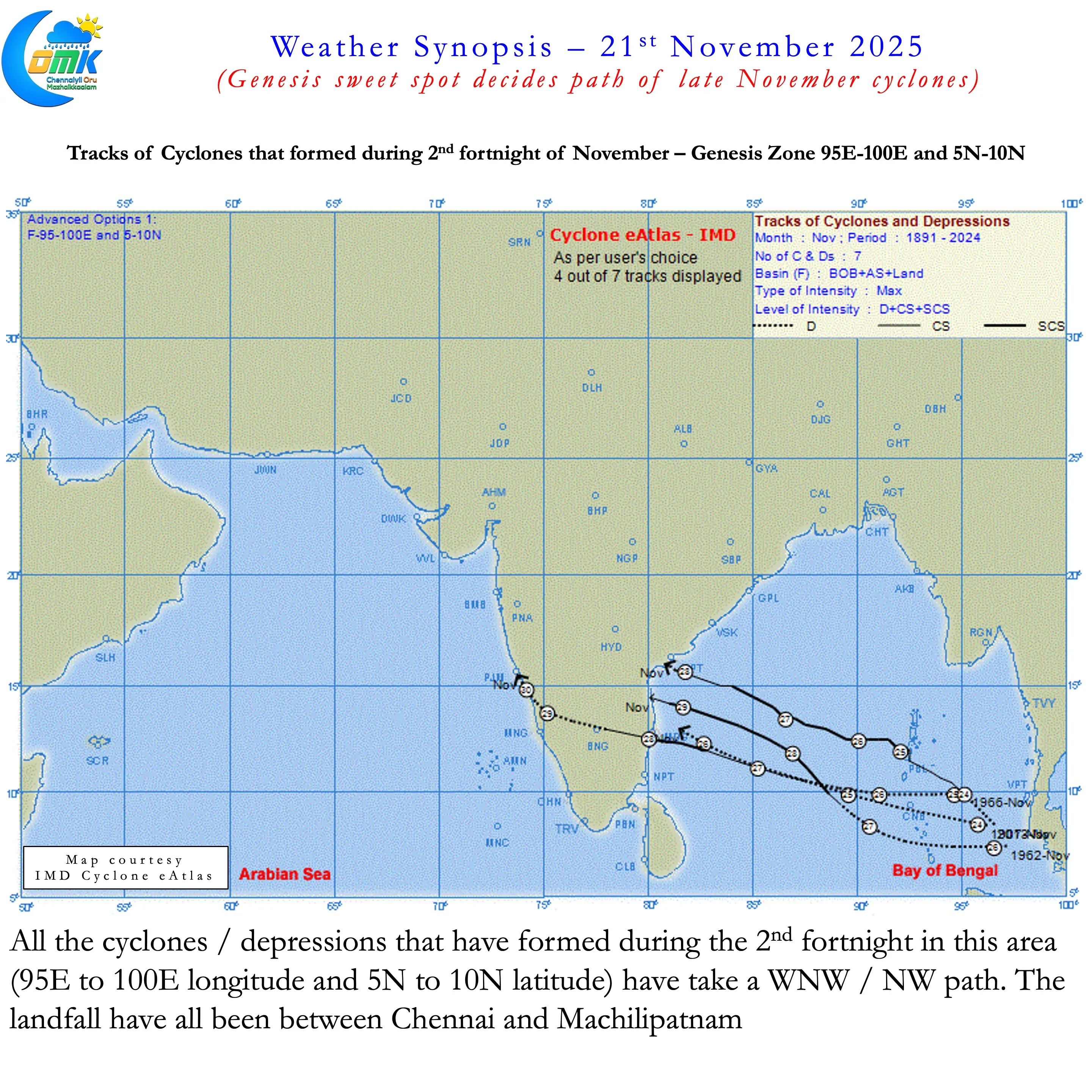
What we have tried to identify is the behaviour of past cyclones / depressions during the 2nd fortnight of November. For the purpose of the study we have restricted the area of genesis to 87E to 100 longitude and 5N to 10N latitude. This area is roughly 1400 kms by 225 kms around the Sumatran / Andaman archipelago. 26 cyclones / depressions have had genesis during the 2nd fortnight from this area. While most of them have taken a WNW / NW path a few have gone North with a recurve. Digging deeper It is a small area of about 225 kms between 90E and 92E longitude that becomes critical. Cyclones / Depressions that have had genesis in this area have moved further North compared to cyclones formed in the rest of the region.
Most models are now consistent about a potential cyclone forming next week. We can be fairly assured Bay of Bengal is likely to host a cyclone the upcoming week. But it becomes imperative to wait until the genesis of LPA to look at possible path / impact zone etc. As seen in the charts if the genesis happens West of 90E longitude past history shows they rarely move above 15N latitude. Almost all of them have impacted Tamil Nadu. When genesis happens East of 92E unless the genesis is closer to 10N latitude there is a high chance of impacting Tamil Nadu. If the genesis happens between 90E and 92E longitude then it may become a 50:50 scenario. If the LPA forms over Malacca strait then there is a high chance for WNW / NW movement. This possibly explains why ML models tend to swing the path wildly.
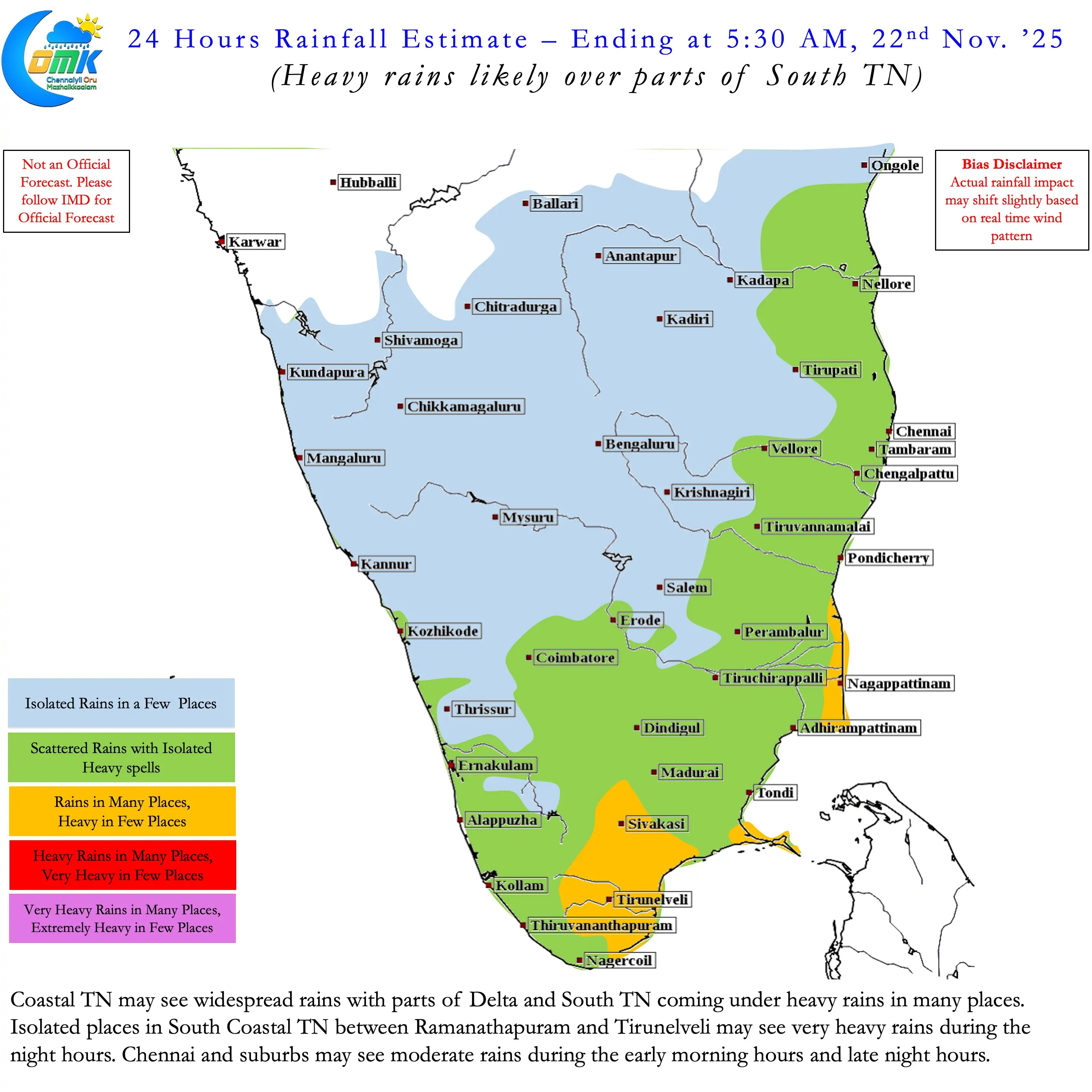
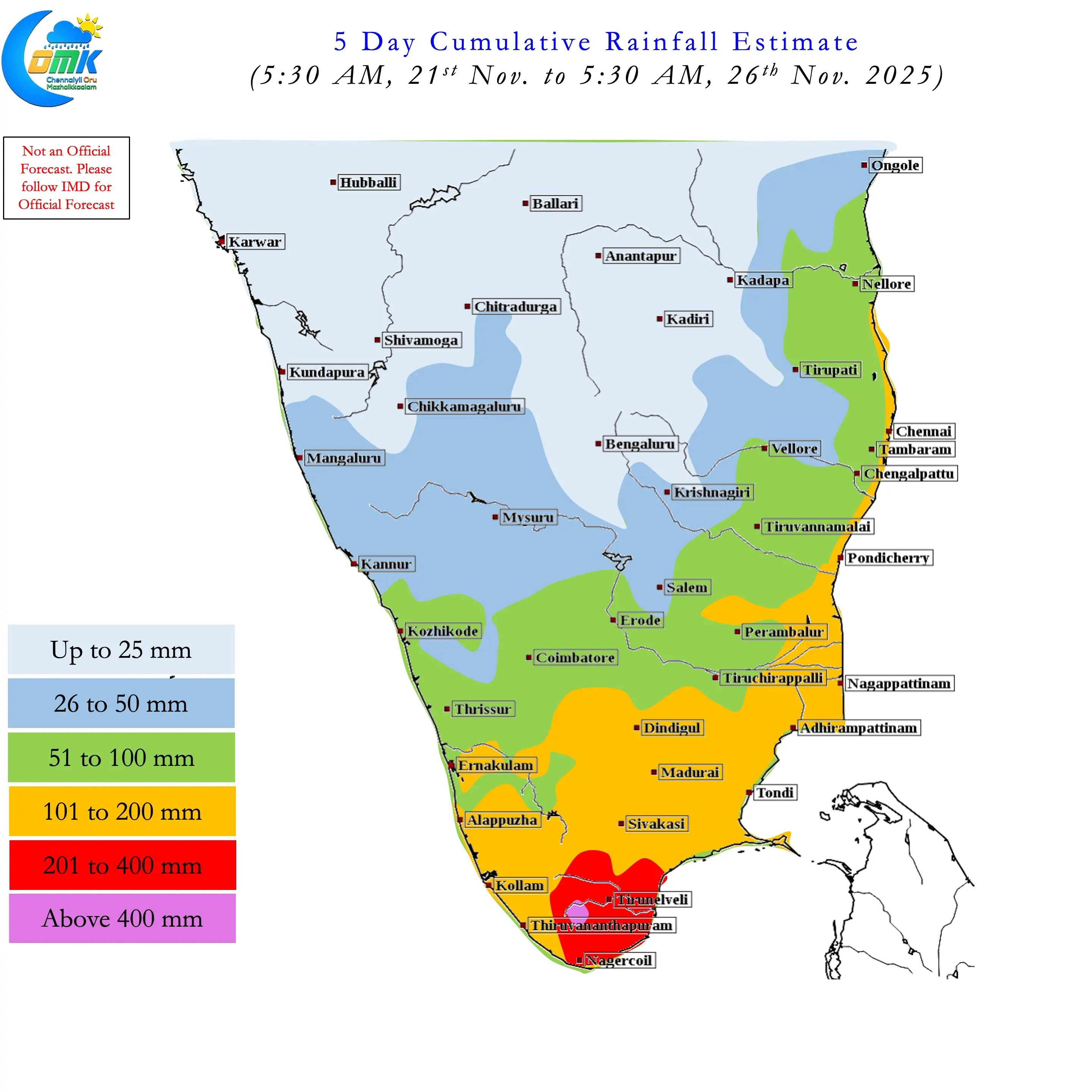
A bird in the hand is better than two in the bush. Irrespective of what happens with the upcoming cyclone the next 3 / 4 days look good for rains. Easterlies pushing moisture across Peninsular East Coast will bring rains. Additionally over the next couple of days until the LPA over SE bay deepens the UAC over SW Bay is likely to enhance the rainfall. Parts of South TN may see heavy to very heavy rains during this period with risk of extremely heavy rains over the Manjolai ghats. Chennai and rest of North Coastal TN may continue to see moderate rains during the morning and late night hours. The spells may be heavy at times.