

Northeast Monsoon this year has already created enough discussion points even though the season has just started. The first fortnight saw interior areas of Peninsular India see anomalously positive thunderstorm activity. The last 24 to 36 hours saw coastal TN witness the first true NEM day with widespread rains all the way from Chennai to Ramanathapuram. Now a possible Fujiwara type interaction is unfolding. A pair of WML either side of Peninsular India. A third one that is refusing to die down adding to the complexity.
Fujiwara effect is when two cyclonic circulations close by interact with each other and try to move around each other. While North Indian Ocean Basin has not seen Fujiwara effect in full we did come across two instances which were very close. The first one happened in 1977 which resulted in the infamous Diviseema Cyclone. The second instance was when Arabian Sea hosted two cyclones at the same time in 2019. Currently we are seeing the WML off Delta coast sandwiched between two circulations.
The WML over Arabian Sea is unlikely to allow much westward movement of the WML off delta coast. This could potentially mean the heaviest rain bands may not penetrate into Peninsular India. But the presence of the third circulation is likely to make it slightly more complex. This is the SE bay vortex that has been battling the WML vortex for dominance since time immemorial. Refusing to die away it now has another chance to take over dominance with the subtle help of the Arabian Sea circulation.
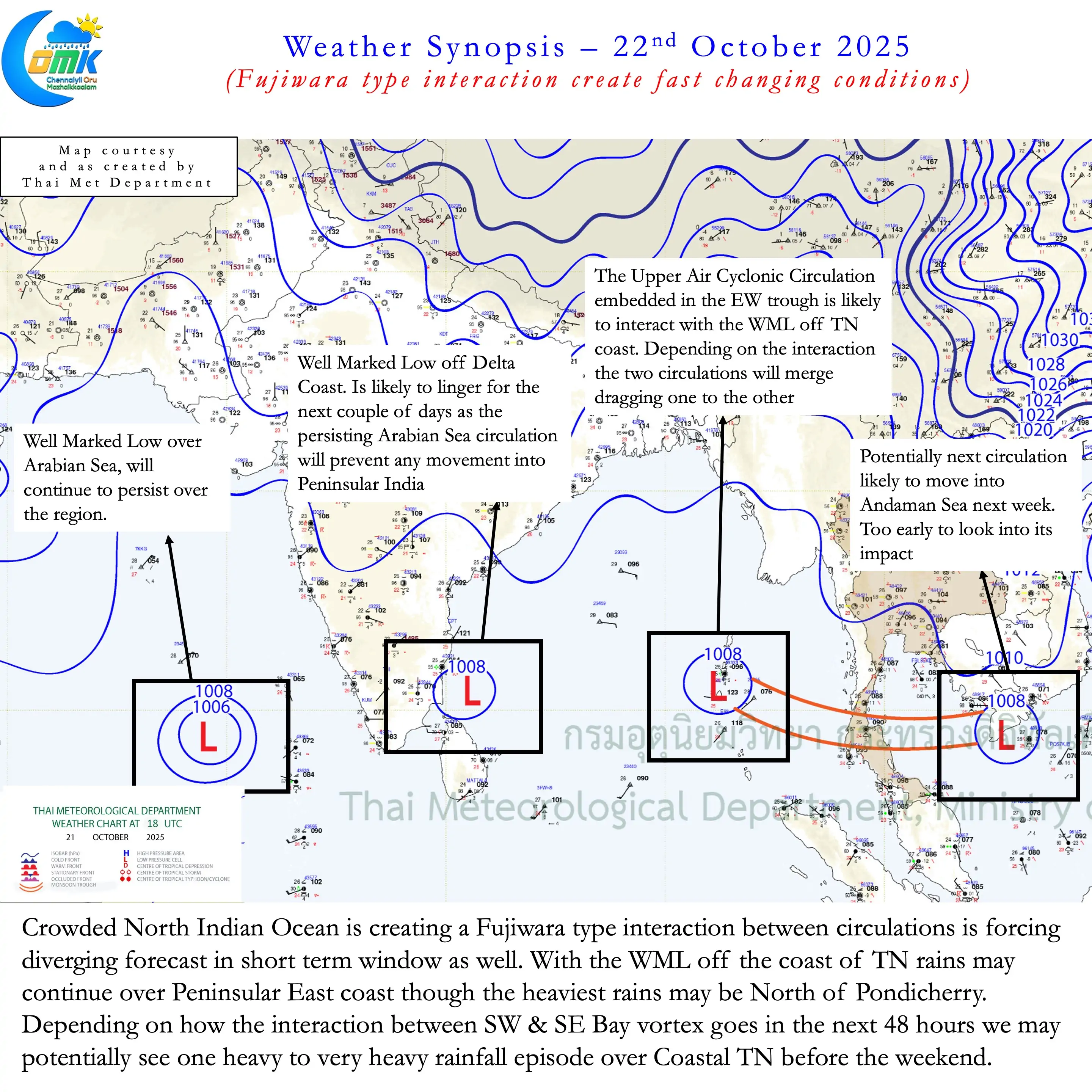
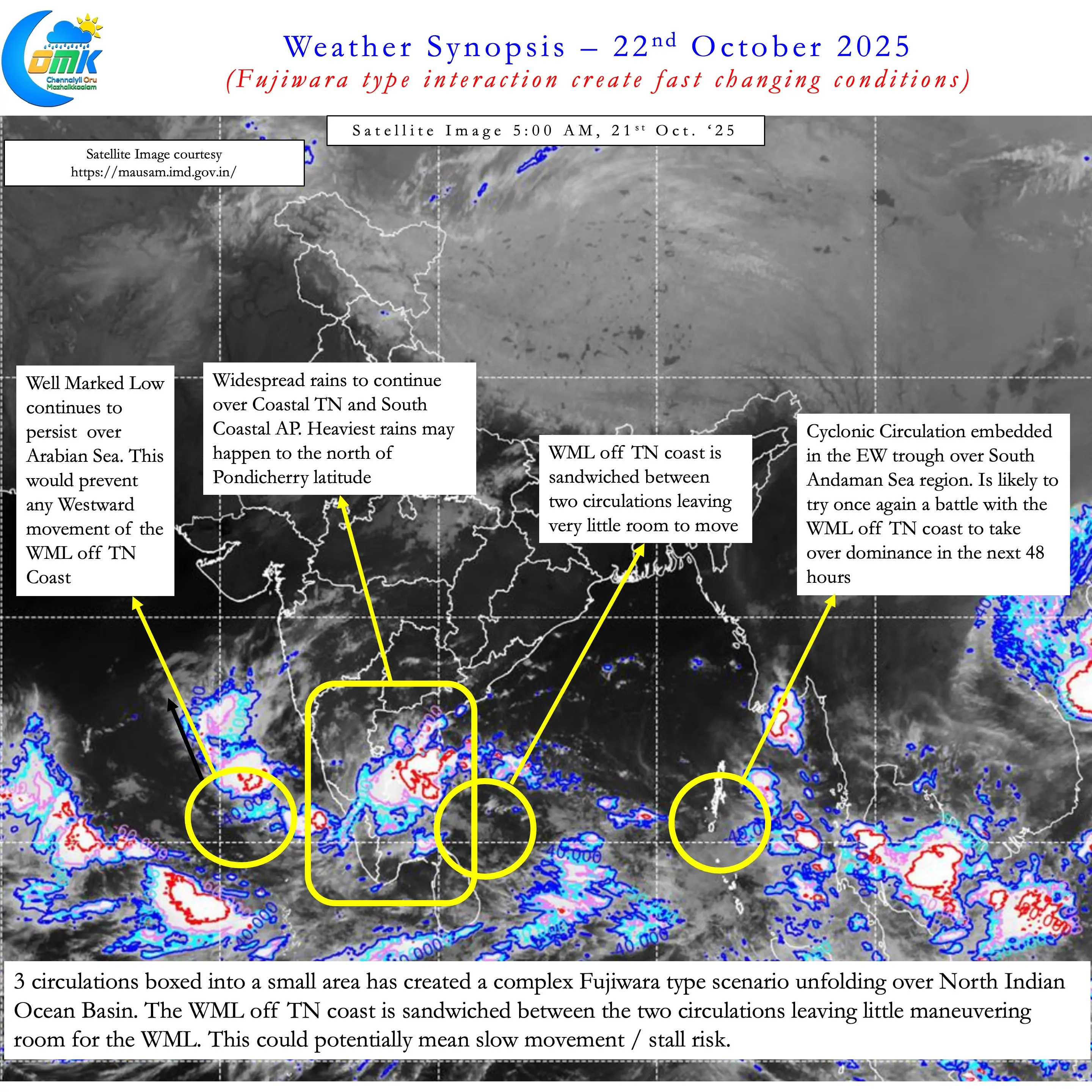
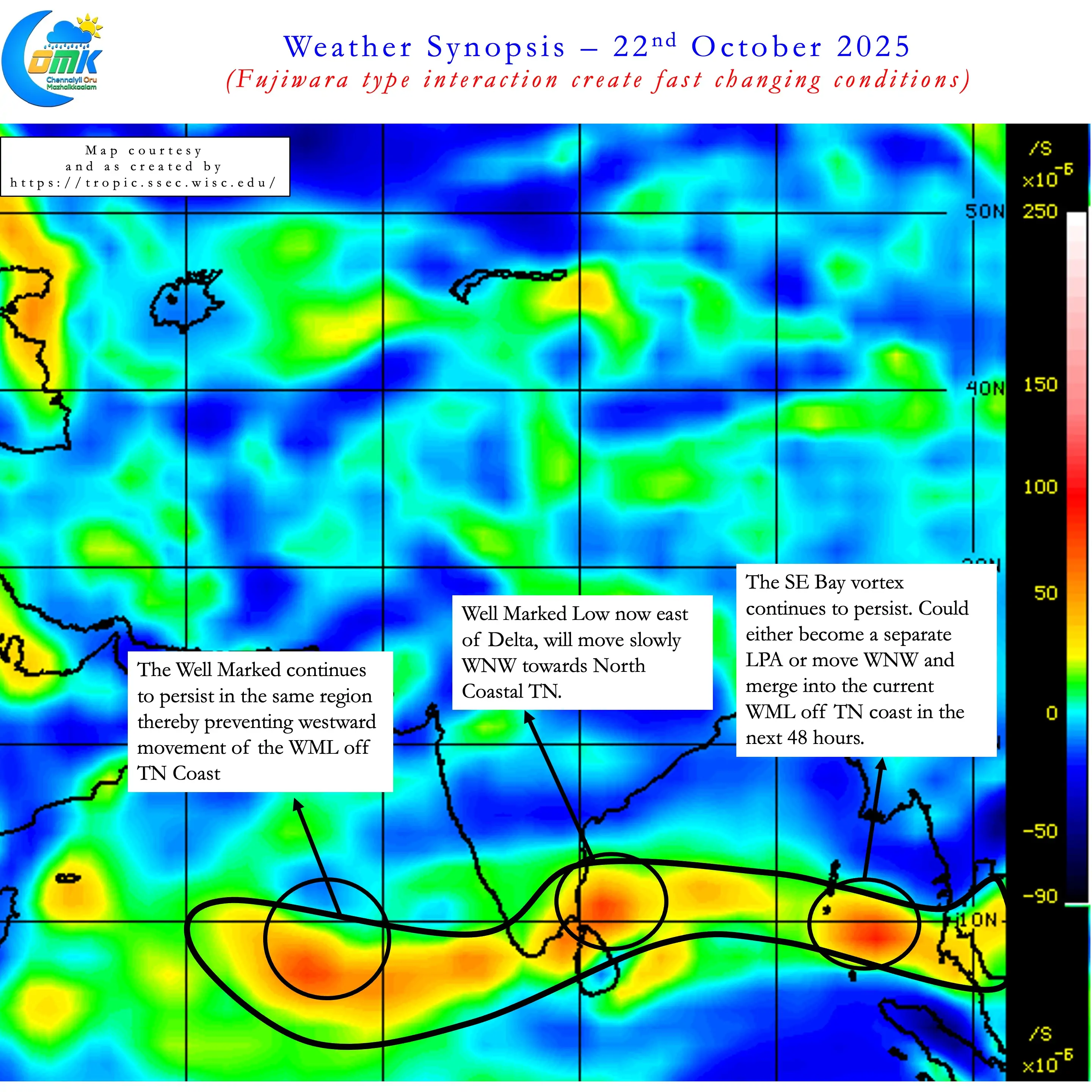
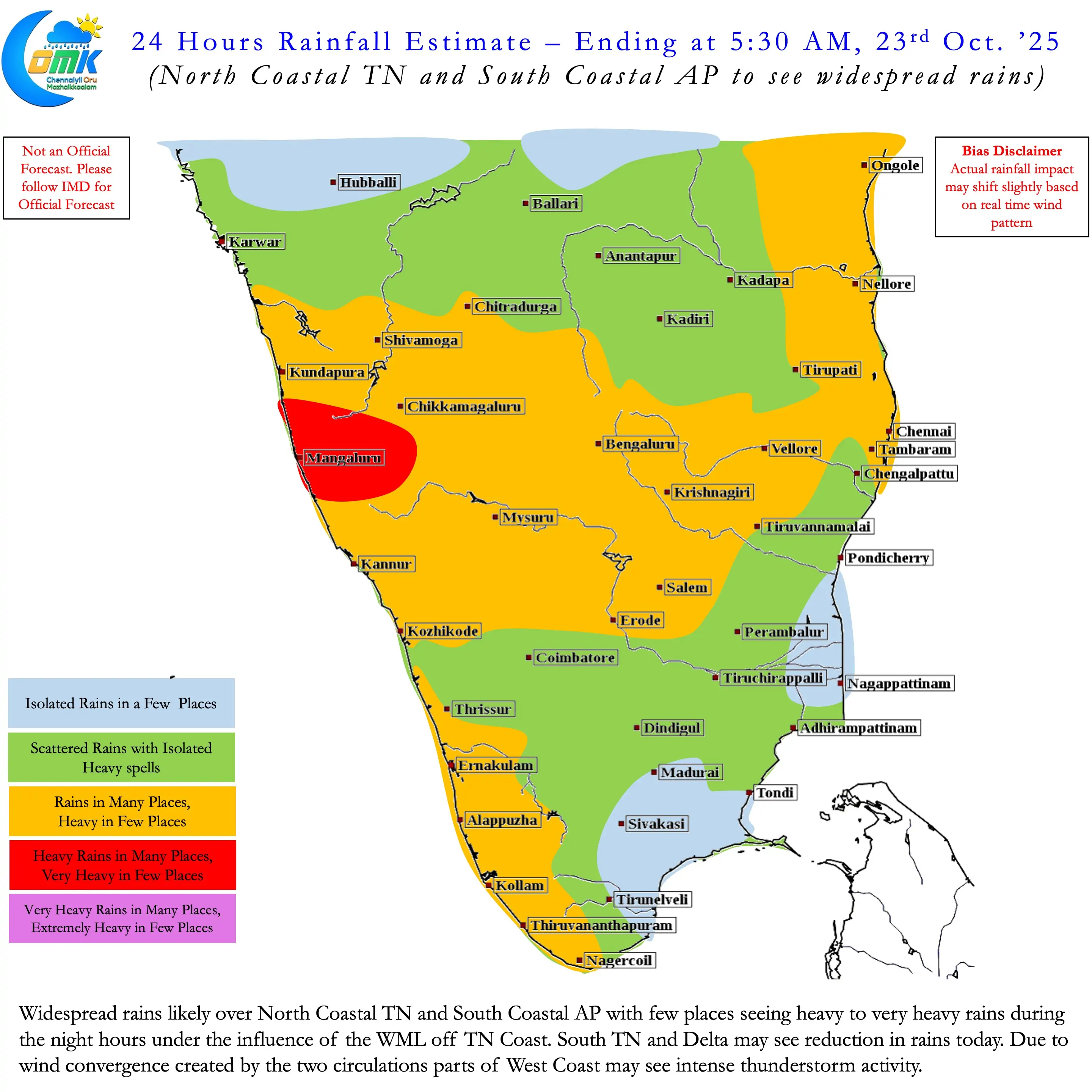
Because of all this we are looking at a situation where a cyclonic circulation could linger off the TN coast for the next 3 / 4 days. Taking into account the wind pattern with the WML now east of Delta rains may ease over Delta and South TN for the next couple of days. North Coastal TN and South Coastal AP will continue to see widespread rains. When the interaction between the SW Bay and SE Bay vortex starts once again we are likely to see one episode of heavy to very heavy rainfall over South Coastal AP and North Coastal TN.
Keeping this in mind it makes sense to follow real time rather than take model forecasts on face value even for 3 days ahead. To summarise.
- Delta and South TN may see much needed respite from rains
- Heaviest rains may happen North of Pondicherry from now on
- On and off rains with heavier spells during evening to morning hours will continue over North Coastal TN.
- The WML off Tamil Nadu coast may not intensity too much. But is likely to linger over the region for the next couple of days.
- The presence of 3 circulations in a boxed area has left little manoeuvrability for the WML off TN Coast.
- The SE bay vortex is likely to interact with the WML off TN coast. This could potentially relocate it further away from TN coast in the next 48 hours. This relocation may alter rainfall pattern once again. We may potentially see one very heavy rainfall episode over North Coastal TN / South Coastal AP before weekend.