

Terms like El Nino / La Nina / MJO etc has started getting into common speak as weather awareness increases. It has also resulted in a lot of myths about flooding events. For e.g. the 2015 Chennai floods was connected to El Nino. Every subsequent El Nino episode brought a question of potential floods for Chennai during NEM. As we reach a fresh transition stage from La Nina to El Nino we can expect the El Nino linked Chennai floods question surface again.
In the meantime while La Nina continues to persist as it continues to weaken parts of Tamil Nadu may come under a fresh spell of rains. It becomes pertinent to point out such spells of rains even after Pongal is not unusual during La Nina years. Bulk of these rainfall episodes happen when there is a tropical and sub tropical interaction. Moisture brought in by lower level easterlies get enhanced by the Mid Latitude Westerly Trough. Additionally the westerly trough drags a low latitude rainfall event further north.
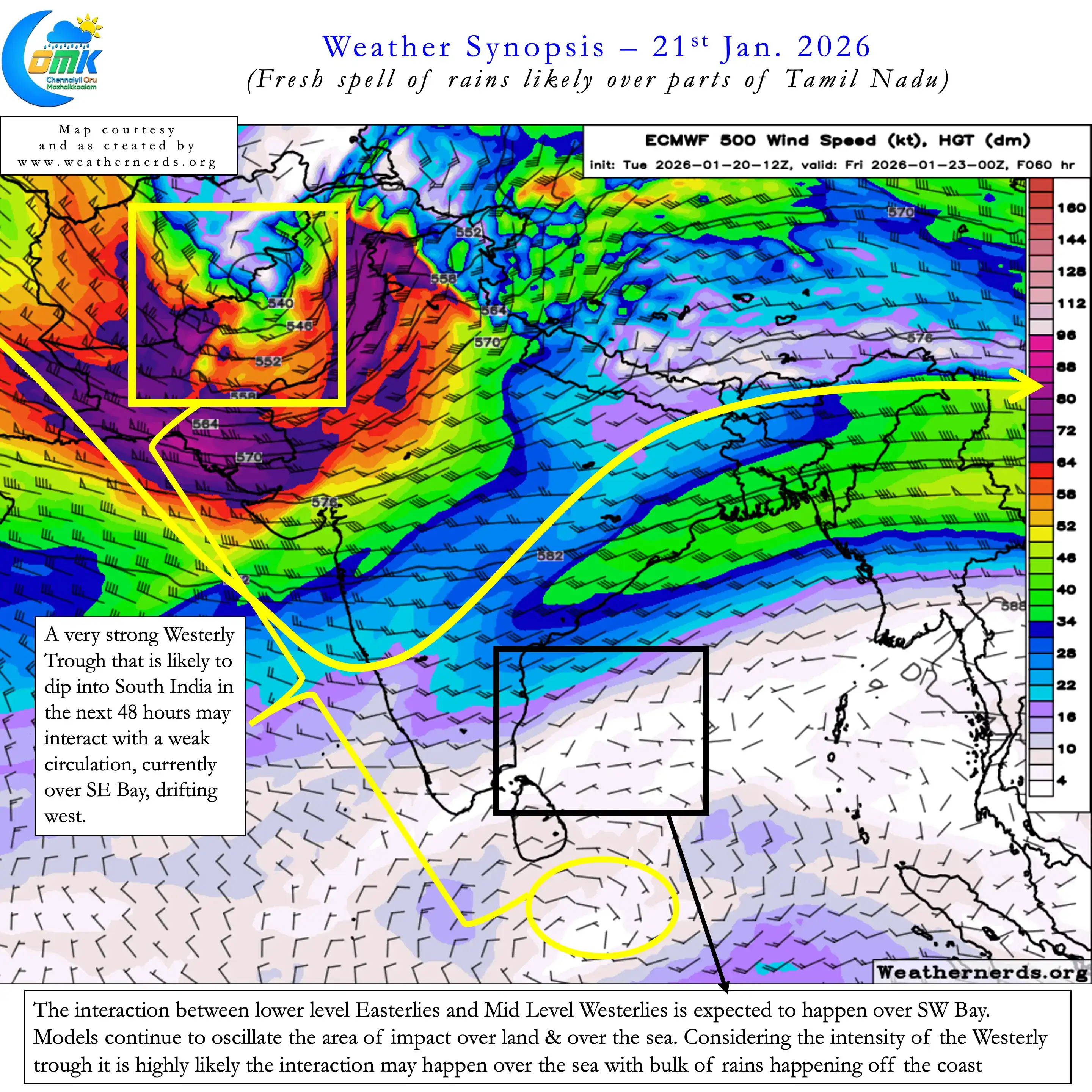
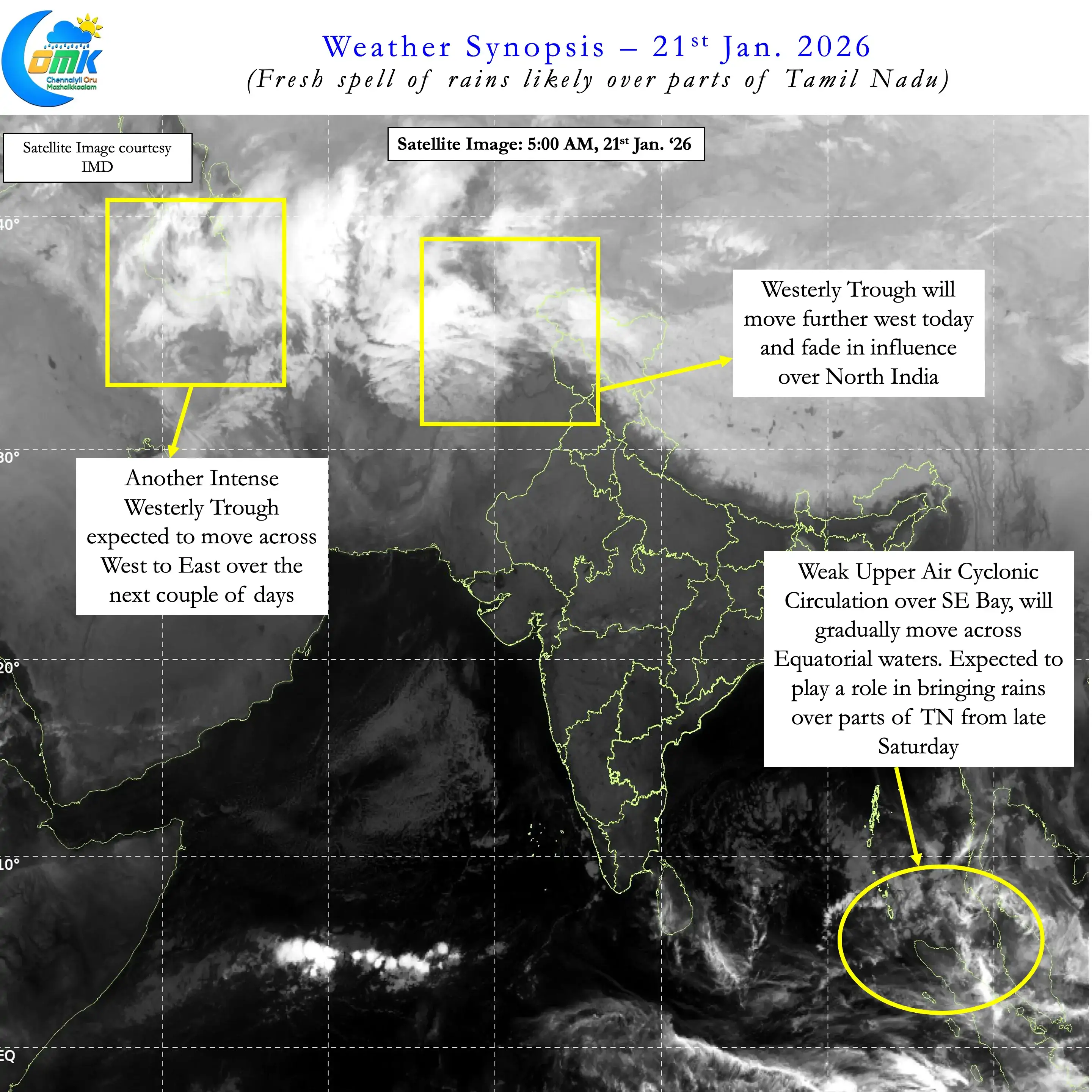
As always judging these interactions well in advance based on model forecasts is futile. Even as a WD is passing through North India another WD is moving over Middle East. This Westerly trough is likely to interact with a cyclonic circulation, now seen over SE Bay, when it moves further west. Models expect this interaction over SW bay with some models pushing the interaction over land. Considering the intensity of the incoming trough there is a high chance it may happen off the coast. But nevertheless it is likely to bring a fresh spell of rains over parts of Tamil Nadu.
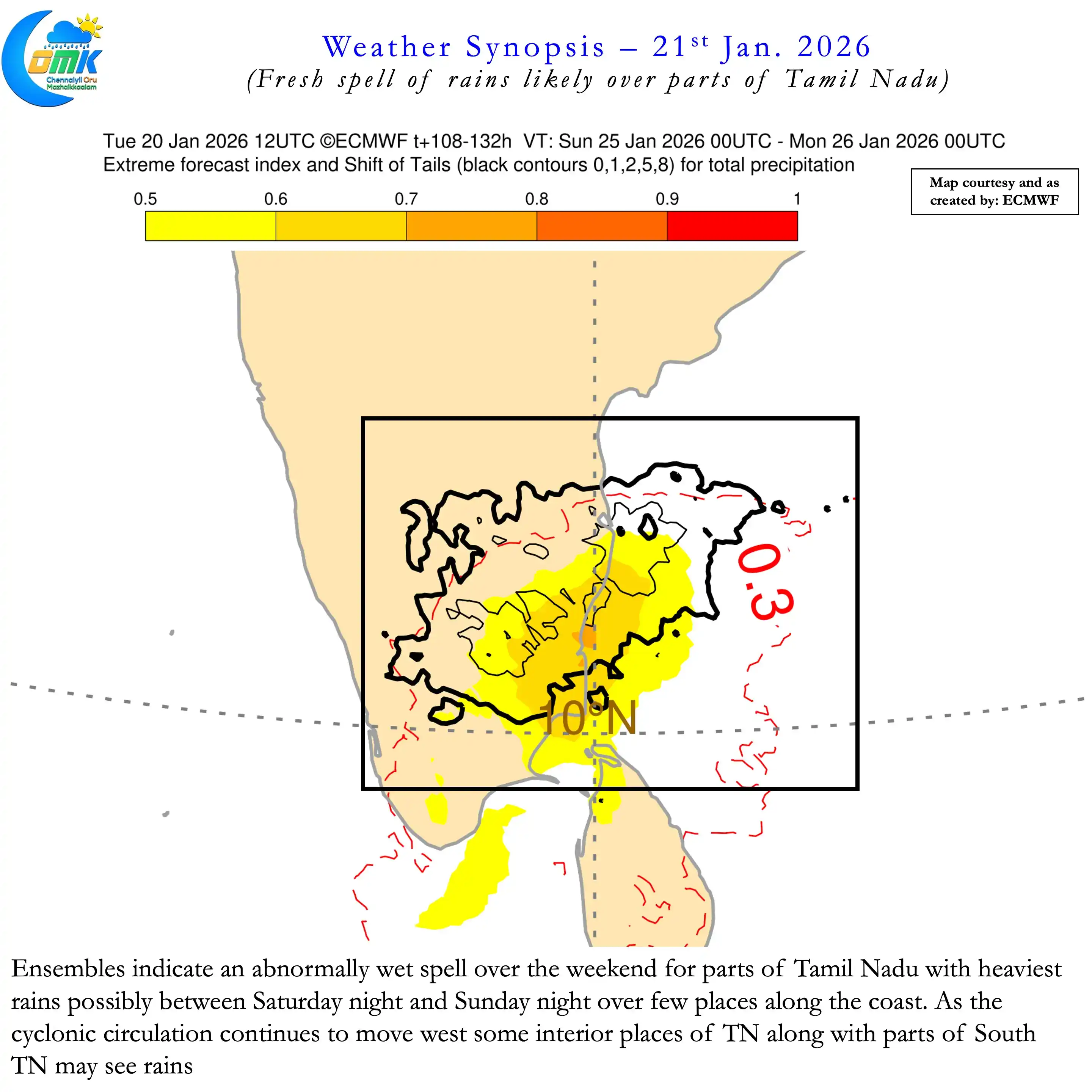
In particular coastal stretch south of Pondy, interior areas of West TN and many places in South TN may see spell of rains over the weekend. ECMWF ensembles do indicate one day of potentially moderate to heavy rains over parts of TN from late Saturday to late Sunday. It is going to be another heart in the mouth moment for farmers harvesting their crops in these areas. For places like Chennai in North Coastal TN rainfall prospects may completely depend on how much the trough dips down into South India.
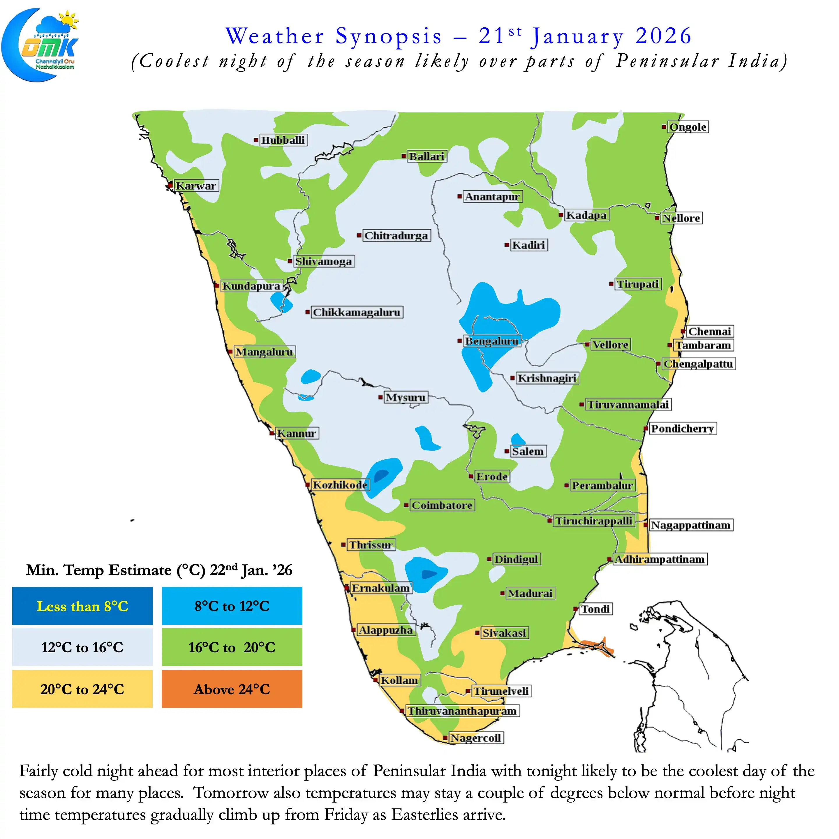
In the meantime as Easterlies strengthen we can possibly see a brief respite from the cool nights in Peninsular India. But before that we may possibly see the coolest night of the season today over interior Peninsular India. Tomorrow may also be cooler than normal before night time temperatures increasing from Friday.
Farming community over Delta districts and adjoining areas to the west need to be ready for rains. Potentially we may see moderate to heavy rains between Saturday and Monday.