
After a lull things are shaping up for an active phase of pre monsoon thunderstorms over Peninsular India. During the early days of April we had talked about a spell of sub par summer thunderstorms over Peninsular India. A combination of factors including unfavourable tropical wave influence created this suppressive phase over Indian sub continent. This also triggered a spell of brutal summer conditions over most parts of the country. A couple of days back we saw parts of Hyderabad come under hailstorm. Yesterday we saw widespread hailstorms over Bengaluru and surrounding. The classic Fire & Ice Show that is typical of pre monsoon thunderstorms over Peninsular India.
Fire and Ice, a poem by Robert Frost is a philosophical take on the end of the world. In a way one can equate it to damages brought about by Heat and Hailstorm. Heat stress is now slowly becoming a discussion in mainstream. Similarly hailstorm may be enjoyable for many but they bring about a lot of crop damages. The Fire & Ice show though has just resumed once again over Peninsular India.
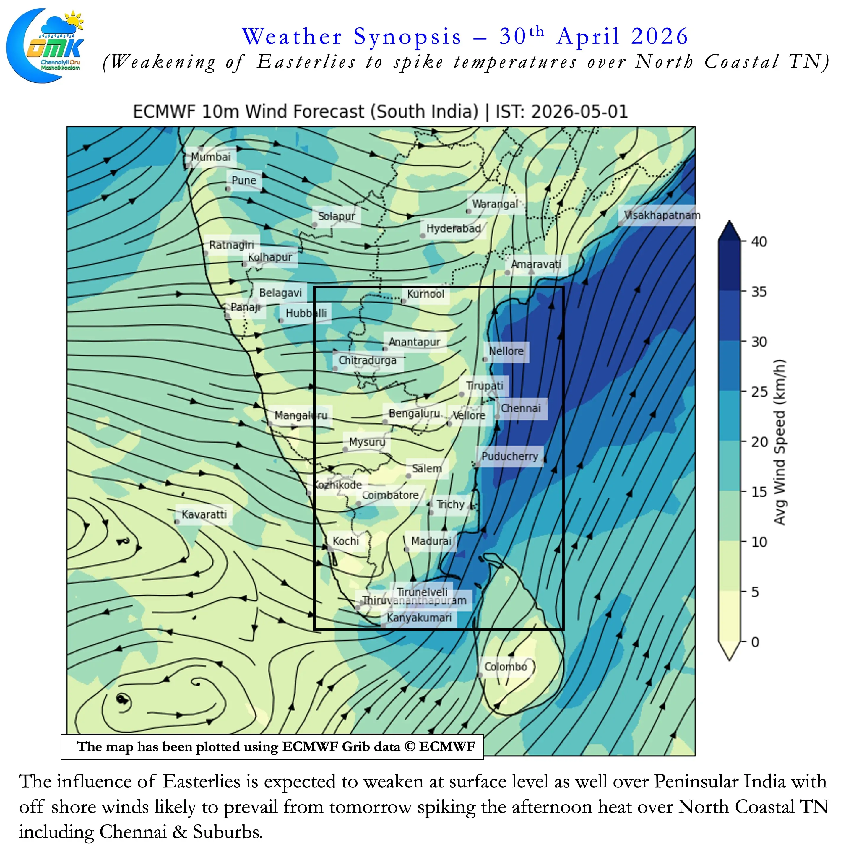
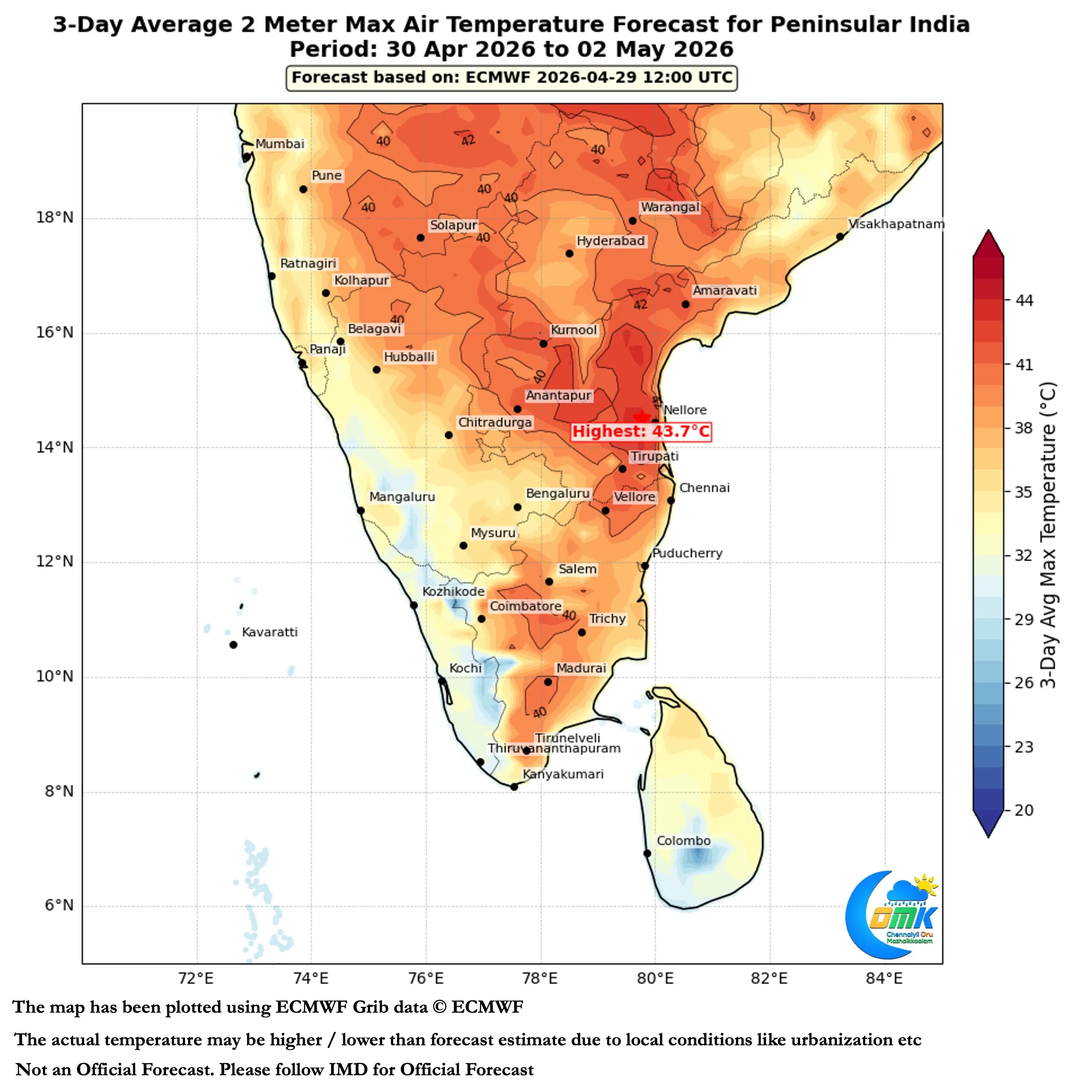
So far North Coastal TN including Chennai to a great extent got benefitted from Easterlies. That could change as surface level westerlies are sneaking in across the region. A spell of off shore winds may slowly bring about delay in sea breeze intrusion over the coastal areas. Weather models indicate some of the suburbs may start hitting the dreaded 40°C this weekend. Interior places in North TN along with adjoining areas ofSouth Coastal AP may start competing with Rayalaseema on the heat front.
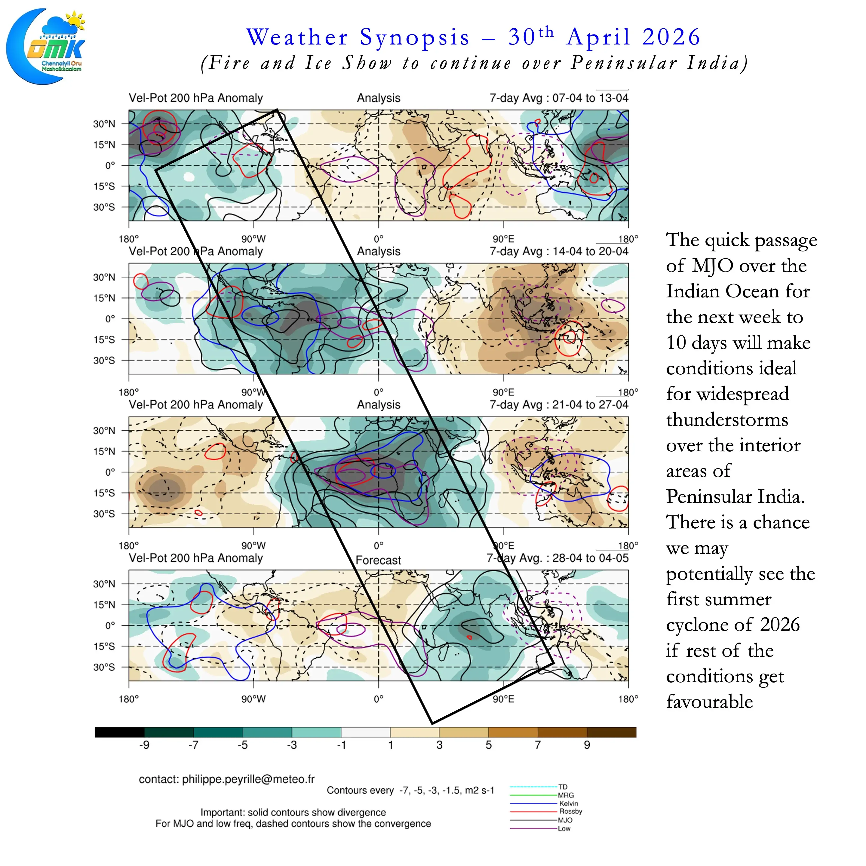
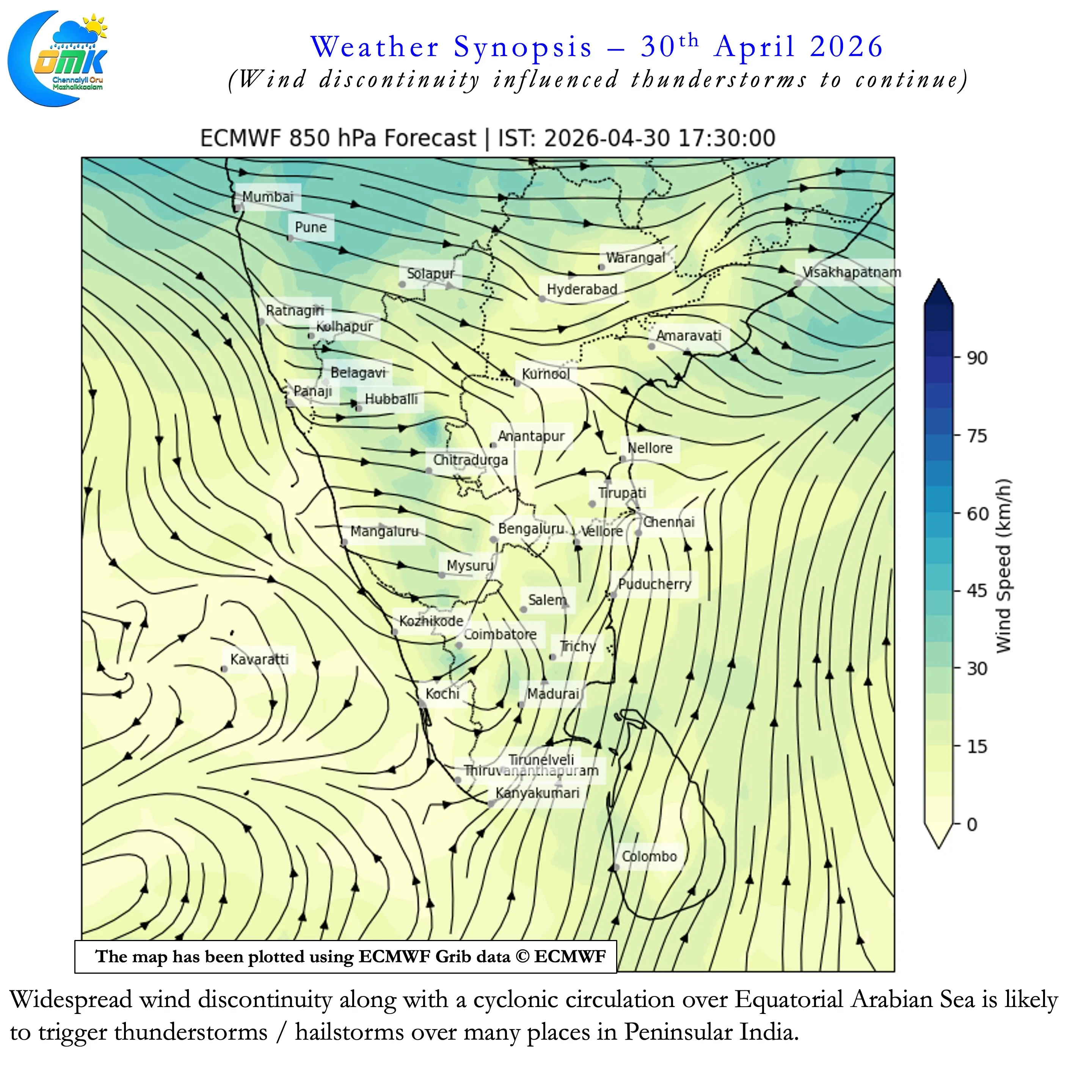
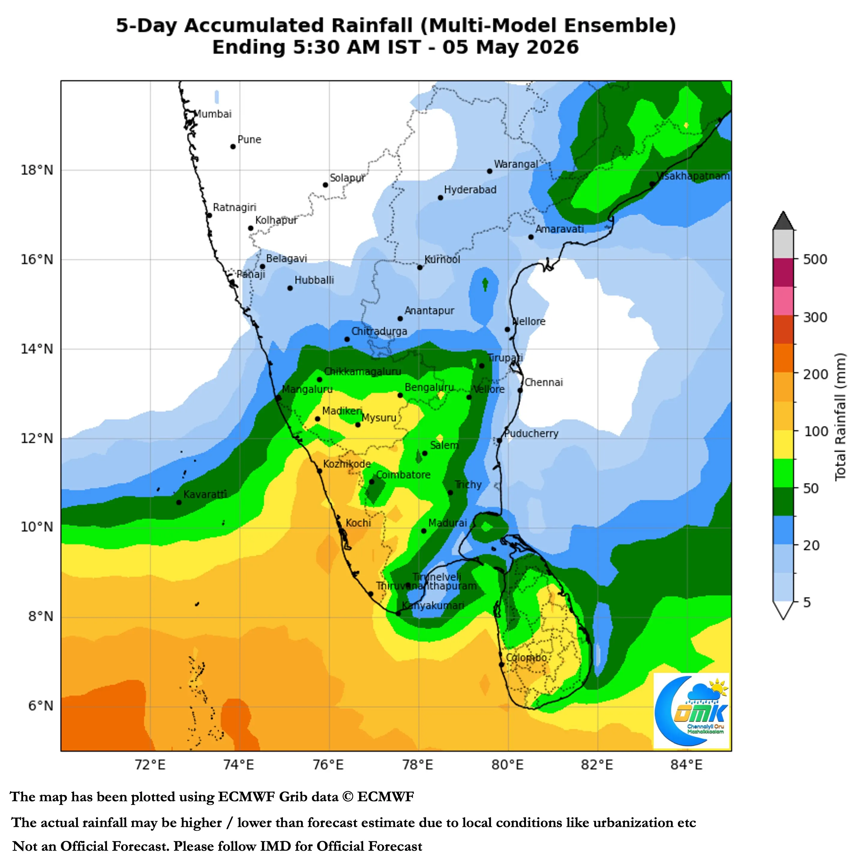
The passage of MJO over Indian Ocean is likely to make it conducive for thunderstorms over large parts. of Peninsular India. Models though indicate it could be a quick passage across the Indian ocean. But nevertheless we are finally breaking the suppressive phase. Equatorial Arabian Sea is seeing a weak cyclonic circulation. Westerly troughs have once again started to transit across the Himalayas. With favourable tropical wave transit the atmosphere is primed for severe convection.
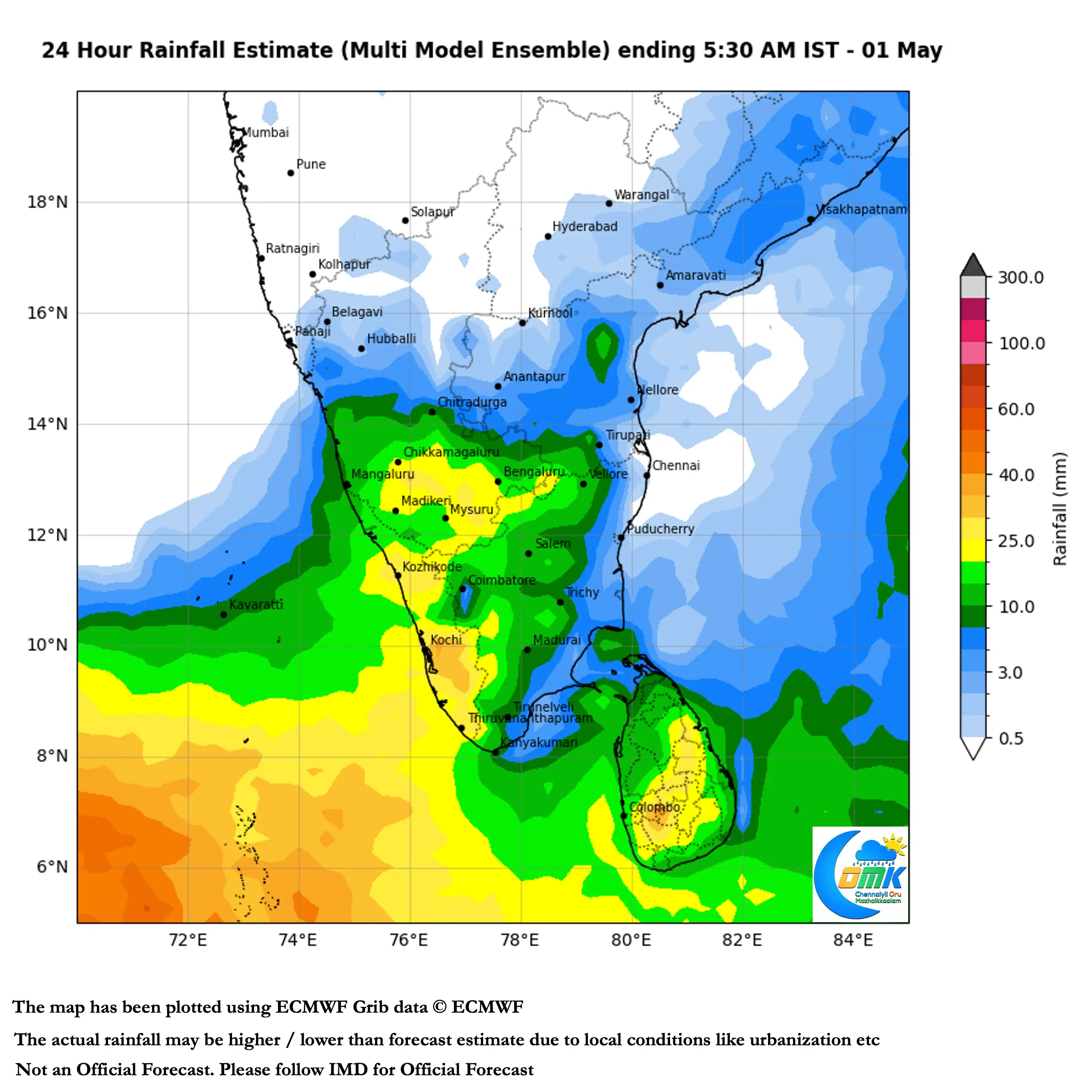
Over the course of the next few days we may see hailstorms at many places over Interior Peninsular India. In particular places closer to the Eastern Ghats along the KA / TN / AP borders. KA / KL / TN borders may see increased thunderstorm activity. Places along the Western Ghats all the way from Shimoga to Kanyakumari may also see rains. It would not be a surprise if we see Bengaluru come under hailstorm once more in the next day or two.
As far as Chennai goes we need a medical miracle to bring us rains. But there is no escape from the heat though.