
Yesterday many parts of Tamil Nadu once again saw Thunderstorms with places in parts of Tirunelveli & Kanyakumari dts receiving rains after many days. In a related development it was reported parts of Thoothukudi district around Ottapidaram saw weak hailstorms along with heavy spell of rains as well. This possibly indicated the unstable atmospheric conditions that’s currently prevailing over the southern parts of Peninsular India.
While Chennai did not see much activity the usual hotspot for thunderstorms around the North Coastal areas, close to Pulicat Lake, saw moderate to intense Thunderstorms during the late afternoon hours. One of the reasons Chennai did not see any major activity was the further slowing down of lower level Westerlies. This meant the interior storms started slowing down in the their movement and also began exhibiting near stationary behaviour providing heavy rains to areas where they developed and triggered fresh cells in the leading edges of the Thunderstorms.
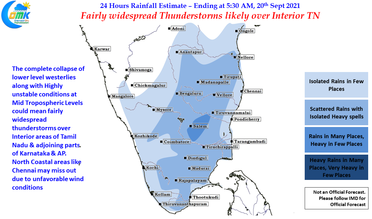

Today conditions look very good for the interiors parts of Tamil Nadu to enjoy a good spell of rains with Thunderstorms likely to form even in parts of West interior TN due to the complete slowing down of lower level Westerlies. While this could create reduced chances for coastal areas of North TN it is a blessing for the interiors. Coastal areas like Chennai which have already pretty much recived the Southwest monsoon seasonal quota should not worry too much with Northeast Monsoon to come.
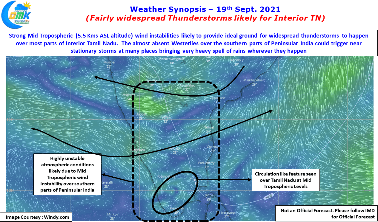
Wind instabilities at Mid Tropospheric levels in the form of circulation like feature over Tamil Nadu will ensure conditions are perfect for fairly wide spread Thunderstorms to develop today across most parts of Tamil Nadu. In particular Namakkal, Erode, Salem, Kallakurichi, Tiruvannamalai and parts of Villupuram dt may see heavy rains in isolated places.