
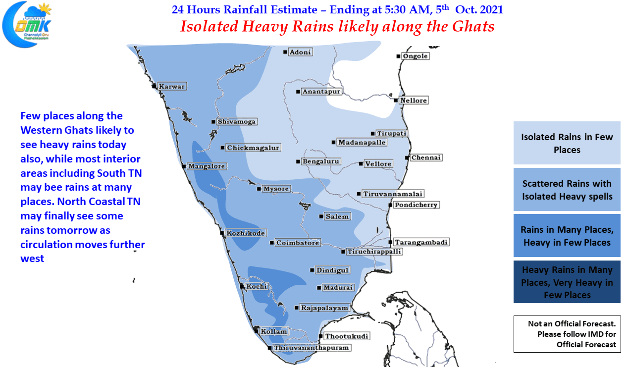
It was a strange day to follow weather yesterday, particularly if you are from Chennai, as mostly clear skies with slightly warm conditions was seen. Common public may have been confused wondering why is it dry & warm when the news channels were talking about Northeast Monsoon Onset & possible heavy rains. As explained in our post yesterday the culprit is the Northerly winds which is bringing in the drier air rather than the moist air from Bay of Bengal. Those who are regular morning walkers may have also felt a nip in the air as though winter conditions are prevailing. Northerlies are the culprit if you felt so.
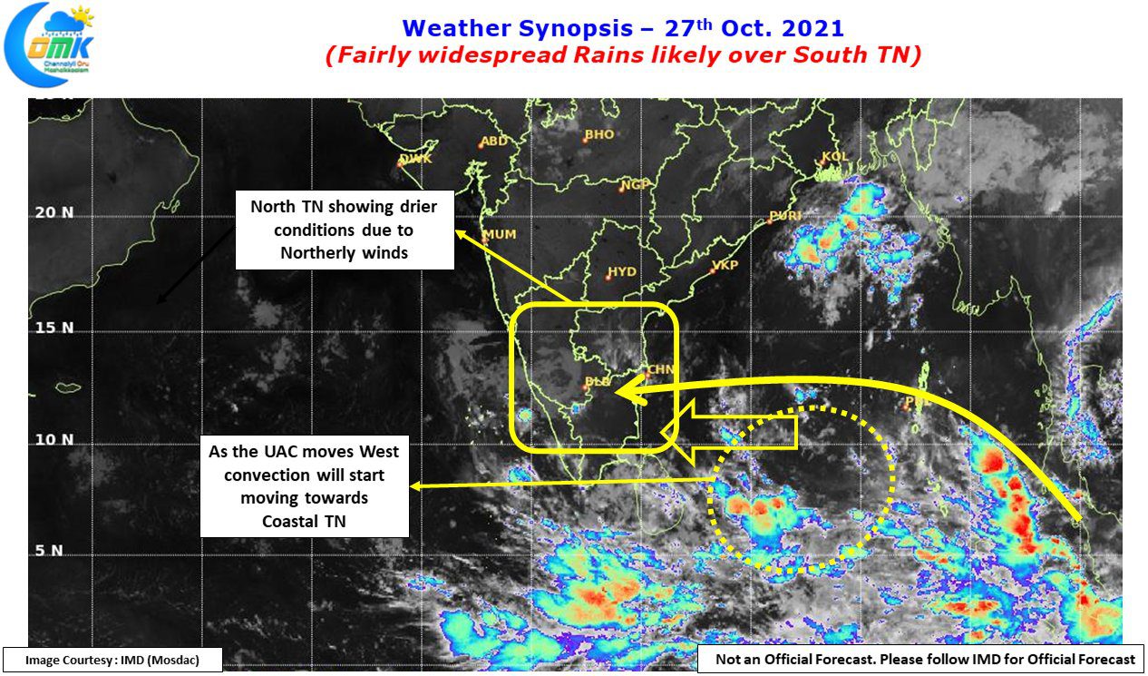
The Satellite image also pretty much sumps up the situation with clearer skies seen over most parts of Peninsular India while the active convection is seen around Sri Lanka latitude. The Upper Air Cyclonic circulation over the south bay continues to persist & IMD is expecting it to become a Low Pressure Area today while continuing to move in a gradually westward direction. As it comes closer to the Sri Lanka / TN coast the winds will turn more favorable & an increase in rains over the coastal areas may be expected from tomorrow.
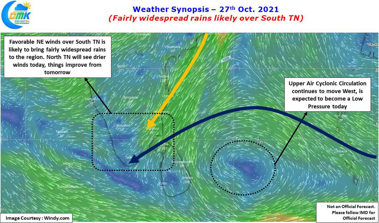
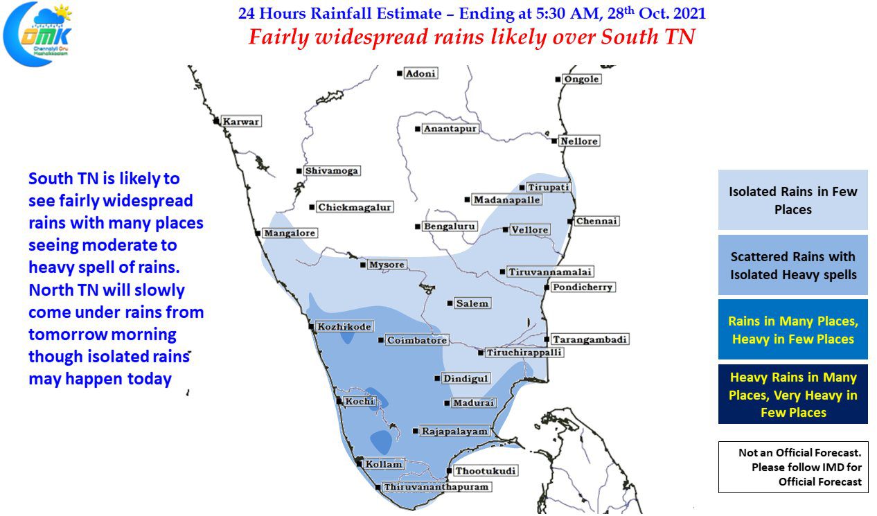
In the meanwhile today may be a repeat of yesterday with fairly widespread rains likely over southern parts of Tamil Nadu & a few places over West Interior Tamil Nadu along with heavy spell of rains in one or two places over the Western Ghats. Later tonight / early tomorrow morning the winds are changing for the good improving the chances for coastal areas. The next few days starting from tomorrow could turn out to be a decent onset spell across coastal areas of Tamil Nadu. All in all things continue to look good for October to end with a fairly high positive anomaly.