
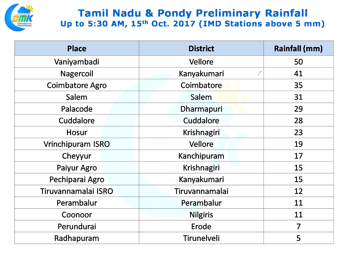
As the Bay Circulation develops thunderstorms in North Tamil Nadu continues to persist with yesterday seeing decent rains in many parts of Vellore, Krishnagiri, Kanchipuram, Villupuram & Tiruvannamalai districts. Southern suburbs of Chennai received a sharp spell of shower in the evening particularly to the south of Tambaram and parts of OMR areas.
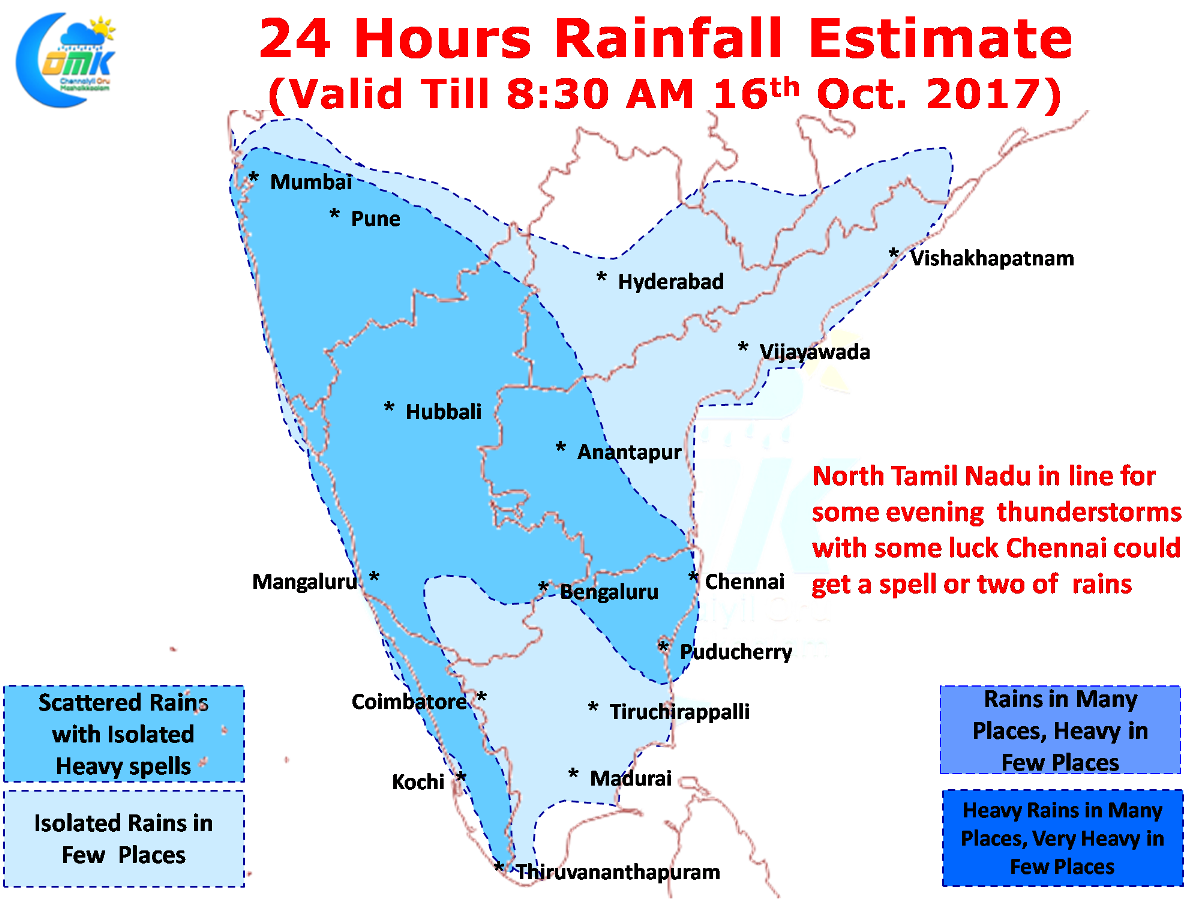
Most models have been indicating the low pressure in Bay of Bengal to form in the next 24 hour or so we could slowly start seeing the thunderstorms slow down in the interior areas. The wind instability that was driving thunderstorms for most of the days in the last fortnight or so will get streamlined on account of the low pressure thereby reducing the thunderstorms in North Tamil Nadu & rest of Peninsular India.
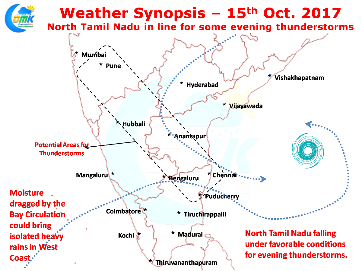
Nevertheless today could possibly be an active day of thunderstorms in North Tamil Nadu with models indicating a zone of instability running from the East Coast to West Coast along parts of Rayalseema, Interior Karnataka & South Maharashtra. This will once again benefit the districts of Vellore, Krishnagiri, Tiruvannamalai bringing some more rains to the region which has been soaked to the core already.
While Chennai has been missing out on the rains mostly for nearly more than a week now, models indicate things look better today with possibly a spell or two of evening rains on the cards as wind pattern seems to be slightly better for Chennai compared to the last few days. With steering winds expected to be from Northwest Chennai will need thunderstorms to form around the Tirupati / Nagari region.