
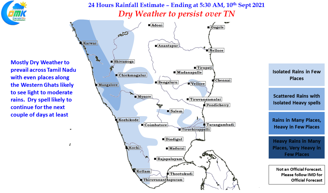
Last couple of days have seen day time temperatures inch up slowly as dry atmospheric conditions & the consequent absence of thunderstorms meant afternoons were mostly hot across the state. While few places around Salem got some rains, with the city area getting a rather surprisingly heavy 2 cms leeward areas of Tamil Nadu remained dry mostly across the state yesterday. Also after nearly two weeks both the IMD observatories at Chennai crossed day time max temperatures of 35 degree Celsius. Today also things are going to be similar with day time maximum temperatures hovering around 35 degrees for Chennai & suburbs.
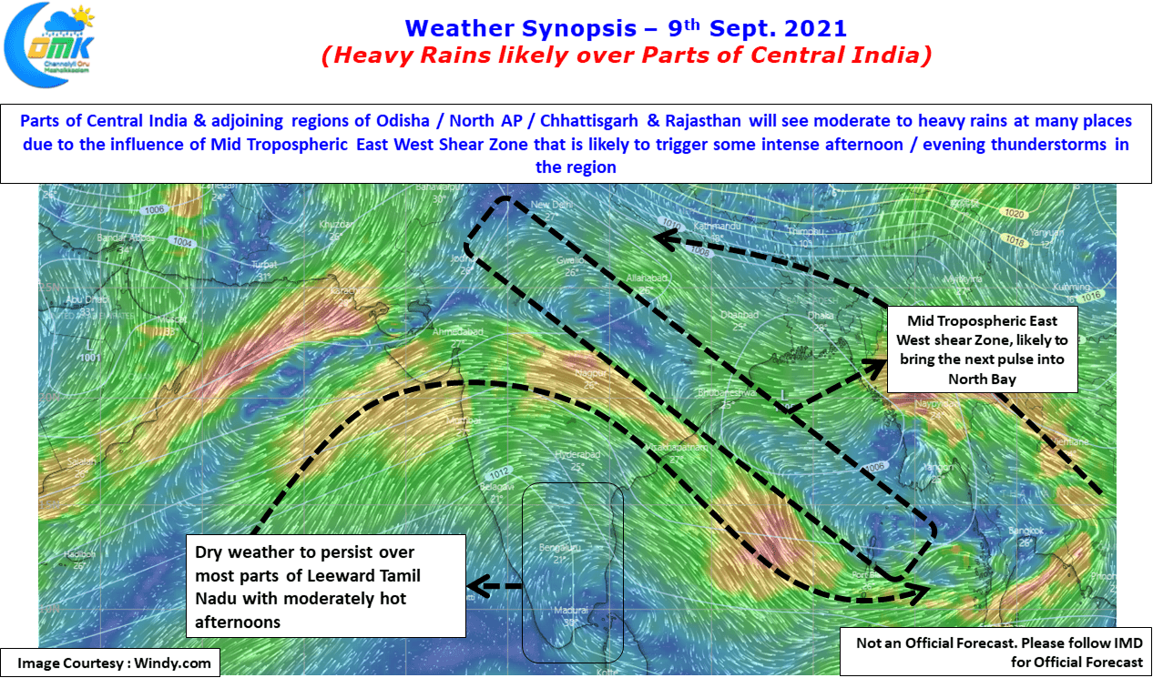
In the meanwhile Odisha which has been reeling under a deficit Southwest Monsoon so far could look forward to a rainy spell thanks to the East West shear Zone that is running across Bay & into Central India. This east West Shear zone is likely to provide conducive conditions for thunderstorms to develop in the region all the way from Bay to East Rajasthan bringing moderate to heavy rains at most places while few places might get heavy to very heavy rains from afternoon & Evening thunderstorms. The region around Chhattisgarh / Odisha / MP & East UP has been seeing some fairly intense thunderstorms for the past few days with a few ground strikes exceeding 200 kA power. Today also the region is likely to witness intense thunderstorms with dangerous heavy duty ground strikes.
Parts of Gujarat has been seeing good rains for the past couple of days influenced by the Low Pressure that is in the Western end of the Shear Zone. Meanwhile one can expect a possible pulse to evolve as a Low Pressure area in the Eastern End of the Shear zone where already a weak circulation tilting southwards is seen. This LPA might form in the North Bay in a couple of days time and as it moves WNW will possibly drag the Monsoon Trough closer to the foot hills of Himalayas reducing the rains along with it and may be switch on the withdrawal process in a week to 10 days time from NW India. But it is all still a little fluid at the moment.
Down south though is going to be relatively quiet with dry weather likely to prevail not only over the leeward parts of Tamil Nadu but also places along the Western Ghats may end up receiving only light to moderate spells, particularly over South TN where Kanyakumari dt continues to seen an extremely bad Southwest Monsoon season so far. The pre monsoon thunderstorms during Tauktae in the month of May has meant so far the year has not turned out to be a disaster to these parts of TN & adjoining Ghats of Kerala.