

Fine Margin refers to a very small difference that changes outcomes dramatically. In tropical weather we see these fine margin manifest in many forms. A slight change in wind shear could greatly enhance / weaken a tropical cyclone. A small change in the genesis location could alter the ridge dynamics dramatically leading to a completely different path. Over the next 48 hours we may witness yet another instance of fine margins deciding outcomes. The Depression in South Bay is almost set in stone in terms of landfall. But a small change in the path over the next 24 hours could alter rainfall impact over North Coastal TN dramatically.
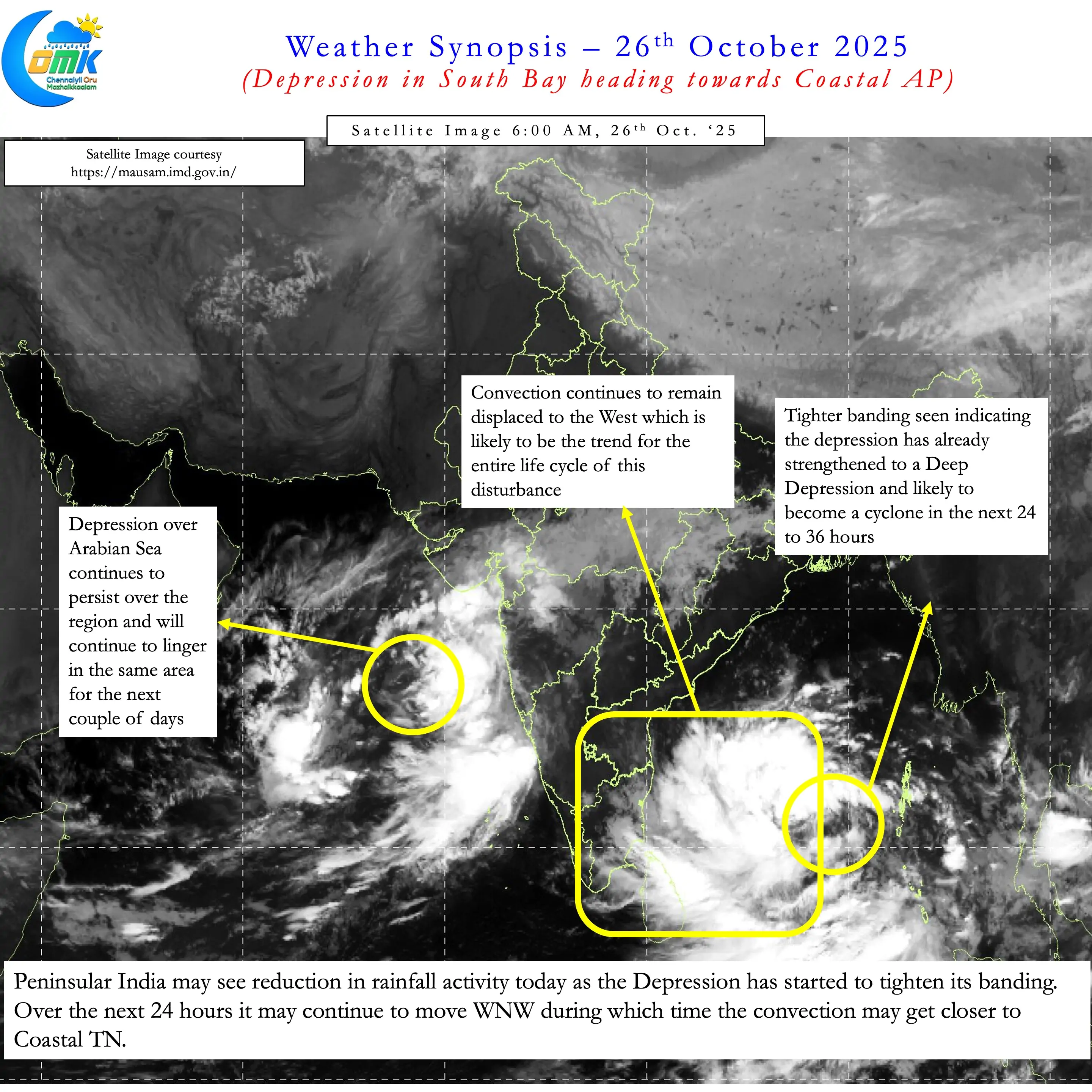
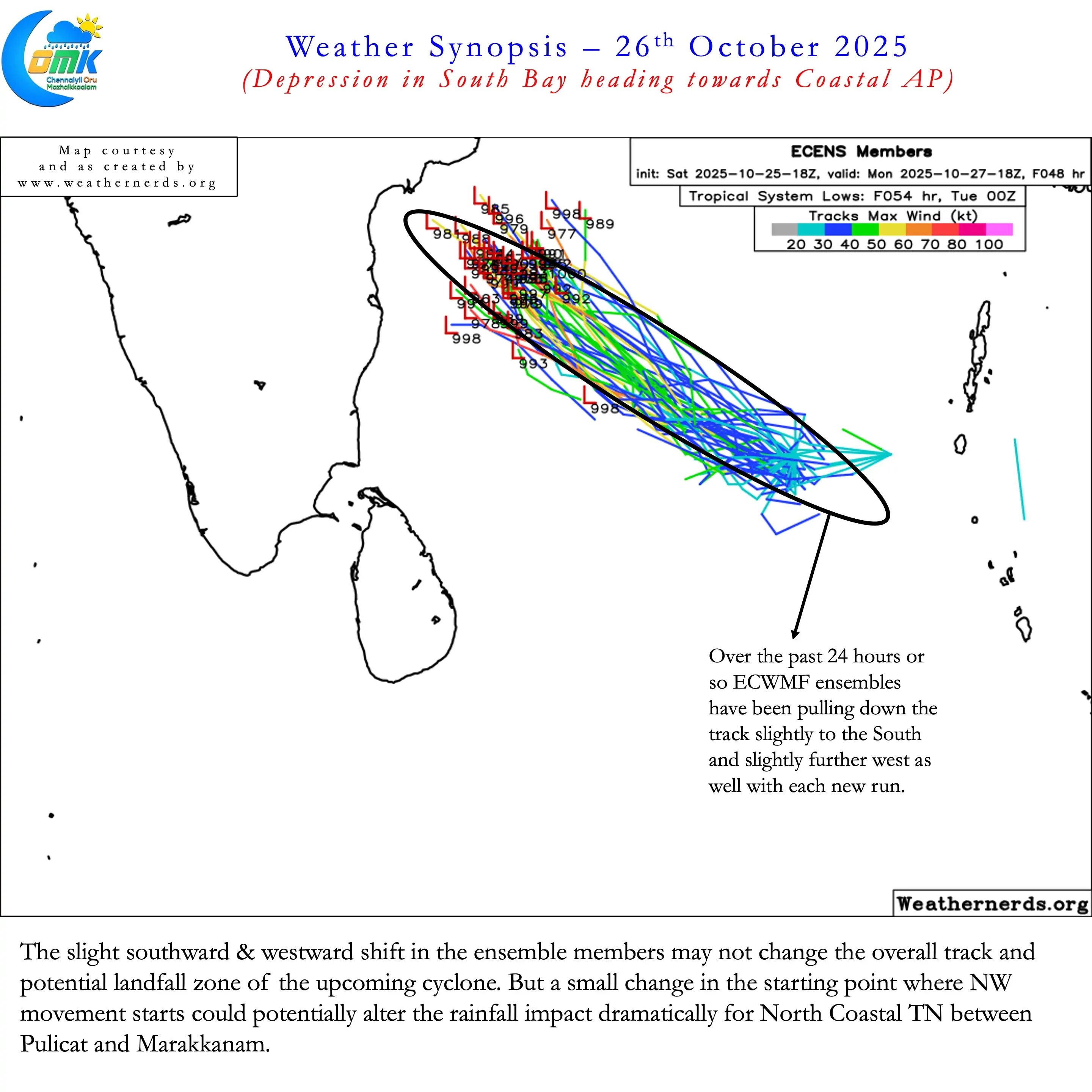
Satellite image indicate the depression in South Bay is already showing impressive signs of intensification. It is at a relaxed shear environment and supported by a warm ocean body providing conducive conditions. It appears it could have already intensified to a Deep Depression though we will have to wait for IMD to announce. Over the past 24 hours a trend has started to emerge. ECMWF ensembles have started to slightly shift the track to the west and south compared to initial estimates.
Taking this into account and overall model behaviour seen so far the Key take aways are given below.
- The Depression is likely to become a Deep Depression in the next 6 to 12 hours
- It is likely to further intensify into a Cyclonic Storm in the next 24 to 36 hours
- A clear trend seen in Ensembles with a slight southward and westward shift in track over the past 24 hours.
- But overall there is not much change in the track and potential landfall zone. The cyclone is likely to make landfall between Kavali and Kakinada close to Machilipatnam.
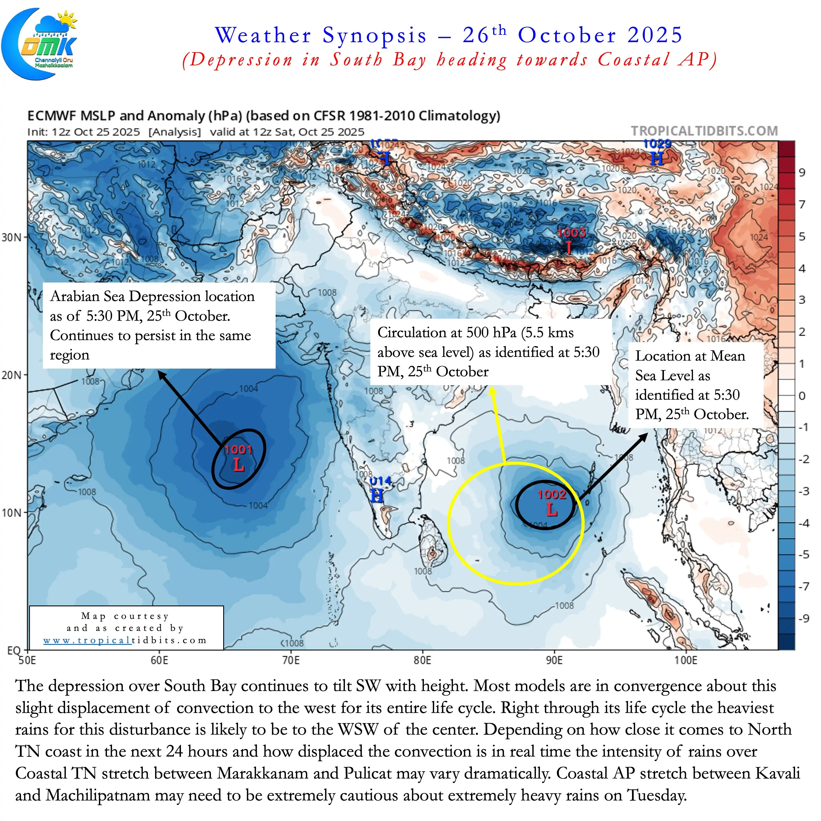
- The disturbance is tilting Southwest with height and is likely to retain a similar structure right through its life cycle
- This could potentially mean the heaviest rains is likely to happen to the WSW of the center most of the time as it gets closer to landfall
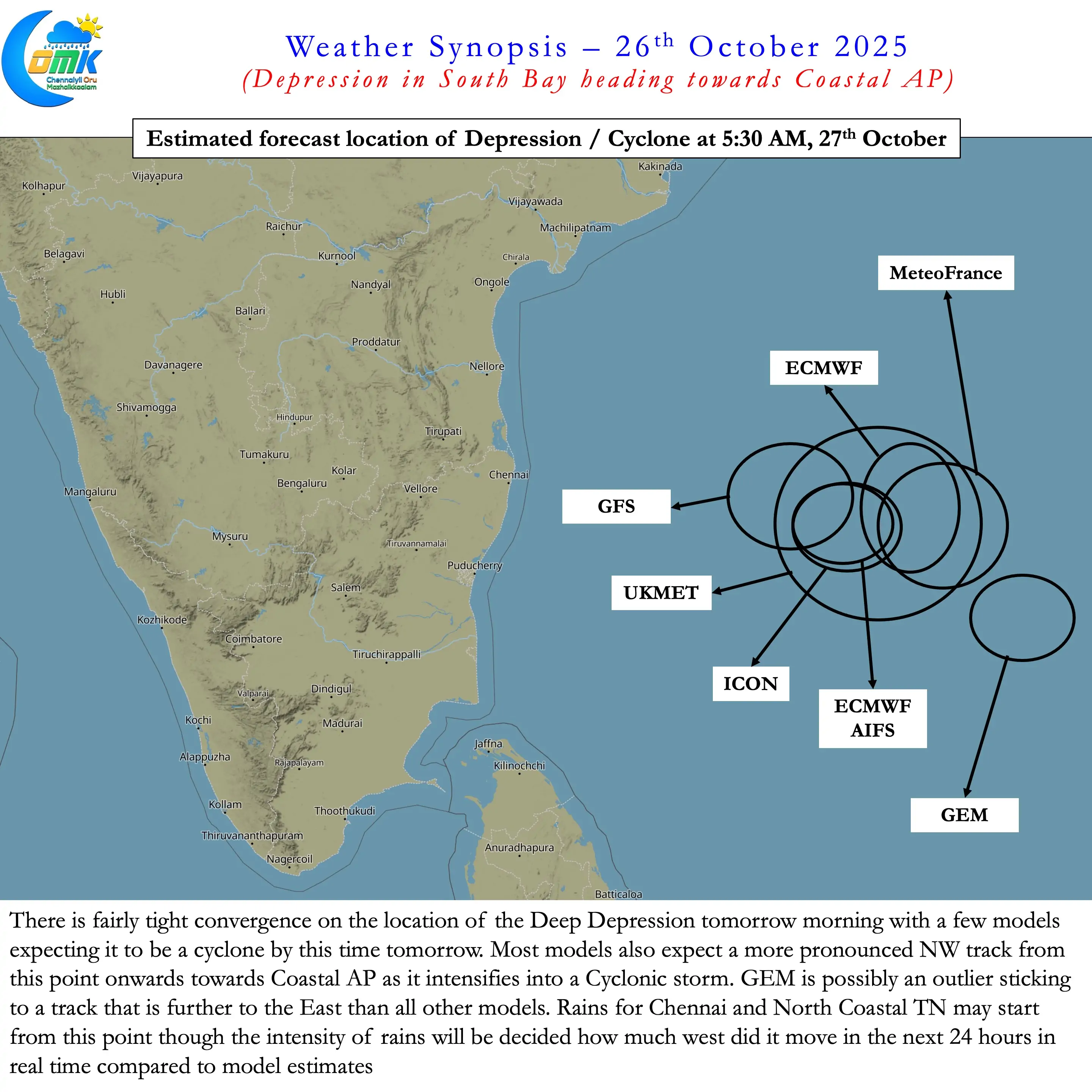
- The deep depression is expected to move in a WNW direction until tomorrow morning. During this period it may get to about 400 to 500 kms ESE ofChennai. From this point it may start moving NW after intensifying into a Cyclonic Storm.
- As things stand Coastal TN between Pulicat and Marakkanam may be the only stretch that may see rainfall impact from this disturbance
- Due to the Southward / Westward shift trend seen there is a high possibility of widespread heavy to very heavy rains for the 24 hours starting from 5:30 AM on 27th October over North Coastal TN. There is a slight chance 1 /2 places along the coastline may see extremely heavy rains.
- The intensity of rainfall over North Coastal TN will depend on how close it comes to Chennai. Additionally the more displaced the convection is to the West heavier the rains could be.
- Rains likely to start after midnight today, initially as light and picking up in intensity during the morning hours.
- The most vulnerable zone for very heavy to extremely heavy rainfall is the Coastal AP. The stretch about 100 kms either side of Kavali needs to be extremely cautious.