

A couple of days back our post was “Cyclone Gaja Twists Turns Ahead” true to spirit it is creating a screenplay that is keeping every one tenterhooks. Cyclone Gaja continues to torment and tease weather watchers, administrative functionaries, common public and news media with its YoYo pattern. After what looked perfect conditions for intensification Cyclone Gaja showed its lazy side once again, failing to consolidate for the entire day.
This phase has also now coincided with a “Stall Scenario” as well. We had anticipated a Stall Scenario on Sunday when Cyclone Gaja could get caught between the two High Pressure Zones & struggle to move. Instead yesterday while it started to move SW under the influence of the Indo Arabian Ridge the failure to intensify meant once again the Indo China Ridge came back into equation dragging Cyclone Gaja in a N/NE direction.
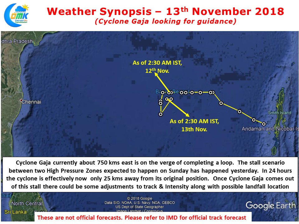
If one were to put a perspective Cyclone Gaja as of today morning 2:30 AM is effectively about 25 kms away from the position it was 24 hours back. Despite moving nearly 250 kms during this 24 hours it has almost come to the same place as where it was at the start. Looking at the last position possibly it could complete a loop by morning today.
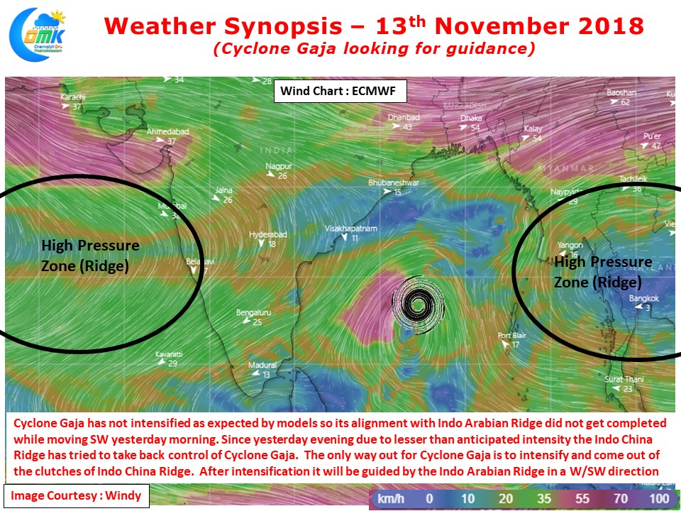
Looking at the wind charts it appears Cyclone Gaja need a bout of intensification drastically to come out of the clutches of Indo China Ridge. As long as the Indo China Ridge keeps a connect over Cyclone Gaja it will be a battle between the two ridges on which one gets the rights to steer Cyclone Gaja. With models estimating a bout of intensification we can possibly expect some movement today.
Depending on where Cyclone Gaja comes out of its loop and starts its journey afresh there could be some changes to the track, intensify & final destination. Till then we will have to only Wait & Watch Nature play the game at its terms & Pace.