

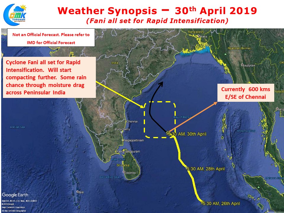
Cyclone Fani has intensified into a Severe Cyclonic storm and is currently lying near Pondicherry latitude at a distance of about 600 kms E/SE of Chennai. Over the next 24 – 48 hours it is expected to intensify further into an Extremely Severe Cyclonic Storm as it cross the latitude of Chennai. At its closest it is likely to be around 350 kms or so away from Chennai.
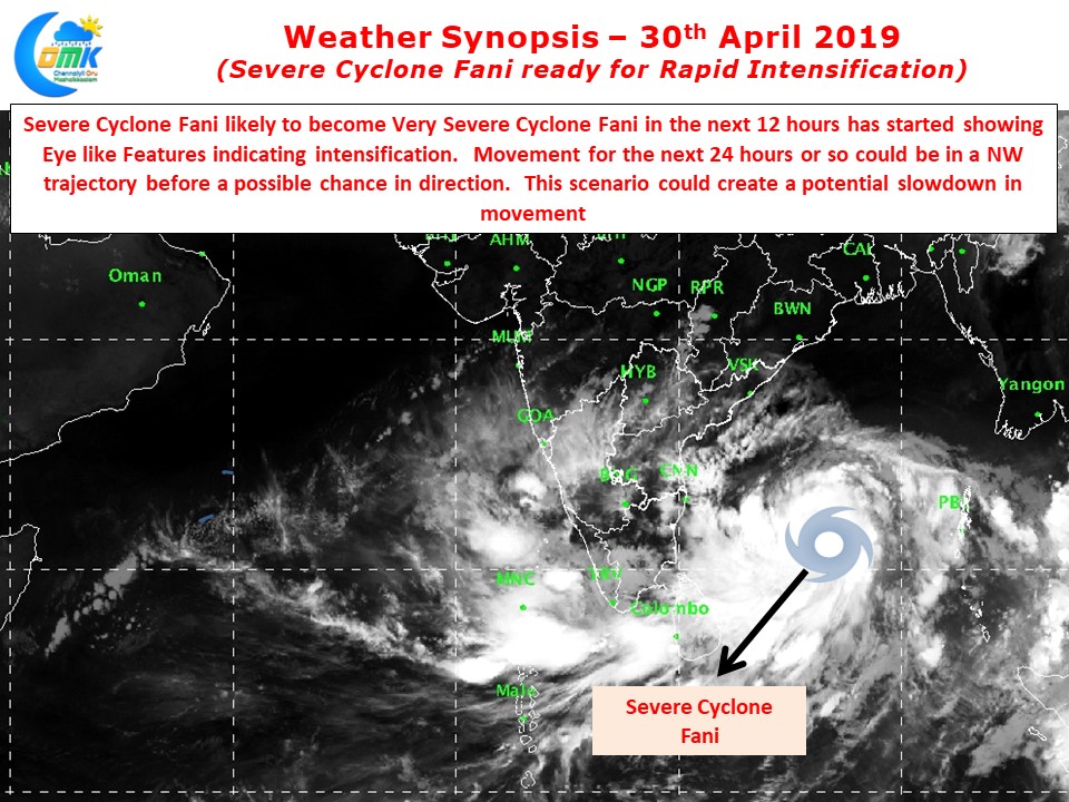
Satellite images confirm the intensification phase ahead for Severe Cyclone Fani as it has started showing Eye like features indicative of strengthening & consolidation by the system. The Wind Shear in the region remains relaxed and the ocean temperatures well above optimum for the cyclone to thrive on.
With the Cyclone now coming closer to Chennai latitude there will be increased westerly winds over North TN from today. As it passes our latitude on its journey up North for the next few days Westerly winds are likely to dominate with not much chance of Sea Breeze. This is likely to impact the temperatures as well. Most places in North TN is likely to see day time max temperatures increase by 5 / 6 degrees above normal.
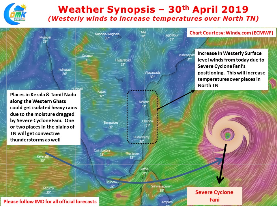
Additionally the burst of Westerly winds will also create a moisture drag across Peninsular India which is likely to trigger isolated heavy rains in one or two places of Kerala & Tamil Nadu along the Western Ghats. Further there could be convective thunderstorms due to the same moisture drag and increased temperatures in one or two places in the plains of Tamil Nadu as well.