

The three weeks of July so far has already given one active and one break phase for Southwest Monsoon 2026. The active phase coincided with the floods over Konkan starting from 2nd July till 7th July. This was immediately followed by the break phase that started on 11th July and extended till 15th July. The year so far has seen oscillating patterns and we are looking at the next phase of Oscillation. This is also going to be a critical period for Kerala and Coastal Karnataka.
On 11th June the seasonal rainfall departure for Southern Peninsular India was at 3%. Since then it has been in the negative zone every single day. Except for 4 days between 8th and 11th June the seasonal performance has been in the negative zone always. Currently it stands at -20% and things have reached a critical stage for basins like Cauvery. The Krishna basin benefitted from the active phase during late June / early July. But Cauvery has not had any such luck so far with cumulative seasonal inflow still to touch 35 TMC. Seasonal performance for Kerala & Mahe stands at -34%. Similarly seasonal performance for Coastal Karnataka stands at -31%.
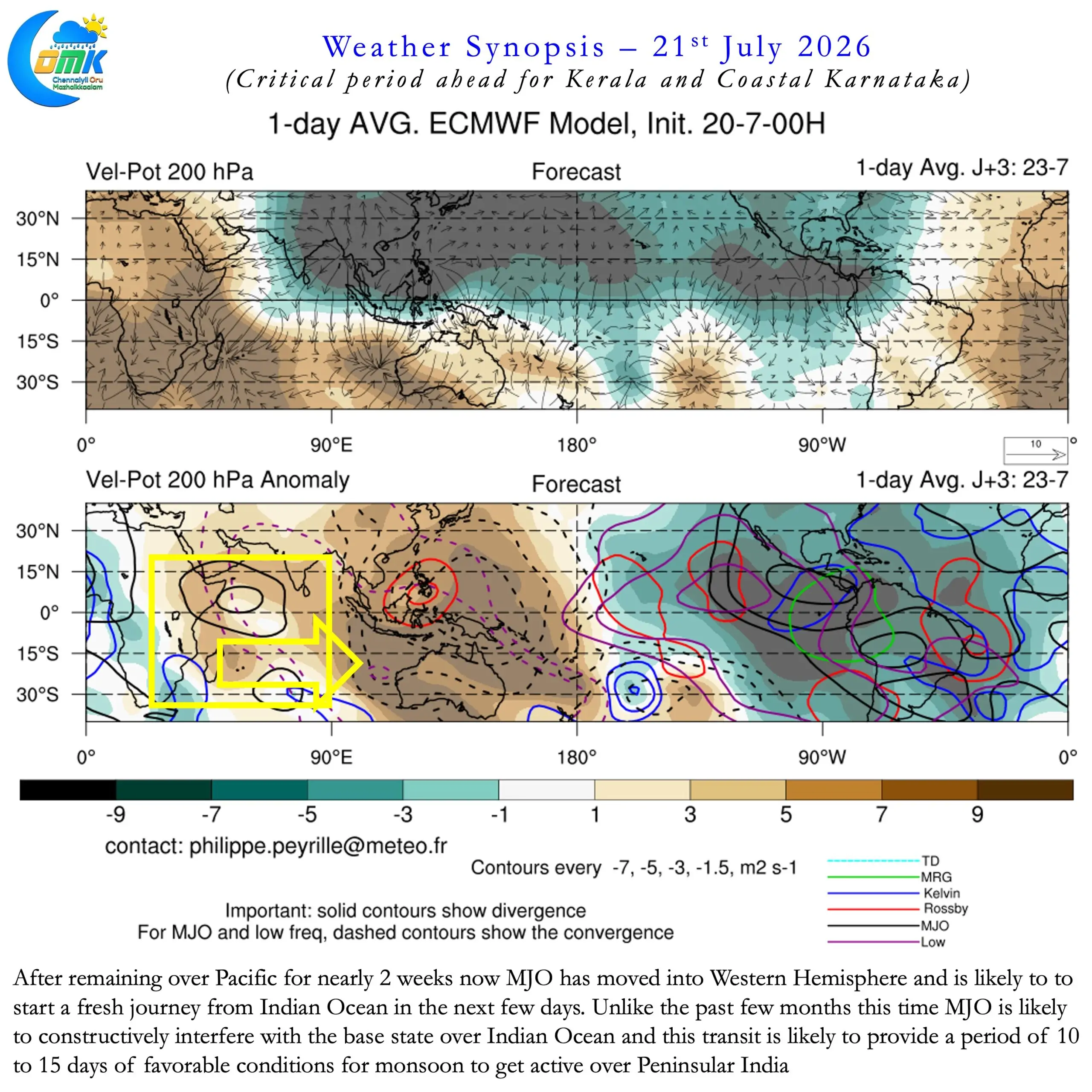
This makes the upcoming favourable through of MJO dice critical for Kerala and Coastal Karnataka. Over the past couple of months MJO has been going around the globe in about 30 – 40 days. The pattern has been fairly consistent with how MJO may behave during an El Nino year. Quick transit across Indian Ocean along with destructive base state interference while transit. A slow movement across Pacific Ocean with repeated stalls. This leads to long suppressive conditions over the Indian Sub continent resulting in poor monsoon dynamics.
After completing yet another stall over West Pacific MJO now has moved into Western Hemisphere. Over the next few days it may move into Indian Ocean for a fresh journey and global circuit. Crucially unlike the earlier movements during May and June this time it may constructively interfere with the base state . This along with a favourable Intra seasonal Oscillation is likely to benefit the southern parts of Peninsular India.
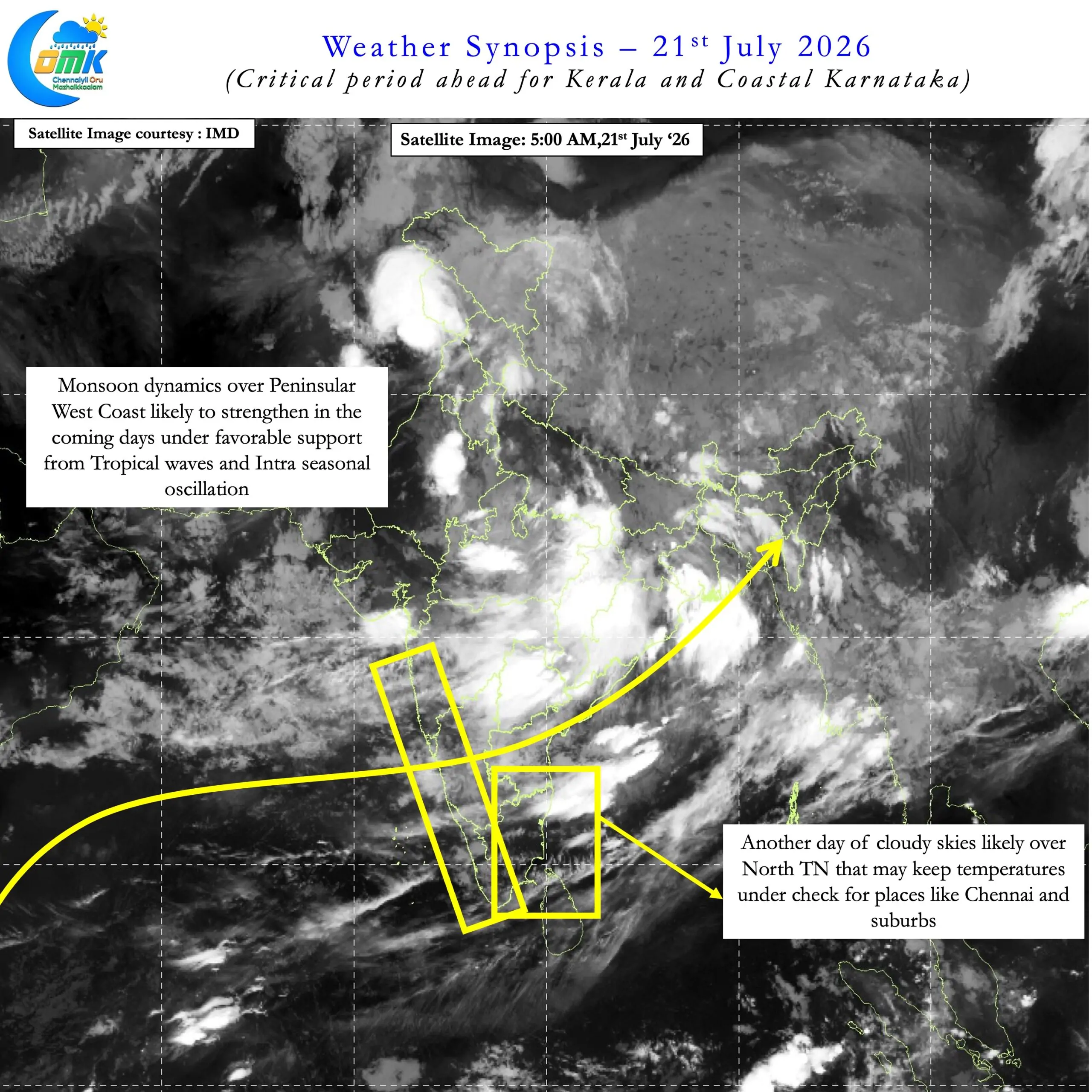
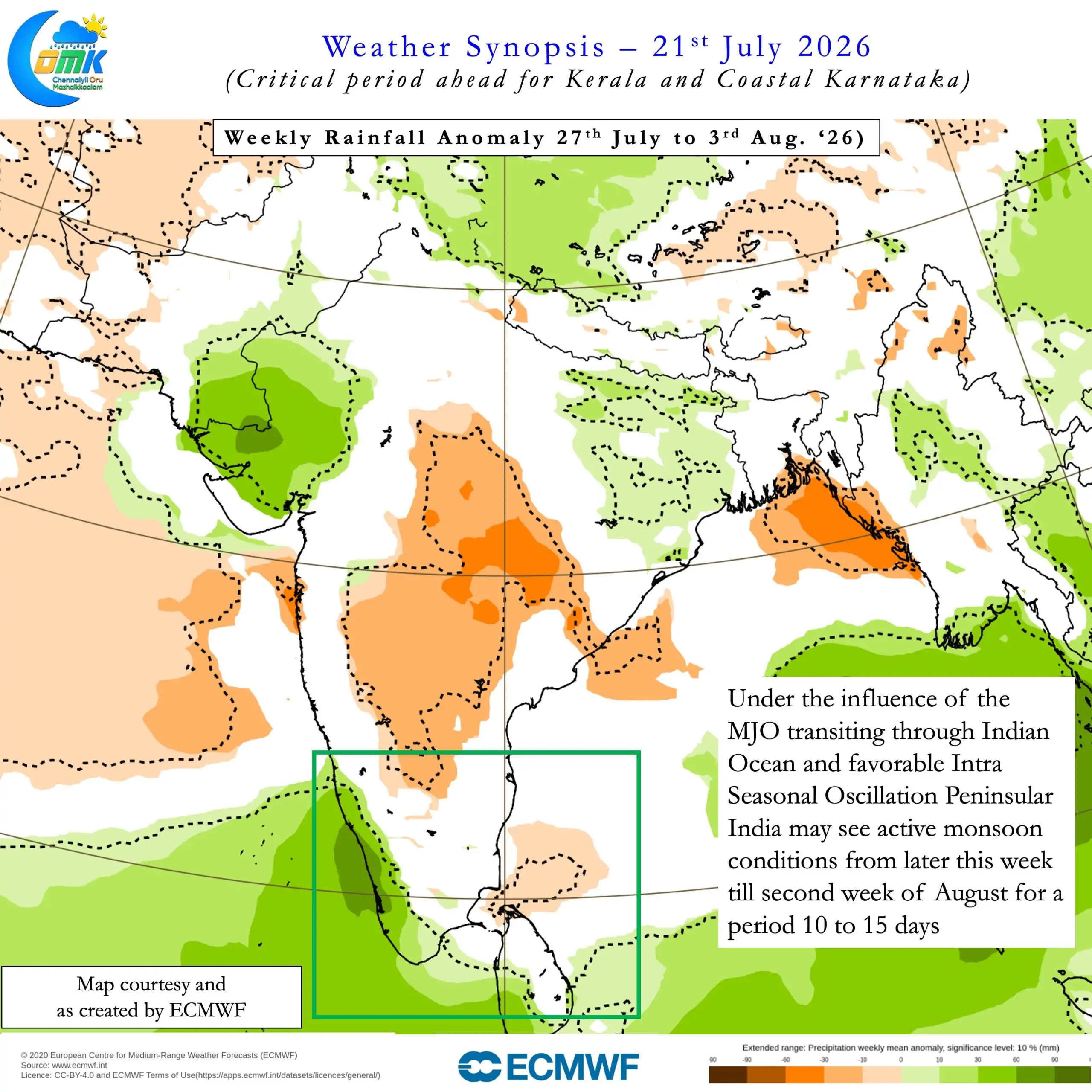
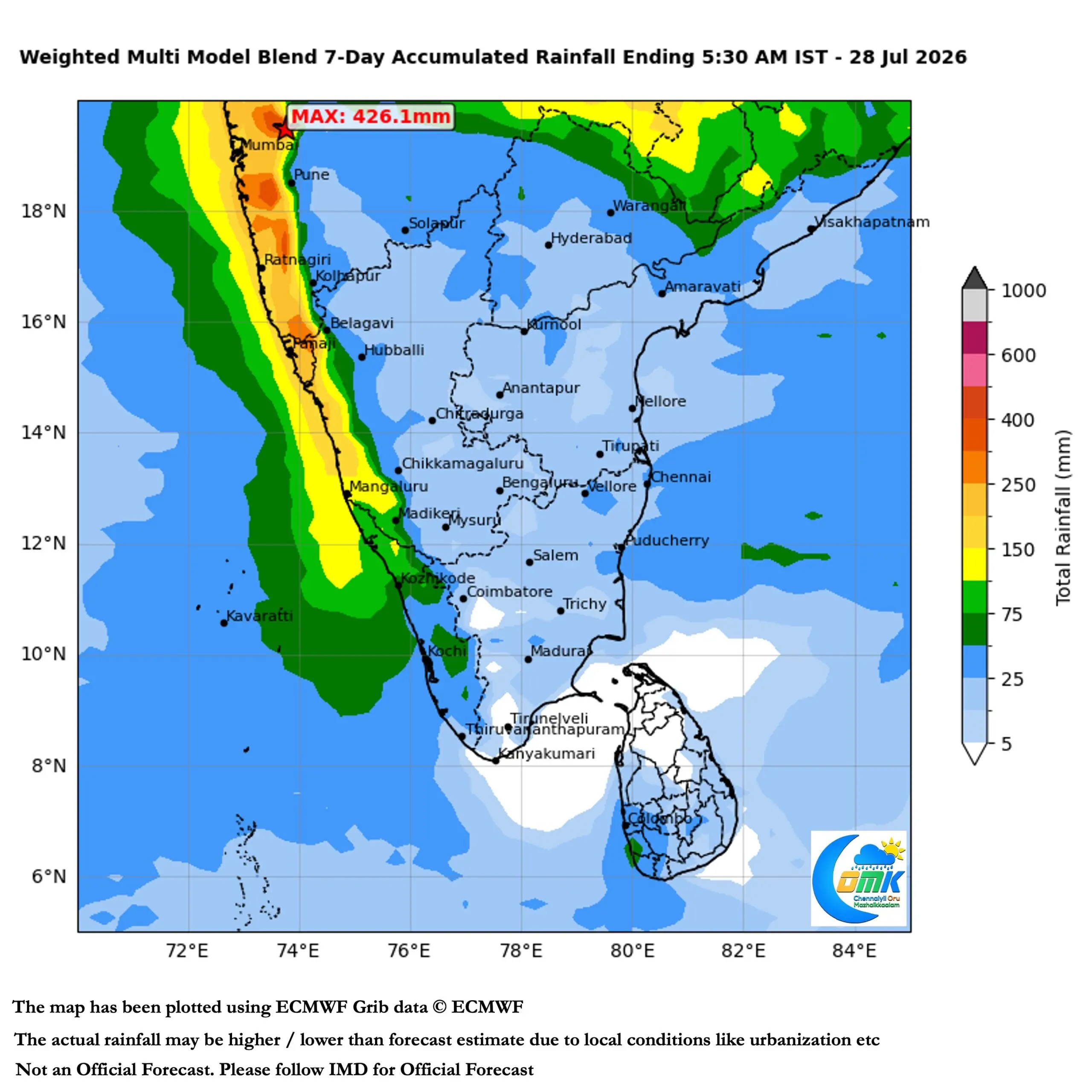
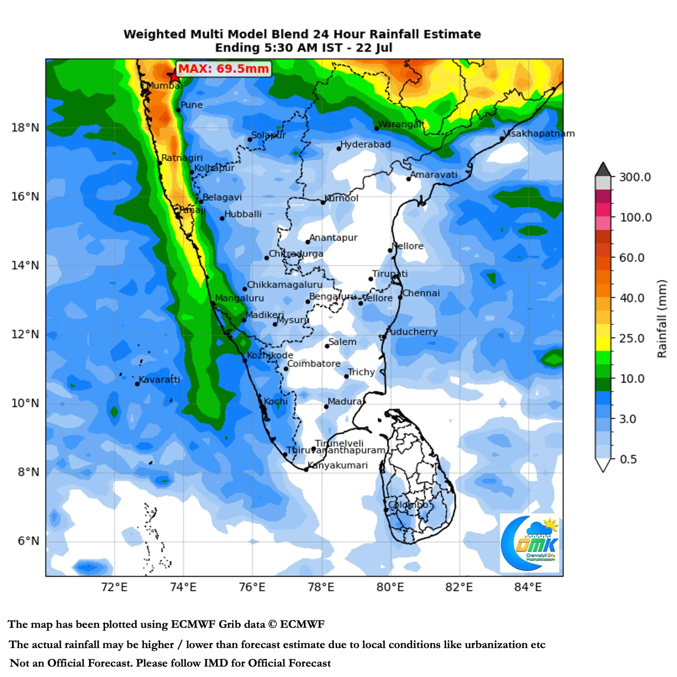
Starting from later this week for a period of 10 to 15 days we may see active monsoon conditions over Peninsular West Coast. This is going to be a critical make or break phase for both Kerala and Coastal Karnataka. Models indicate another round of active phase towards end of August. But this active phase may establish the platform better for increased inflows into basins like Cauvery when the next phase comes late August.
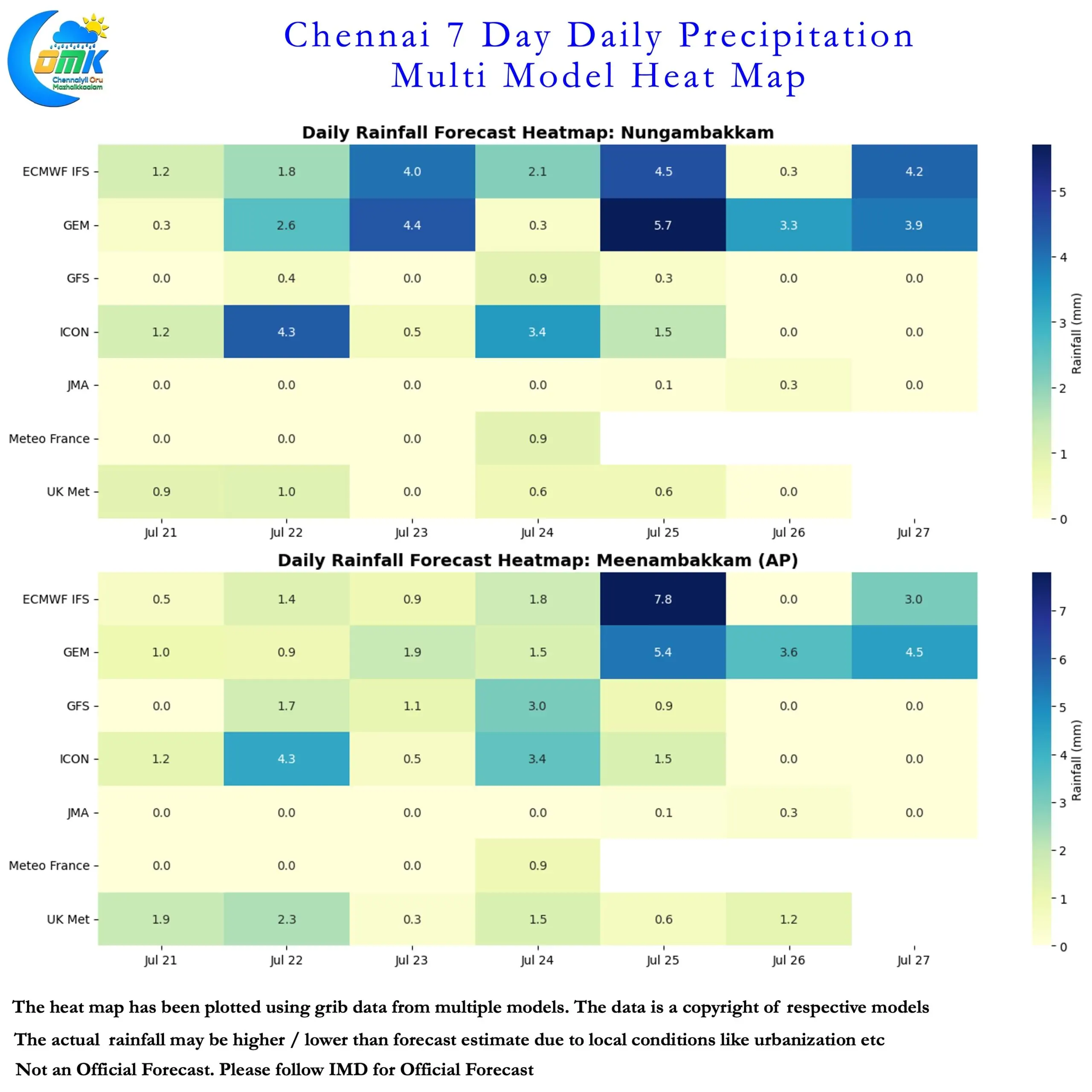
Meanwhile the plains of Tamil Nadu may continue to see scattered thunderstorm activity benefiting from increased moisture availability. Until a proper monsoon surge happens we can look forward to on and off spells of rains. Though it may not happen at the same place every day. It may also ensure the day time temperatures over North TN remains bearable. South TN though may have to wait until monsoon completely picks up for the afternoon temperatures to come down.