
About a month back in one of our earlier posts we had mentioned about how the Indian sub continent is different in many ways with its weather dynamics and its unique location allowing an interaction of tropical and mid latitude weather factors providing for weather events that are not always picked up well by weather models but fascinating to track for weather enthusiasts. While the original post was in the context of how “Unseasonal March Rains” may not be actually “Unseasonal” if one looks into larger dynamics there was a brief mention on how a potential mid latitude and tropical weather interaction could throw up a googly. But little did we expect it was not a googly but a text book Mid Level Westerly trough & lower level Easterly interaction in the classic leg break mode with the past week’s rains ending up like this ball from Shane Warne to a bamboozled Andrew Strauss.
For the past week or so hailstorms dominated not only dominated weather discussions over the Indian sub continent but also the general public as many parts of Peninsular India came under intense hailstorms under the influence of a Mid Latitude Westerly Trough that dipped abnormally south over parts of Peninsular India. Interior areas getting hailstorms is something that happens time to time but this time around even places closer to the coast also saw hailstorms. A few days back parts of Velachery in Chennai saw brief burst of hailstorm Peikulam, roughly 30 kms west of Tiruchendur, in Thoothukudi district recorded very intense hailstorms yesterday. While weather enthusiasts certainly rubbed their hands in glee tracking this once in a life time spell of thunderstorm it has not been good news for the farming community who had to bear the brunt of the hailstorms resulting in crop damage.
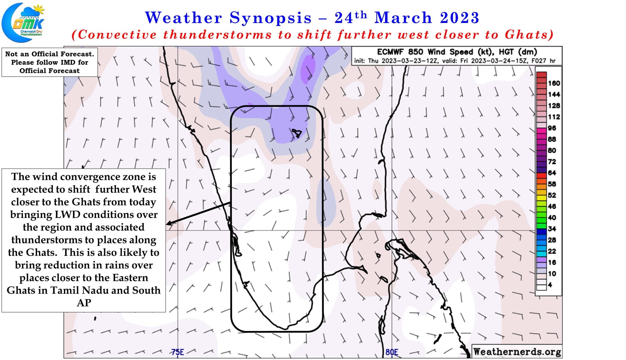
While the farming community may not exactly have been happy about the hailstorms in states like AP & TS, Odisha and Tamil Nadu the more normal convective thunderstorms in the form of mango showers / coffee showers are a much looked for spell of rains for the farmers closer to the Ghats. Thunderstorms triggered by Line of Wind Discontinuity (LWD) checked in over Peninsular India during the second week of March but had to take the back seat once the Westerly trough arrived. With the Indian sub continent now under the influence of a much milder follow up Western Disturbance and the abnormally dipping Westerly Trough well and truly over it is time to look forward to the regular convective thunderstorms to return over places closer to the Western Ghats.
Starting from today gradually the active zone of wind convergence / instability will move further west closer to the Ghats reviving the convective rains over the region. Consequently places closer to the Eastern Ghats which were the hotspot for the past week or so will take a backseat bringing some much needed respite from rains to the places closer to the coast in Tamil Nadu and South AP. Today weather models indicate isolated places around Tiruchirapalli, Karur & Namakkal dts in Central West TN to come under fairly intense thunderstorms and associated lightning strikes during late evening hours. Along the Western Ghats the high range districts of Kerala and adjoining areas of Tamil Nadu may see heavy spell of rains during the afternoon hours at a few places.
Chennai and suburbs along with adjoining areas of North Coastal TN may see a reduction in thunderstorms though isolated places may get a sudden burst of rains which will not sustain for long period of time due to strengthening steering winds.