
The long period average for TN & PDC during the Winter Season (Jan. & Feb.) is 24.7 mm. This is the season with lowest rains for Tamil Nadu and Pondicherry. Summer (March to May) provides for 124.9 mm while SWM provides for 328.5 mm. Northeast Monsoon primary rainfall season for Coastal TN contributes 442.8 mm. At times we may see monsoon dynamics persist into January bringing heavy rains. This is more prevalent during La Nina years when moist Easterlies interact with Westerly troughs to bring heavy rains.
The rains on 1st and 2nd of the month has already brought in more rains the seasonal average in the districts of Nilgiris, Tirunelveli and Tenkasi. Now we are all set for the 2nd rainfall event of 2026 which could be more widespread. The well marked low currently over the Equatorial waters and adjoining South Bay is likely to become a depression today. It is likely to continue its WNW movement over the next 48 hours to reach close to the East Coast of Sri Lanka.
At this point we may start seeing widespread rains over Coastal TN between Delta and Chennai. This may not be good news for parts of Delta and North TN that is getting ready for harvest of paddy crops. Weather models are in tight sync about the circulation coming East of Sri Lanka. At this point some expect it to move inland into Sri Lanka while some expect it to move along the East coast of Sri Lanka in a NW direction.
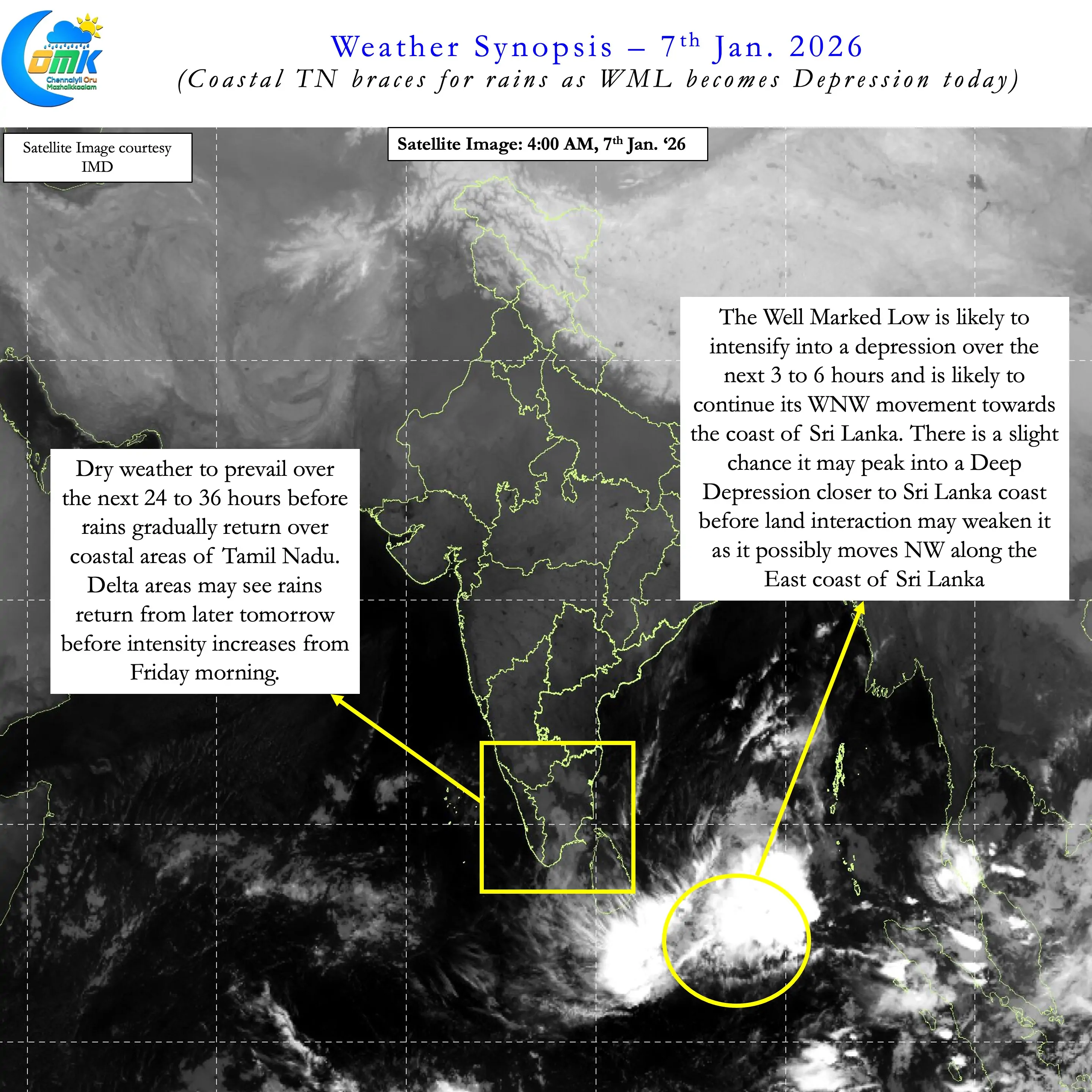
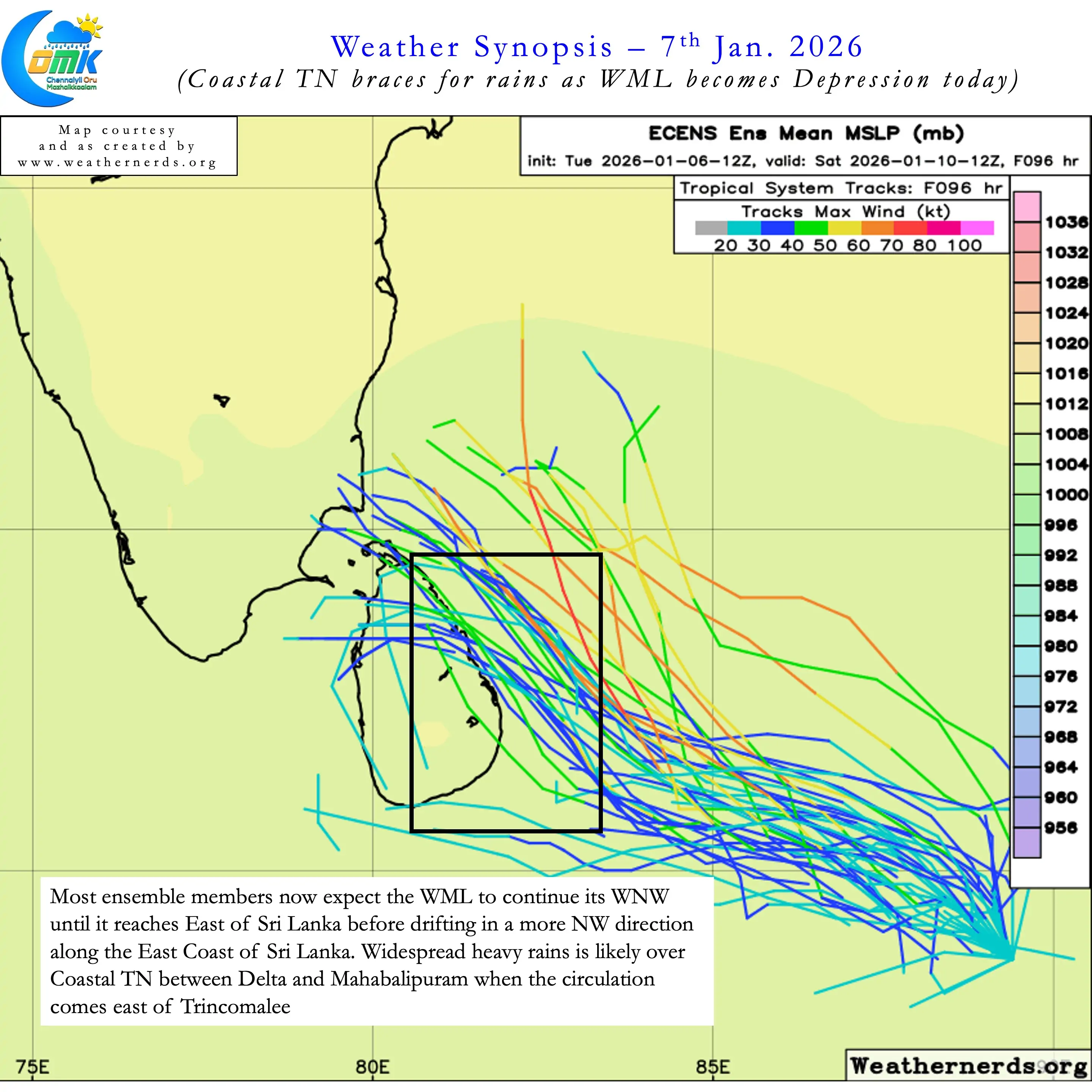
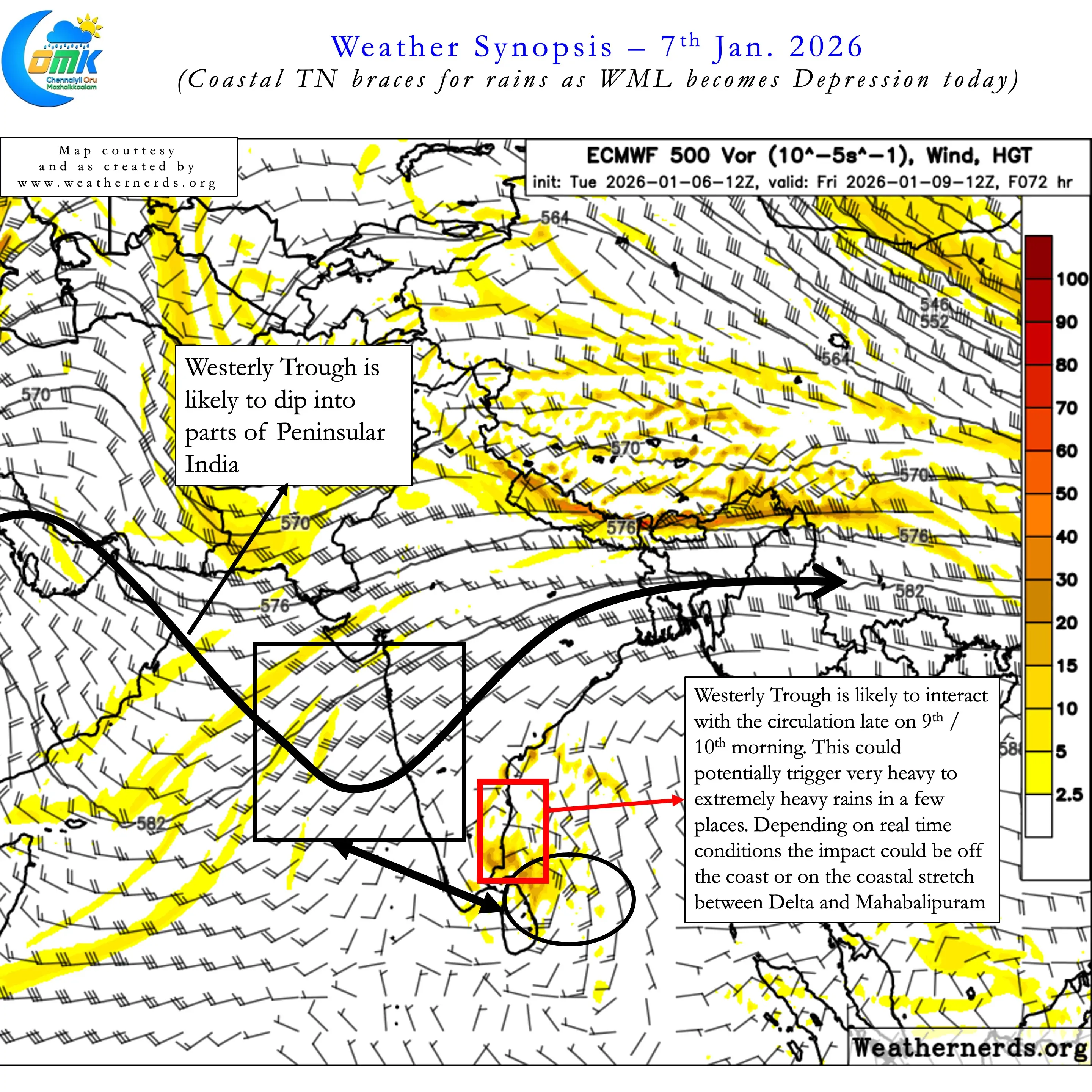
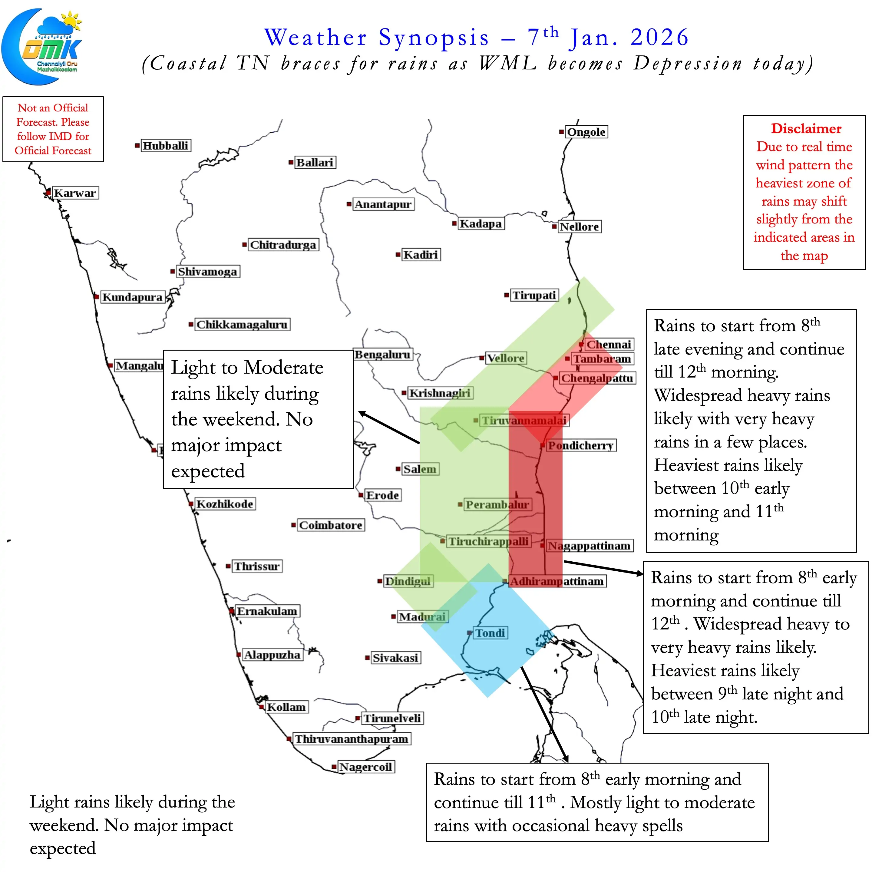
Looking at ensembles of ECMWF and AI models there is a higher chance for movement along Sri Lanka coast. This could not only bring more rains to Coastal TN but also open an interaction with the incoming westerly trough. As we saw during the New Year day rains around Chennai this interaction could throw models off guard. They may enhance the rainfall potential dramatically. It also comes with a high degree of uncertainty on the impact zone as well. Real time interaction may not exactly happen at locations where models estimate.
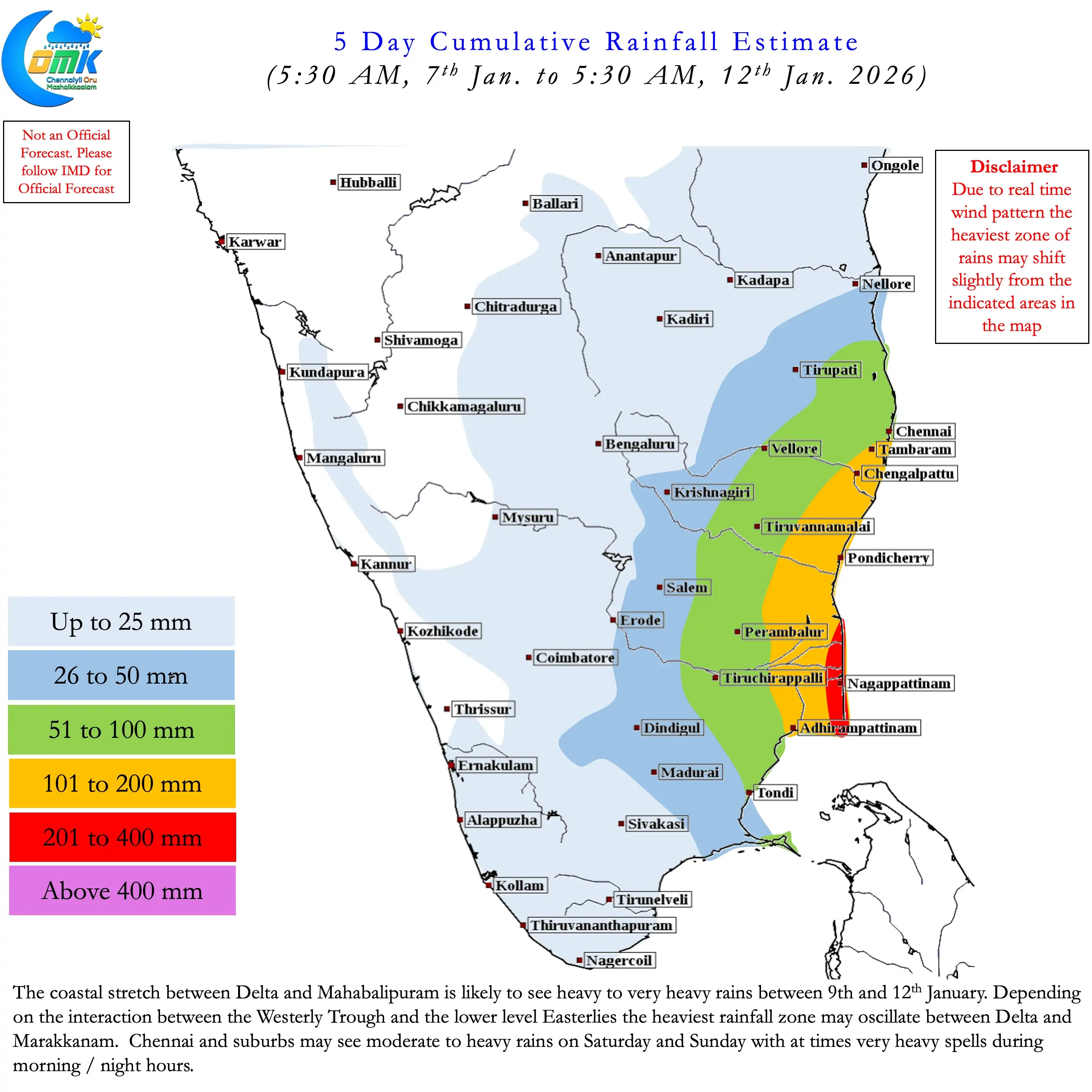
It is certainly not exaggeration to say Coastal TN between Delta and Mahabalipuram is vulnerable for very heavy rains. 1 / 2 places in this stretch may come under very heavy to extremely heavy rains during the 24 to 36 hour period on 9th and 10th Jan. At this point the circulation may be East of Trincomalee while the Westerly trough starts its dip over Peninsular India. These interactions are difficult to judge and may have to be monitored in real time.
Nevertheless Coastal TN between Ramanathapuram and Tiruvallur districts need to brace for rains over the weekend. Widespread heavy to very heavy rains likely between Delta and Mahabalipuram. There is a chance 50 kms either side of Pondicherry may see the heaviest rainfall impact due to interaction of the trough and circulation. Chennai and suburbs may see widespread heavy rains with few places also getting very heavy rains.