
On Behalf of COMK we wish A Happy & Prosperous New Year to the Family & Friends of the Chennai Weather Blogging Community. May 2022 bring more complex weather events to enhance & enrich our weather learning & understanding of tropical weather events.
After the deluge on Thursday Chennai saw a relatively better day of rains though it was still substantial enough to put normal life off guard due to the lingering effects of the localized flooding from the effects of the previous day’s extreme spell of rains that dumped more than 20 cms of rains in many places like Avadi, Ambattur, Nugambakkam & Marina. If one were to carefully observe the spells yesterday were off shorter duration compared to Friday though the number of spells indicative of the rains being more monsoonish in nature with lesser Thunder & lightning.
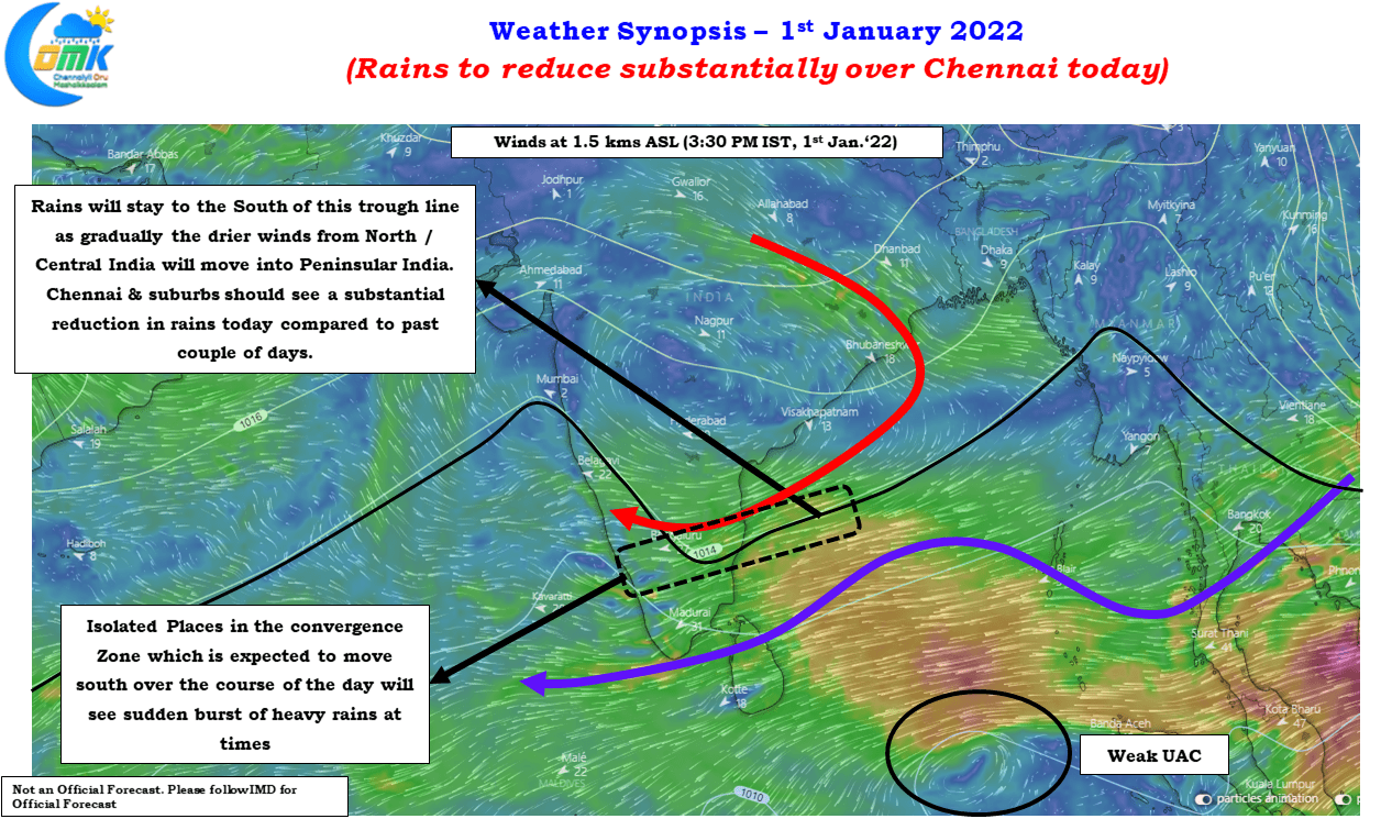
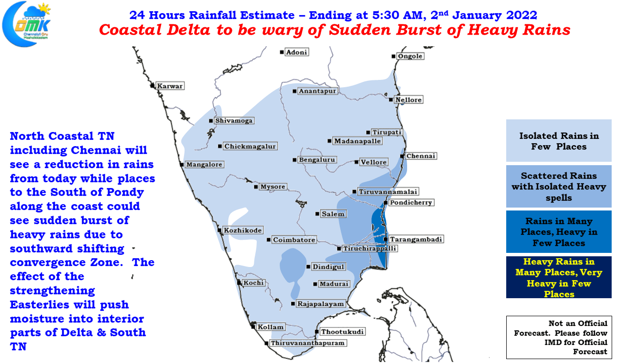
Weather charts indicate North Coastal Tamil Nadu including Chennai & Suburbs are likely to see a substantial reduciton in rains from today as the drier winds from Central & North India start pushing into Peninsular India due to the effect of the High Pressuze zone at lower atmospheric levels get established once again over the Indian Sub Continent. This could mean the wind convergence zone will slowly shift south as the trough line shifts south during the course of today.
As the convergence zone shifts south the Zone with probability of sudden burst of heavy rains will also shift down with the south of Pondy possibly seeing the heavy burst of rains today which happened in Chennai on Friday, South of Chennai on Saturday. Delta dts should be wary of this sudden burst of rains considering the crops are getting closer to harvest.
Chennai & Suburbs will see a relatively quieter day on the rain front with drier conditions gradually getting established from later tonight.