
The last couple of days have seen cloudy conditions dominate the weather scape over Tamil Nadu with temperatures trending well below normal. For second straight day no place in Tamil Nadu touched the 40°C mark with Palayamkottai the hottest at 39.5°C. Both Chennai observatories recorded below normal temperatures yesterday as well though it was slightly hotter than Wednesday.

On the Southwest Monsoon front, parts of South Konkan has seen Southwest Monsoon arrive for this year with Goa now under the Monsoon Map. There is no second thoughts monsoon progress has been slow so far after the initial burst. But things are looking up for the coming days with possibly Mumbai getting its typical “Pre Monsoon Onset” thunderstorms yesterday indicating Monsoon Onset for the Megapolis is a day or two away.
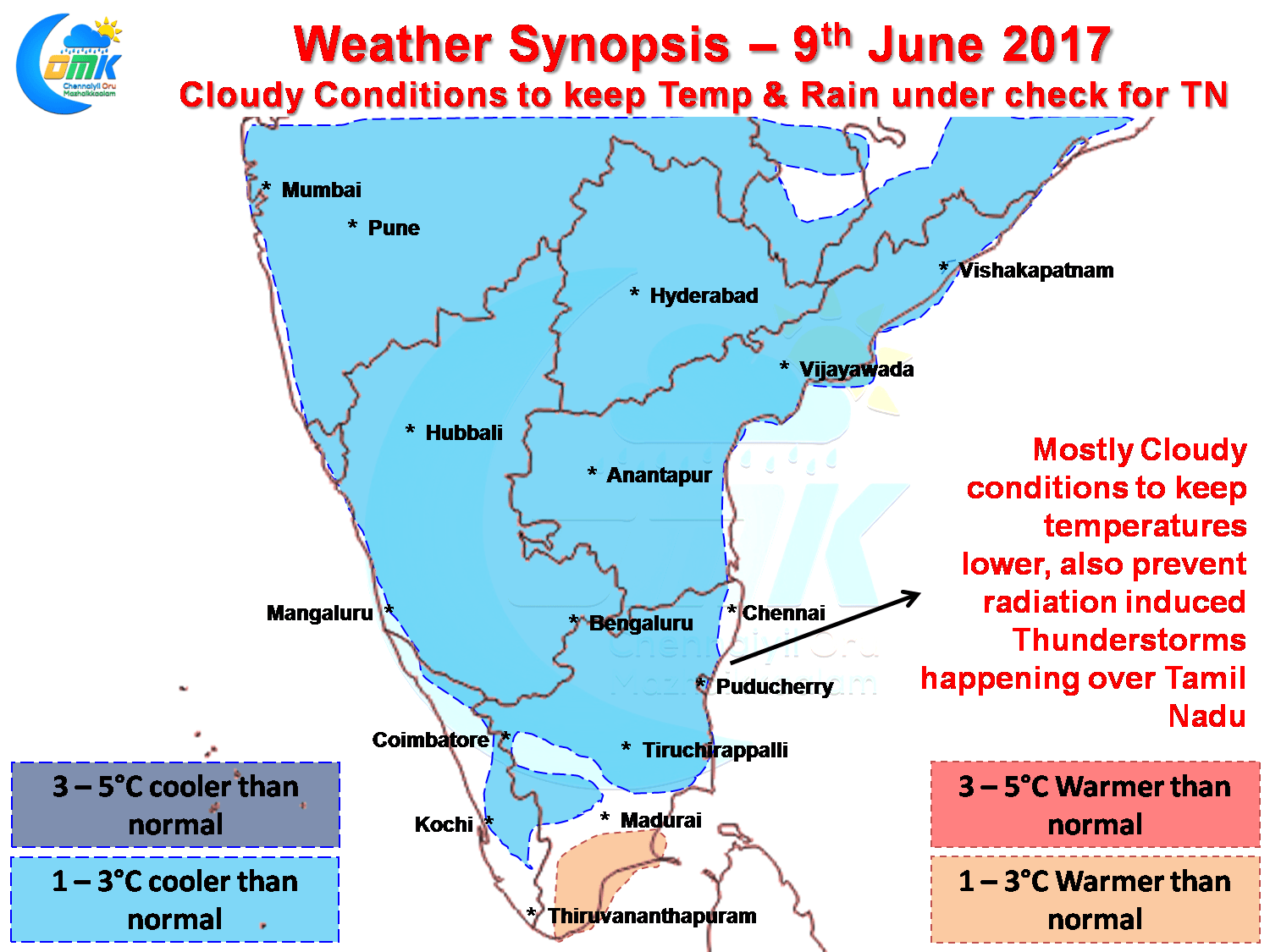
Closer home things are going to be easy on the temperature front as cloudy conditions likely to dominate weather today as well over large parts of Tamil Nadu with models indicating below normal day time temperatures for most parts of South India. With cloudy skies the chances for radiation induced thunderstorms reduces unless supported by synoptic conditions. Currently the UAC in Bay is too far away to provide us any support on this front making it a day of murky weather for most of the state with possibly only some isolated drizzles.

Things on the rain front is looking up for West Coast with possibly the stretch between South Konkan and North Kerala in line for some heavy rains in a few places. Central & North Coastal AP along with adjoining parts of Odisha could see some moderate to heavy rains in a few places under the influence of the UAC. As mentioned above mostly dry weather likely to prevail over Tamil Nadu with possibly some isolated Saaral Mazhai in North Tamil Nadu.
Powered by WPeMatico