
“Our ability to reach unity in diversity will be the beauty and the test of our civilisation.”
Mahatma Gandhi
The diversity of the Indian Subcontinent always fascinates those who make the efforts to observe and understand not just culturally but also geographically and weather wise as well. One of the highest mountain ranges of the world is possibly separated by just a few hundred kms from Thar Desert. Even more stunning is Kuthiraimozhi theri is just about 100 kms away from the West coast of India and possibly receives 1/4th of the annual rainfall received by places about 100 kms to its west.
A lot of talk happens about Indian Summer Monsoon, convective rains during summer are possibly never discussed or researched as much as they should be done. Among the agricultural community though summer rains are always looked for considering how critical they are in maintaining soil moisture over many parts of the country before the arrival of Monsoon a couple of months down the line. Similarly for a good harvest of many commercial crops like Coffee, Mango etc owe a lot to good summer rains.
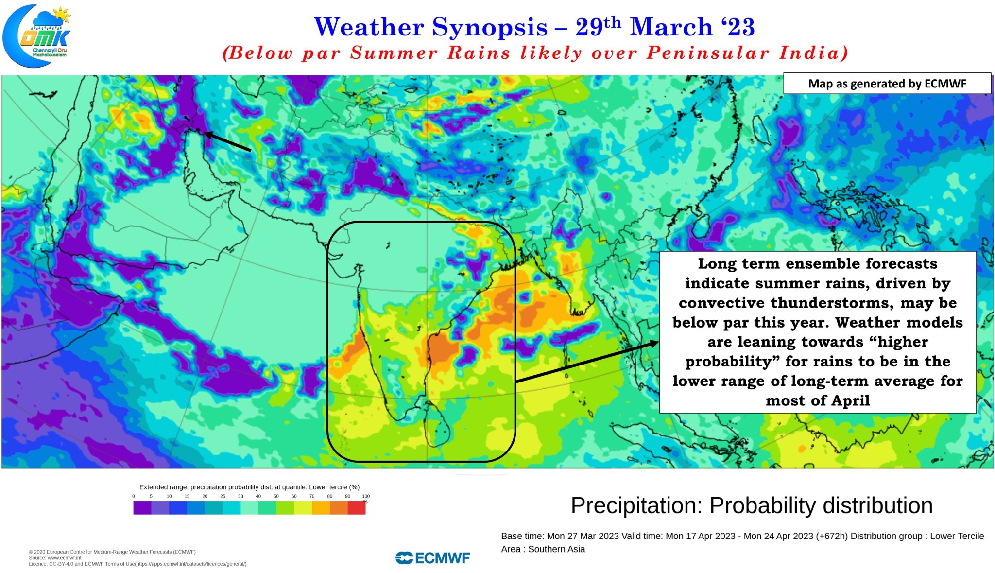
In this context it becomes essential to provide some update on convective thunderstorms during pre monsoon months to give a head start to the farming community that plan a lot of activities around the Mango Showers / Coffee Showers season. It may be difficult to provide a full scale forecast for Summer Rains due to the dynamic nature of thunderstorms and weather models struggling to pick Tropical / Mid Latitude interactions but it is certainly possible to give a medium term inference that could give a fair idea on what to expect for the next couple of weeks.
Ensembles are indicating the next 2 / 3 weeks may see subdued thunderstorm activity along the Western Ghats & West Coast with outputs giving higher probability for the cumulative rains for the next couple of weeks staying closer to the lower range of long term average for the month of April. In a way the favorable passage of MJO enhanced thunderstorms during the last week Tropical / Mid Latitude interaction. Just as the leading end of the MJO waves enhances the precipitation the trailing end of the MJO wave will lead to suppressed conditions. With MJO expected to move further East and possibly weaken as well we could see the suppressed phase of the trailing end of MJO influence atmospheric conditions over Peninsular India for the next 2 / 3 weeks resulting in sub par summer rains for the areas looking forward to Mango Showers / Coffee Showers.