
It has been only a week or so since Northeast Monsoon made onset. But already for many it may appear to have been so long ago. With almost every district in TN & PDC showing positive anomaly so far it is not a surprise. During this 8 odd days we have already seen disturbances on either side of Peninsular India. Now Bay of Bengal is all set to host the next Low Pressure Area. Over the next few days we may once again see disturbances on either side of Peninsular India. Early next week there could be a depression and cyclone either side of Peninsular India.
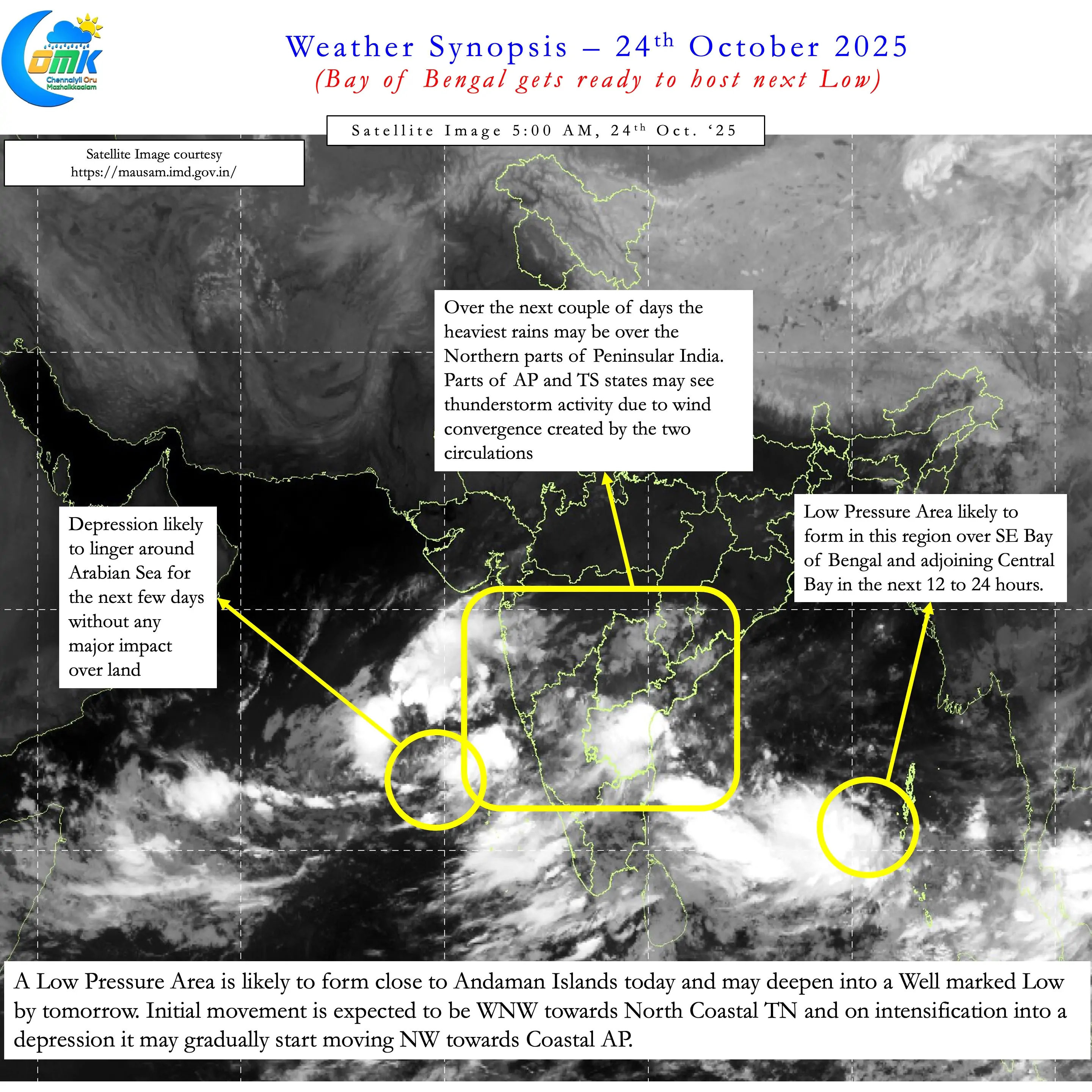
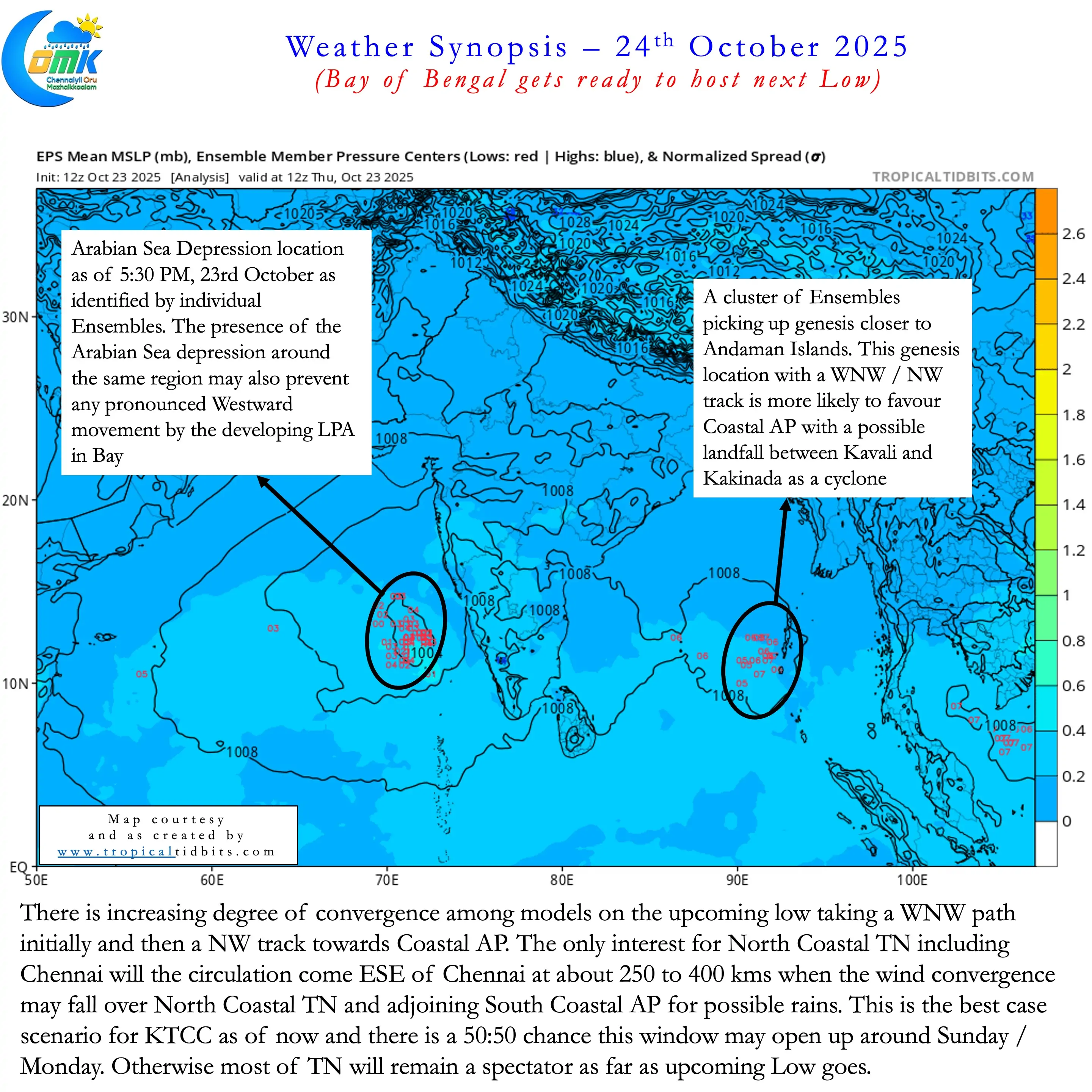
In the next 12 to 24 hours we are likely to see Bay of Bengal throw up an LPA near Andaman Islands. The depression over Arabian Sea is likely to persist for the next few days. There is increasing convergence among models by early next week the Bay Low may become a cyclone. So around Tuesday we may have a scenario of Depression over Central Arabian Sea and a Cyclone over Central Bay of Bengal.
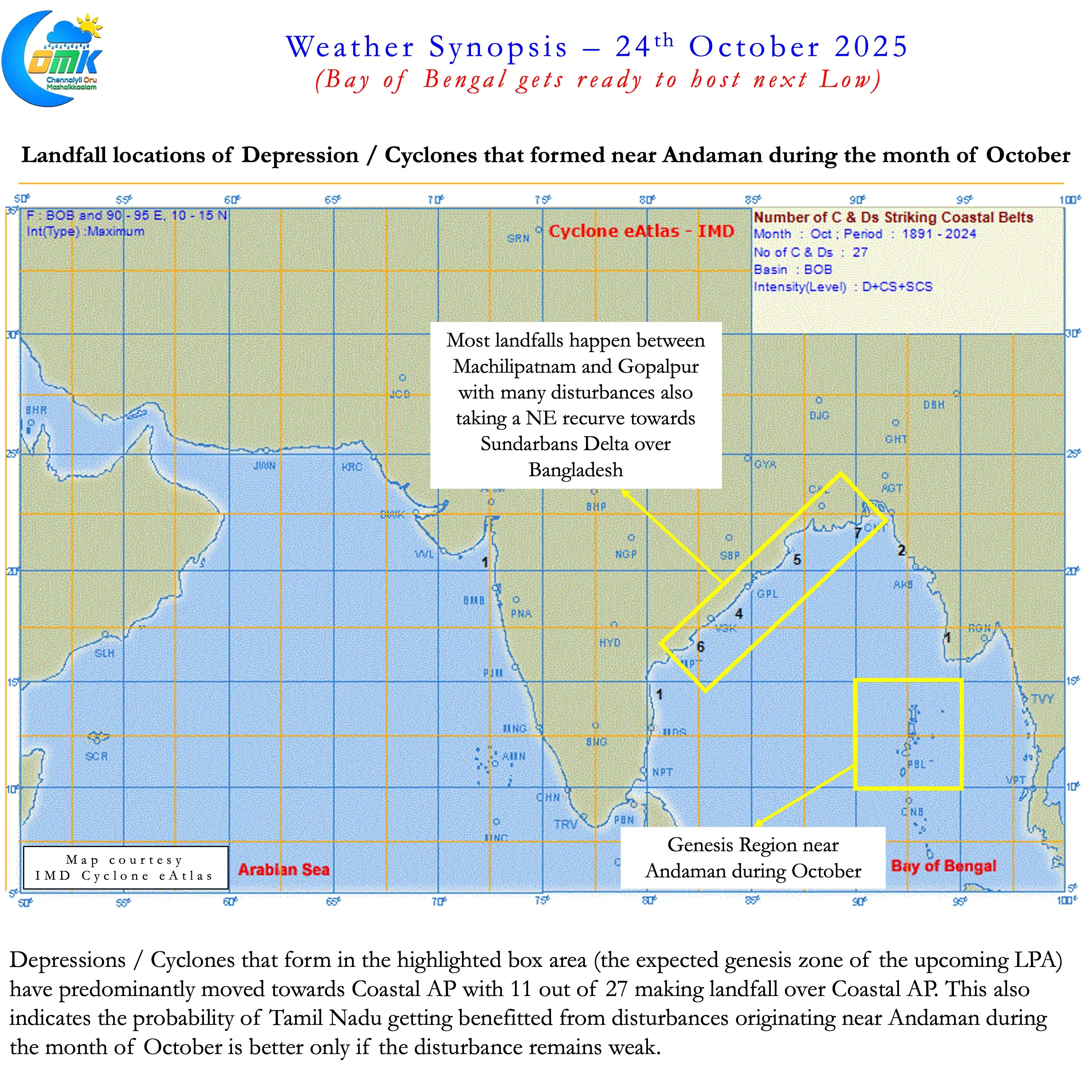
So what to expect from this upcoming Low. In short the genesis region historically does not favour Tamil Nadu during the month of October. Most of the Depressions / Cyclones that form close to Andaman head towards Coastal AP at this time of the year. Taking this into account and based on the trend shown by both deterministic and ensemble weather models the key takeaways are given below.
- LPA likely to form over SE Bay and adjoining Central Bay in the next 12 to 24 hours.
- Likely to intensify into a Well Marked Low by late tomorrow.
- The initial movement is likely to be WNW and then NW as it deepens into a Depression / Deep Depression.
- Historically Depressions / Cyclones do not favour Tamil Nadu. Disturbances originating closer to Andaman during the month of October have a higher probability to make landfall over Coastal AP
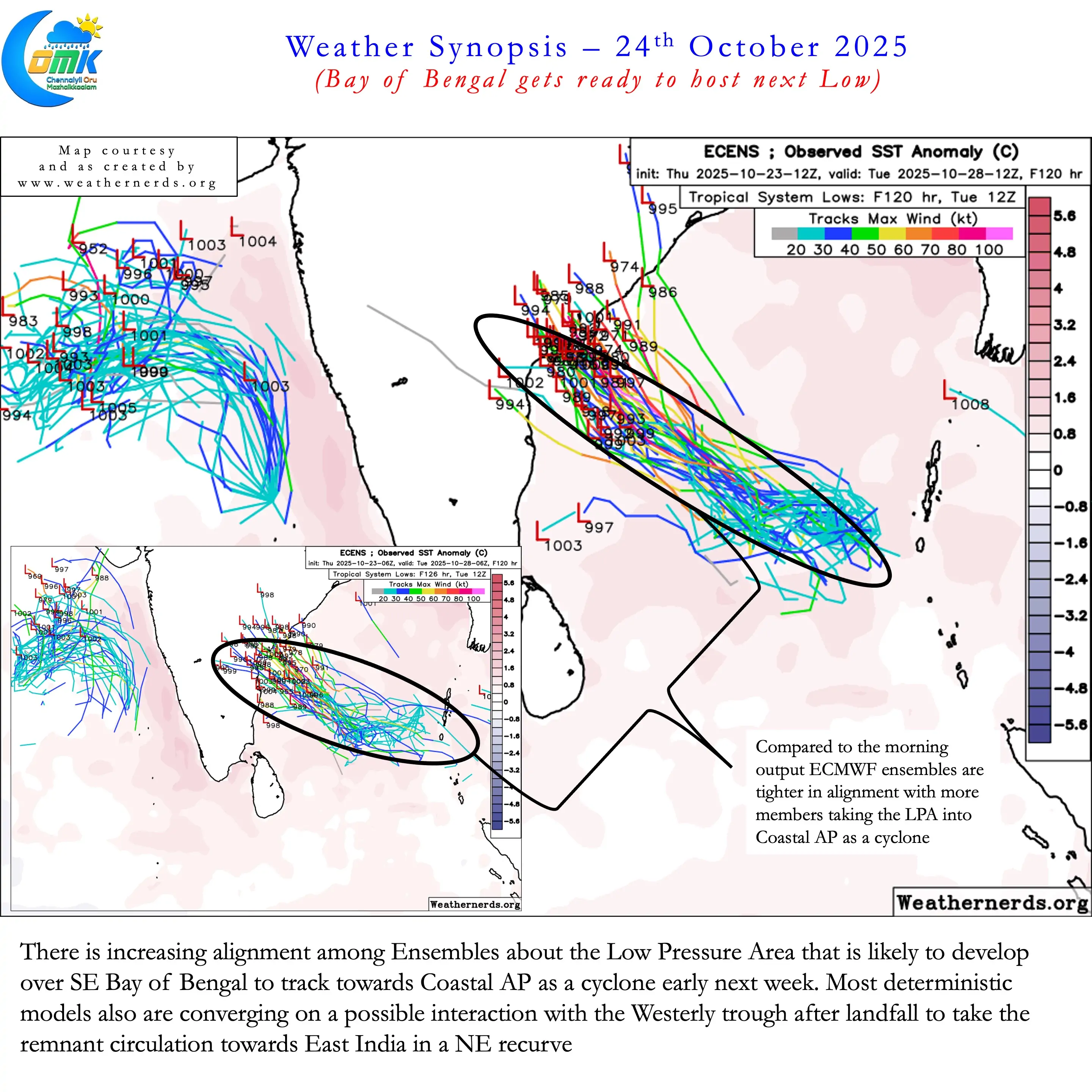
- There is increasing consensus among models it could make landfall as a cyclone next week. The landfall is likely to be over Coastal AP between Kavali and Kakinada
- Most models also converge on a possible interaction with the westerly trough after landfall. This would mean the remnant circulation is likely to move towards East India in a NE recurve
- North Coastal TN including Chennai and suburbs potentially has one window of rains on Sunday / Monday. This will depend on whether the circulation comes ESE of Chennai in its initial WNW movement.
- There is a 50:50 chance this window could bring heavy rains in case the convection gets displaced to the West. This scenario could be identified only through real time tracking.
- South Coastal AP may come under very heavy to extremely heavy rains early next week.
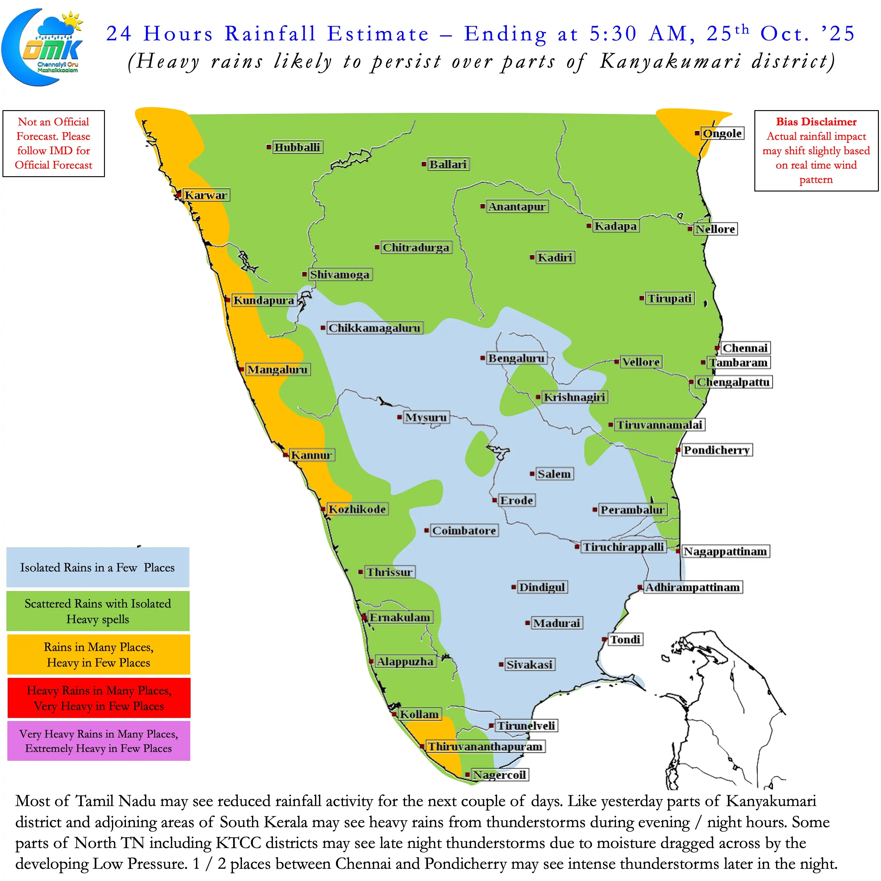
On the rains front for the next couple of days we may see subdued rainfall activity over Tamil Nadu. Parts of Kanyakumari and adjoining South Kerala may see heavy rains today as well like yesterday. North TN may see late night thunderstorms today in a few places due to the moisture dragged by the circulation. Slight chance for 1 / 2 places between Chennai and Pondy to see intense thunderstorms during the night due to convergence.