
Often one remarks weather is volatile and there is a lot of uncertainties involved, but occasionally certain events are picked up well by weather models & show the trend consistently well in advance for sufficient precautions to be taken. The rain spell this week could possibly go into the books as one of those events which was warned well in advance by weather models. While there could have been some variances in the impact magnitude & impact areas almost all the models were consistent on the event with damaging impact particularly over the coastal areas of Tamil Nadu.
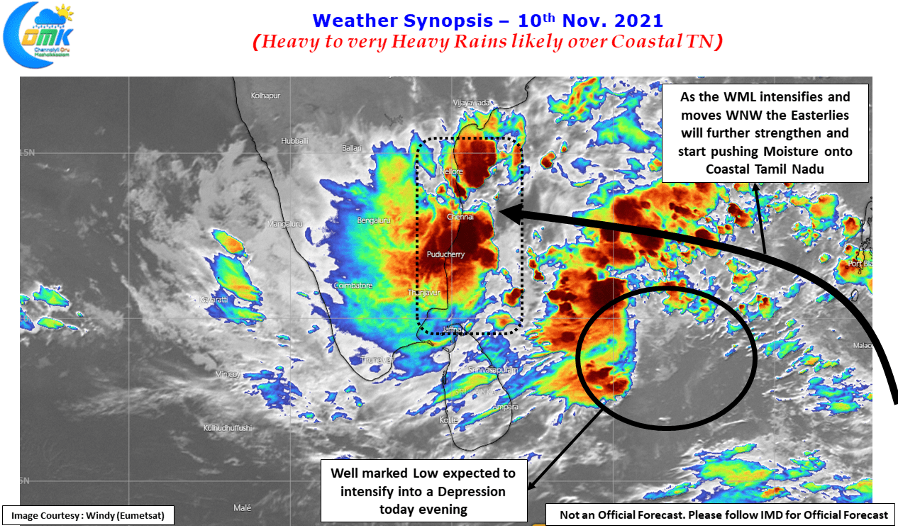
If the extreme rainfall episode on Sunday over parts of Chennai & Suburbs could be considered as the trailer the first warning shot was fired yesterday with another extreme rainfall episode over parts of Delta. IMD observatories at Nagappattinam & Karaikal recorded 20 cms in a span of 6 hours while the 24 hours rainfall in many places along the coast is nearly 30 cms. Satellite image does indicate the convection gradually pushing up under the influence of the Well Marked Low that is now expected to become a depression later today evening.
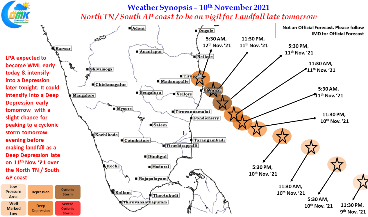
It becomes pertinent to understand what could be the life cycle of this well marked low currently located to the East of Sri Lanka over the South Bay waters because the rainfall intensity, time frame & Impact locations are all connected to the path, intensity & landfall of this disturbance. In this context we have tried to give what is expected of this disturbance over the next 36 to 48 hours or so based on our understanding of the current situation & overall factors that is likely to be in play along with inputs from weather models. Please follow IMD for official forecast on track & other alerts.
With IMD announcing the disturbance to have intensified into a Well Marked Low today morning, it is likely to strengthen into a depression by later today evening and possible a Deep Depression by tomorrow morning with favorable ocean conditions providing support for the intensification. There is a slight chance this could become a named cyclone as well as it comes closer to the North TN coast. Possibly as it nears the coast for landfall it may be prevented further intensification & is likely to cross North TN / South AP coast as a deep depression with the likely landfall zone being 50 kms either side of Chennai depending on the intensity.
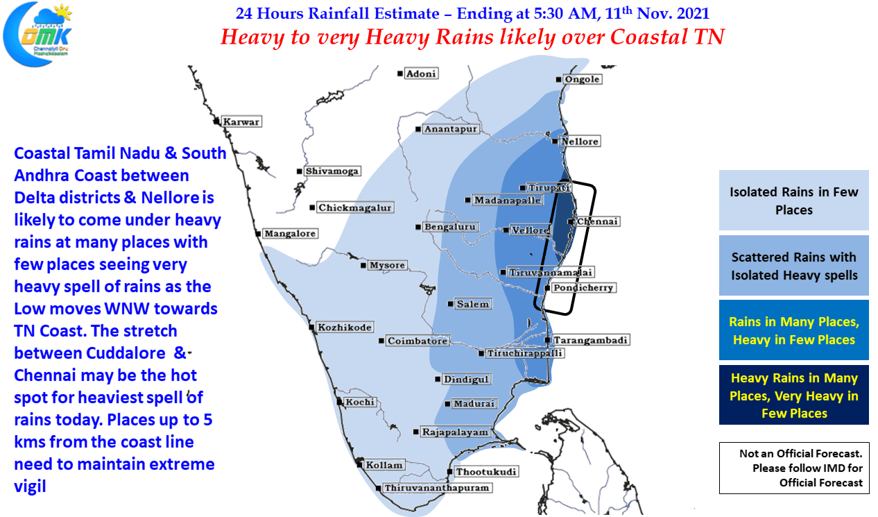
With the disturbance coming in from SW we are likely to see heavy rains over the coastal stretch between Delta Districts & Nellore until wee hours of Friday. The peak impact zone will gradually shift North, today we could possibly see the stretch between Cuddalore & Chennai as the hotspot for heaviest spell of rains while tomorrow it could be Mahabalipuram & Nellore. Chennai & other coastal areas of Tamil Nadu need to keep a very close vigil for the next 36 to 48 hours as extreme rains may happen in a few places with widespread heavy rains likely to happen. In particular places within 5 to 10 kms from the coastline need to maintain constant vigil as these places are the most likely to come under extreme spell of rains. Chennai will see a gradual increase in rains from today morning with one or two places coming under heavy to very heavy rains while most places in the city & suburbs will see heavy rains today.