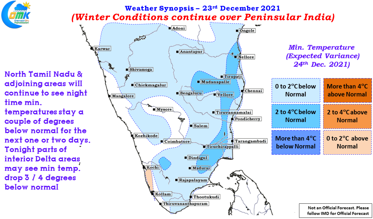
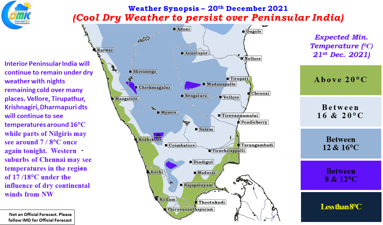
A week is a long time in weather particularly in the tropics where things could evolve at a pace much faster that what models can anticipate. But at times events go exactly as per script written by models, Cyclone Jawad was one such event that went exactly as written. Weather models were consistent on the…
Author: Chennaiyil Oru Mazhaikkaalam
Isolated Heavy Rains likely in South TN
Yesterday the Deep Depression in Bay of Bengal intensified into Cyclone Jowad and now lies at about 250 kms Southeast of Vishakapatnam. After tracking NW for more than 36 hours or so the system now has started to move roughly in a Northerly direction slowing down as well in the process. This slowing down is…
Intensifying Bay Depression heads towards Coastal AP
Yesterday’s Well Marked Low Pressure Area over South Bay gradually intensified into a Depression last evening as it continued to track in a Northwest direction as expected by most weather models. With the depression still in an area of moderate wind shear along with warm ocean conditions it is expected to intensify for a further…
Bay Low Intensifies into a Well Marked Low
Rain Battered Tamil Nadu saw a marked reduction in rains yesterday. In particular North Tamil Nadu saw pretty much a complete cessation of rainfall activity with bright sunshine seen right through the day. With similar pattern likely to prevail for the next couple of days the residents of Chennai will be extremely relieved to see…
Bay Low starts its journey towards East Coast
In what was a welcome relief for many people in Chennai yesterday saw the return of Sun for a long period of time. While evening saw some parts of the city & suburbs come under short bursts of rains these were isolated mostly. Similar trend of rains continued through the night with isolated short bursts…


