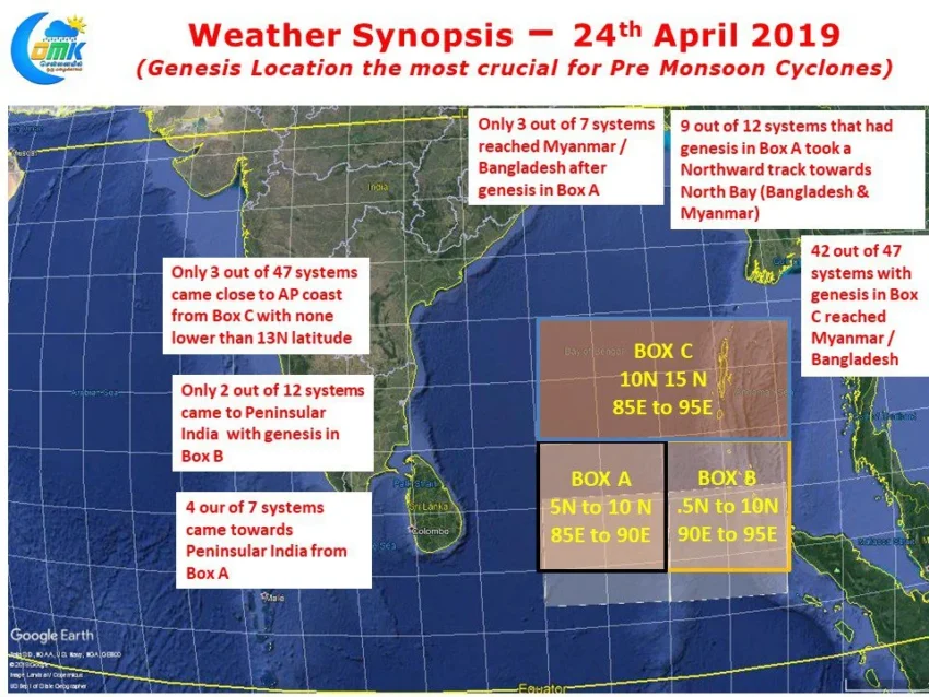
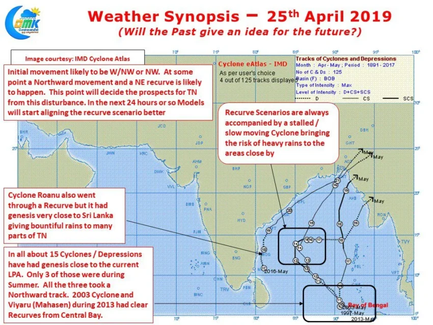
In what is going to be a nail biting journey for not only weather bloggers but media & public as well, the Low Pressure Area has formed in Equatorial Bay very close to the Equator. This is the first step in this journey towards what is likely to be a very strong Pre Monsoon Cyclone….
Author: Chennaiyil Oru Mazhaikkaalam
Eyes on Bay but Nature runs at its own pace
From yesterday the talk of the town has been possible Cyclone towards Tamil Nadu. While weather bloggers have been keeping an eye on weather models for a possible disturbance to evolve the Flash Alerts by Television media from yesterday afternoon has created a frenzy. The dry spell and poor NEM last year has added to…
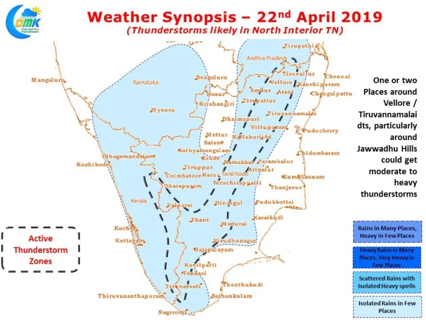
Thunderstorms likely over North Interior TN
After a few days yesterday saw a relatively quiet day on the thunderstorm front as the wind instability triggering thunderstorms was less pronounced due to the Circulation off Sri Lanka becoming more pronounced. Even temperatures stayed low yesterday across most of Tamil Nadu as remnant clouding from the late night thunderstorms had an effect on…
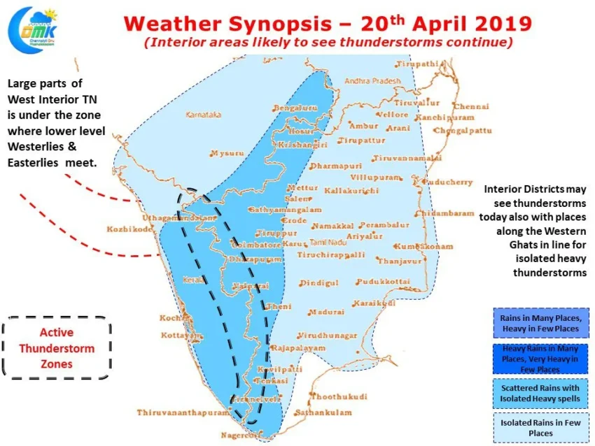
Interior areas likely to see thunderstorms continue
The Pre Monsoon thunderstorm season has well and truly begun with heavy thunderstorms lashing parts of Kanyakumari, Dindigul, Virudhunagar district last evening. Rajapalayam recorded 12 cms while Lower Kothayar in Kanyakumari district recorded 10 cms rains. Similarly Kodaikanal recorded good rains as well. The advent of thunderstorms though has brought some respite to temperatures as…
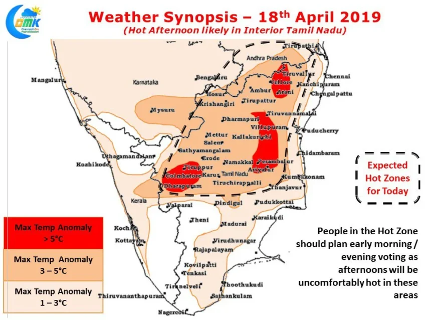
Interior TN to witness Hot Election Day
As whole of Tamil Nadu goes to voting for electing the MPs’ from their respective constituencies uncomfortably hot weather during the afternoon in the interior areas need to be kept in mind. Yesterday saw 6 places in Tamil Nadu cross 40 degrees with today likely to be around the similar mark too. While parts of…