
Parts of Chennai woke up to the sights and sounds of Rains as Northern Suburbs and parts of North & West Chennai witnessed moderate thunderstorm activity around 5 in the morning. The Northwest Suburbs of Puzhal & Red Hills saw fairly heavy spells with both the stations recording 14 mm and 16 mm respectively. Minjur another suburb to the North recorded about 8 mm of rains. The city areas recorded much lesser rains with Anna Nagar recording about 2 mm while IMD Nungambakkam recorded about 1 mm. The thunderstorms that formed in the South AP region slowly moved towards the coast giving the rains to the coastal areas on the way.

Parts of South Tamil Nadu has been seeing fairly hot conditions prevail over the last few days and things are likely to continue today as well with Numerical Models indicating some parts of Tirunelveli / Madurai / Virudhunagar districts likely to see day time maximum temperature stay 3 – 5°C above normal. The last couple of days Palayamkottai IMD Observatory has been recording 40°C and the trend may continue today. Parts of extreme North TN under remnant clouding could see near normal or slightly below normal temperatures today.
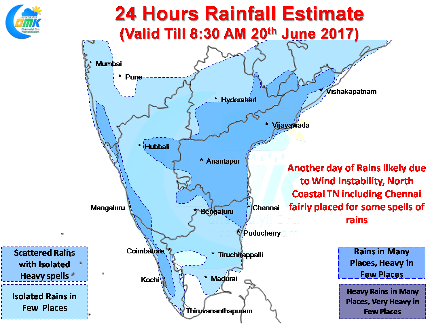
Like Yesterday on account of the stalled Monsoon dynamics we are likely to see wind instability prevail over the Peninsular region today as well. With Northerlies still dominating and upper level trough dipping upto parts of Rayalaseema / South Karnataka region we are likely to see another day of thunderstorms in these regions. As has been the case under the impact of Westerlies these thunderstorms will make their movement towards coastal areas giving good rains on the way.
Numerical Models indicate North Coastal Tamil Nadu including Chennai is firmly placed for some of these thunderstorms to give moderate spells of rains later in the day with possibly rainy conditions prevailing till later in the night.
Powered by WPeMatico