
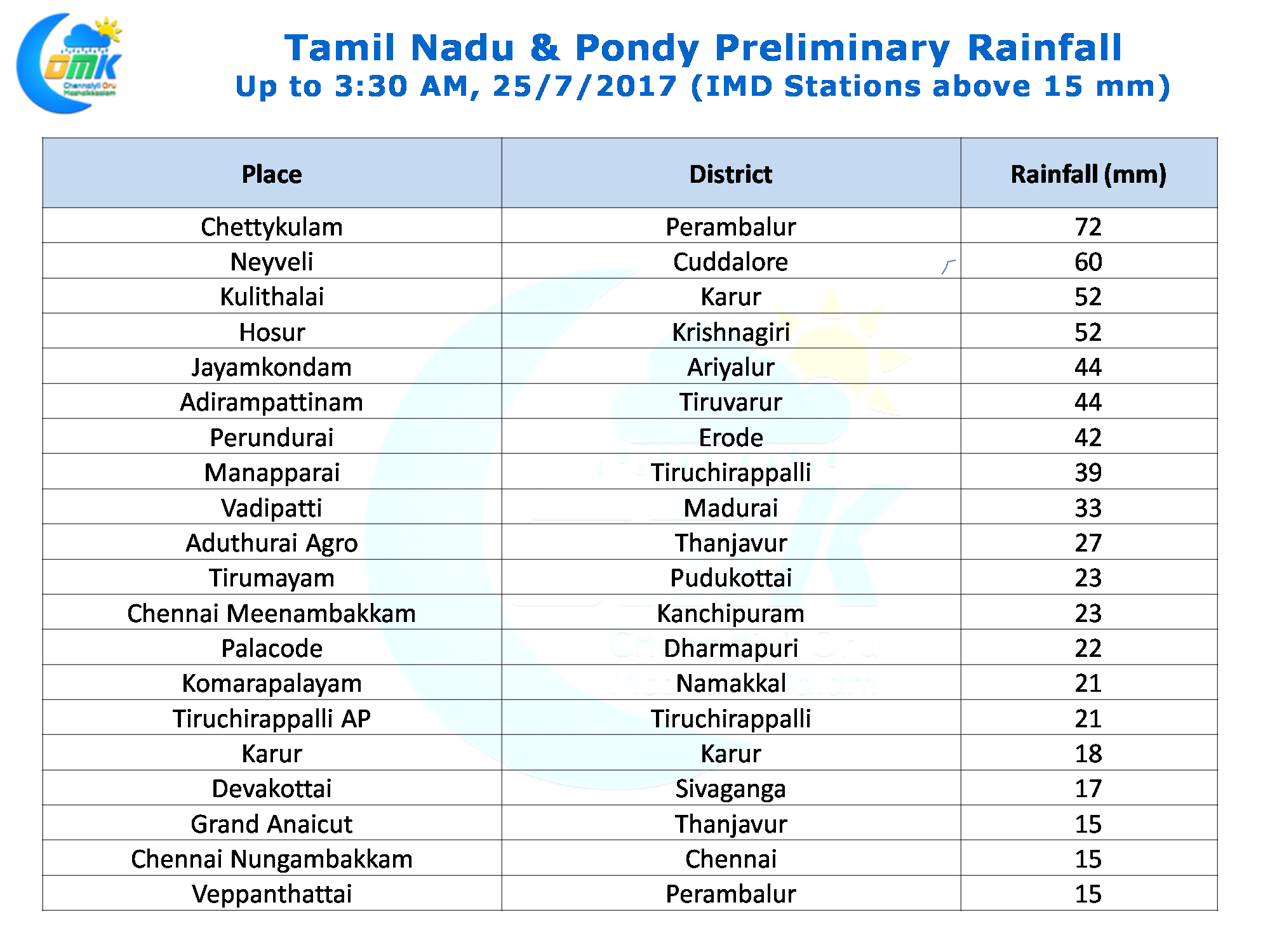
Thunderstorm season is back with a bang over Tamil Nadu. Yesterday saw many districts of Tamil Nadu in particular the interior places record moderate to intense late evening / mid night thunderstorms. Chennai also did not miss out with most parts of the city getting light to moderate showers. The IMD observatories at city & airport recorded 15 & 23 mm respectively. The evening show started from the Northern suburbs and continued in a North to South direction with the areas in the southern parts of the city getting the more intense spells of rains.
With the East West Shear Zone present over the southern parts of Peninsular India and a pseudo circulation persisting over the Bay of Bengal off the coast of South AP / North Tamil Nadu the wind pattern is conducive for thunderstorms to continue in the region for the next few days. Models are indicating the interior areas to get the best benefit with South Interior Karnataka, Rayalaseema & Northwest Interior TN the regions to benefit the most.
Today also we are likely to see a lower level wind convergence of different air masses over parts of Peninsular India while at mid troposperhic level a wind shear zone type of wind pattern is expected to prevail over the North TN & South Interior Karnataka region bringing in the necessary instability needed for thunderstorms to develop.
While the interior places are likely to get the better rains like yesterday the coastal areas will also get their due share when the storms cross the coast. The steering winds will continue to remain weak and slow hence the thunderstorms will take a lot of time in their movement dumping rains all over the place they cross in the path.
Powered by WPeMatico