
According to IMD’s Daily Rainfall graph for Tamil Nadu & Pondicherry Sub division the accumulated rainfall for the Pre Monsoon Season (March to May) is 26.3 mm against the average of 32.2 mm for the period upto April 10th. Ironically of the 26.3 mm accumulated since 1st of March the last two days has given more than 10 mm on account of the widespread rains over South TN & places along the Ghats have got. Places in Theni & Virudhunagar district like Watrap & Gudalur recorded more than 10 cms for the 24 hours ending 8:30 AM, 10th April indicating how heavy the thunderstorms along the Ghats were at times.
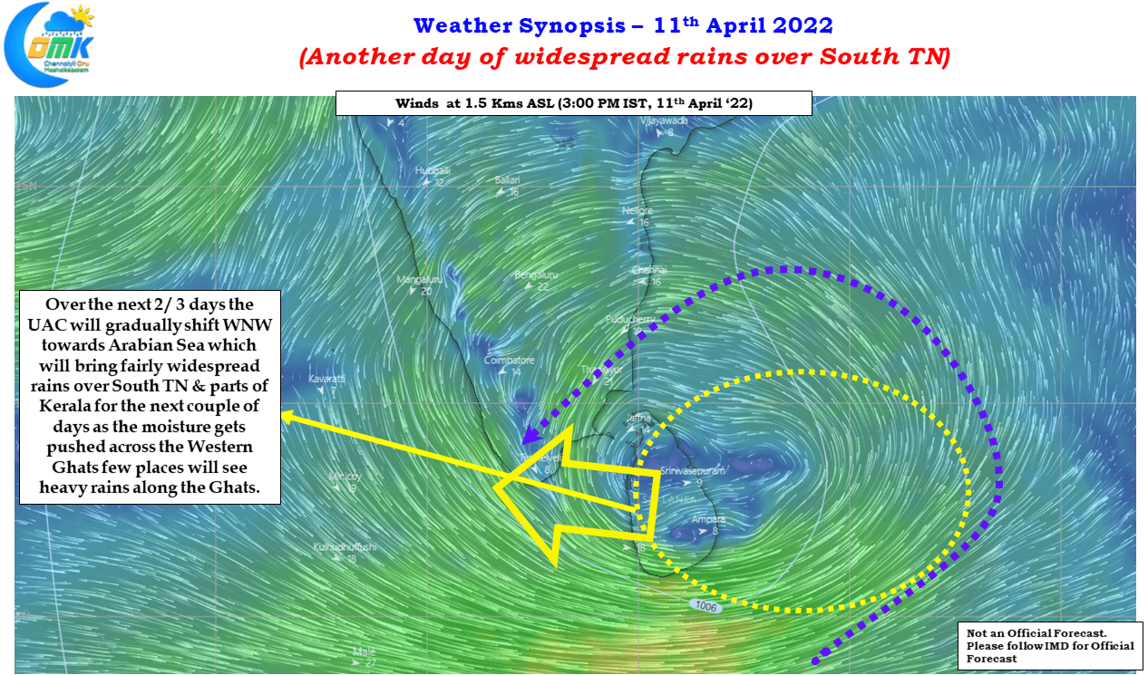
While we explained in our earlier post on how the presence of CCKW over the Indian Ocean has enhanced these Veppasalanam thunderstorms one should not forget the primary ammunition for these thunderstorms was the abundant moisture supplied by the Upper Air Cyclonic Circulation, which at one point of time many bloggers were eagerly expecting to become a cyclone over Bay of Bengal, now straddling the Sri Lankan coast & adjoining areas of Bay. This UAC is expected slowly push west into Arabian Sea over the next 2 / 3 days making it ideal conditions for the rains to continue over South TN.
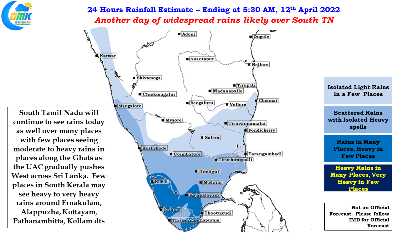
Today we might see another day of widespread rains over South TN with parts of Tenkasi, Kanyakumari, Thoothukudi, Tirunelveli & Virudhunagar district likely to see moderate to heavy rains in a few places. Similarly due to the moisture drag created across the Ghats by the UAC, we may see isolated places in the High Ranges of Kerala record heavy to very heavy rains during the afternoon / evening hours. South TN will continue to see rains for another day or two slowing down once the UAC pushes into Arabian sea and fades away later this week while trying to move up north along the coast of Kerala. At the same time with the CCKW influences also fading away we might start to see a slight slow down in the thunderstorms around Vishu / Tamizh Putthaandu.