
Devas & Asuras. Yin & Yang. God & Devil. Negative & Positive. For the scientifically inclined all of these can be a form of Newton’s Third Law of Motion, For every action, there is an equal and opposite reaction. In the same context for the Weather Bloggers the Pendulum swing between Active Monsoon Conditions over the West Coast & active thunderstorms over the rain shadow region of interior Tamil Nadu is a version of Newton’s Third Law of Motion or the weather version of negative & positive. While one increases the other reduces, effectively the pendulum swings between thunderstorms & active monsoon over the west coast.
This week we are likely to see the first Monsoon Low form over North Bay which in turn is likely to trigger a monsoon surge over the west coast. For the regular weather watchers of Indian Sub Continent, Boss of Bay is indeed the key to a good monsoon season. While Arabian Sea may be seen as the one driving Southwest Monsoon overall, the active phases / Monsoon Surge etc is more often than not coincided with when Bay of Bengal exerts its muscle in the form of a Monsoon Depression.

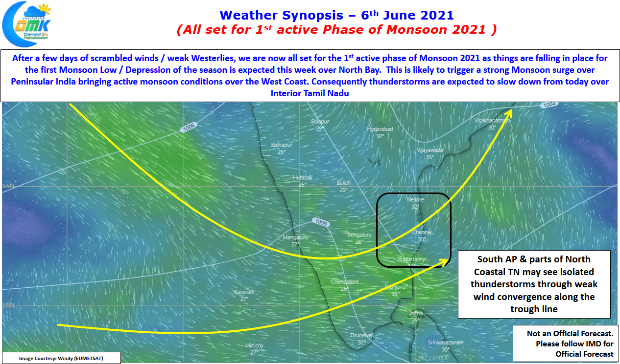
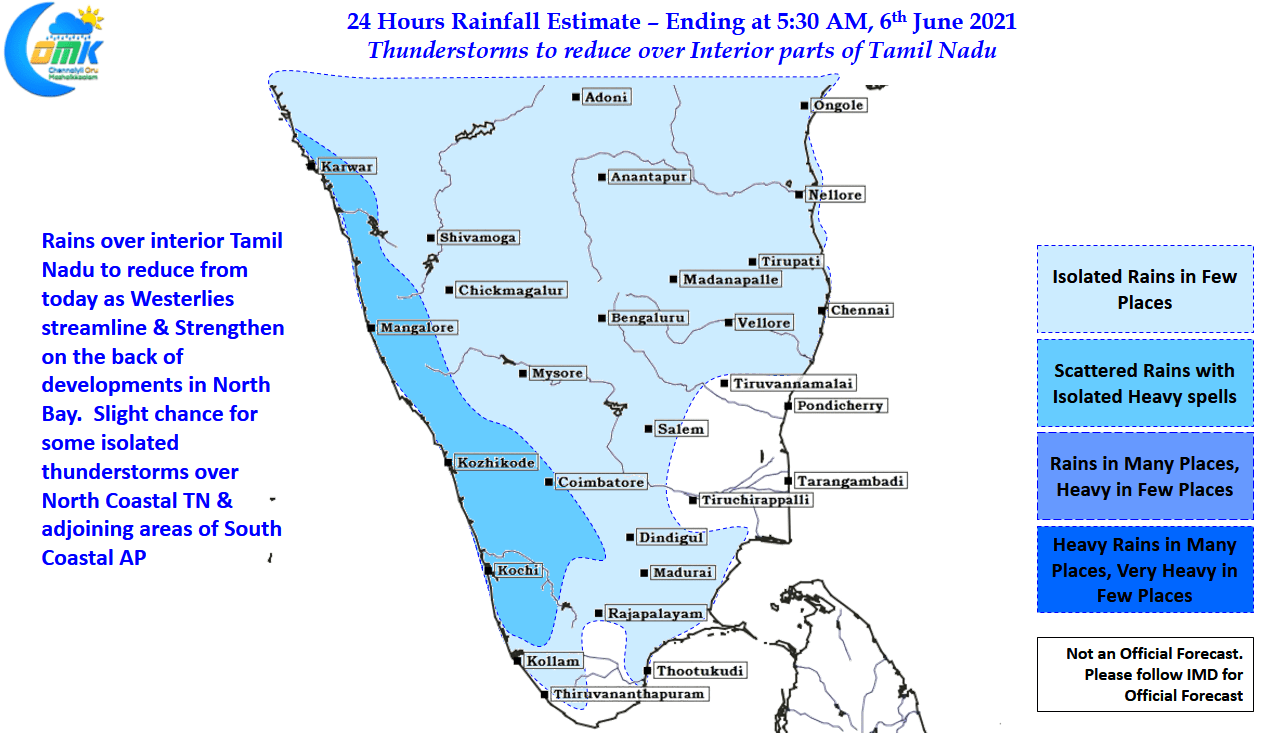
The reaction to this would be the reduction in thunderstorm activity over interior Tamil Nadu. After a few days which saw widespread thunderstorm activity in many areas of the state things are expected to reduce from today as westerlies strengthen & streamline over the west coast. But as often is the case the days before the formation of low is the period to watch out for Chennai as our best chance of rains is in these couple of days when the Westerly winds reach the coast but are not strong enough to dissipate chance of thunderstorm formation. Today also chance for isolated thunderstorms exists for North Coastal TN & adjoining areas of South AP due to weak wind convergence. As we often say as far as rains in Chennai go we have to take what ever comes our way without having any major expectation.