
After Cyclone Vardah hit North Coastal Tamil Nadu the rains slowly faded away bringing in the dry suppressed winter weather conditions across the state. On Thursday & Friday nights we saw the nighttime minimum temperatures dip across the Northern parts of the state including the coastal belt between Chennai & Vedaranyam. In an indication of how things are shaping up yesterday night saw temperatures trend a degree warmer than the previous two nights. 
The trough of low now persisting in Southeast Bay is expected to move in a W/NW movement towards the coast of Tamil Nadu in the next 24 – 48 hours. Subsequently it will possibly drift down towards the coast of Sri Lanka. As things stand we are likely to see the next spell of rains for Coastal Tamil Nadu from late night of 26th / early morning of 27th.
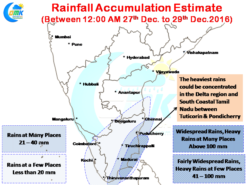
Going by how things are likely to pan Delta districts & South Tamil Nadu are ideally placed for receiving moderate to heavy spells of rains from this Bay disturbance with the stretch between Thootukudi and Puducherry in line to receive some much needed rains though its too late now to bring about any major fillip to the farming community.
Chennai is possibly just outside the zone which could see moderate spells of rains going by how things could evolve based on current conditions but with little bit of a North kink than what models estimate today could bring Chennai also into the mix of some moderate rains early next week.
Powered by WPeMatico