
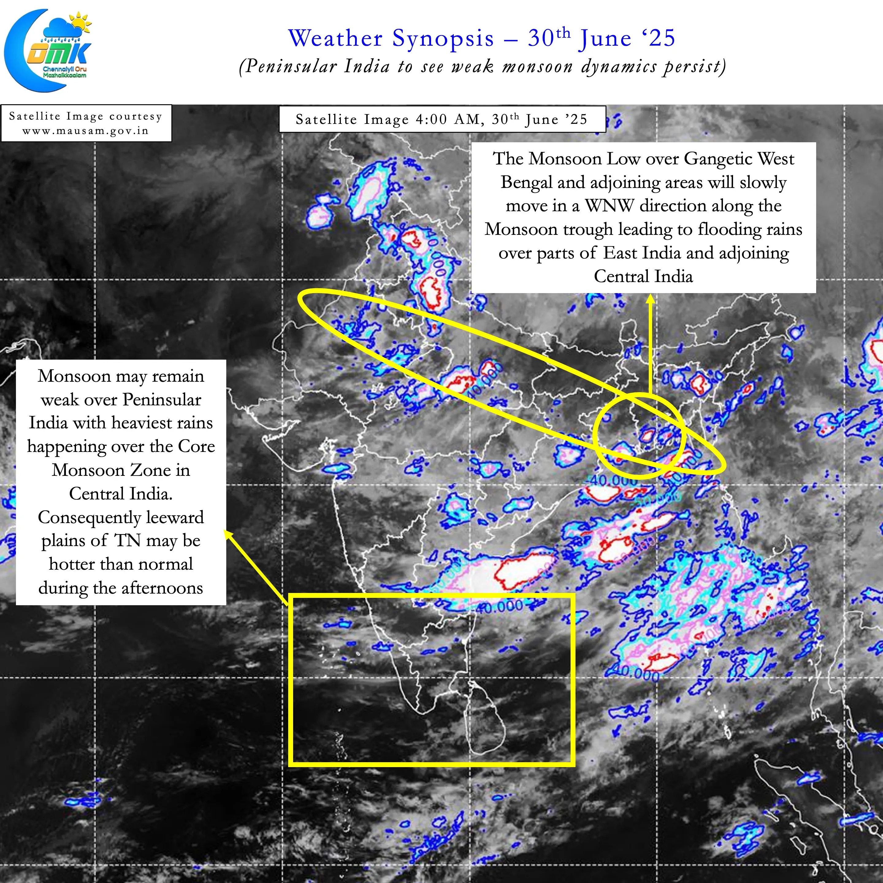
Southwest Monsoon this year has been very moody over Peninsular India. This can be seen quiet clearly through the daily rainfall chart for Kerala since the start of Monsoon season on 1st June. Overall the seasonal performance stands at -1% with 11 days seeing above average rains. In all this we have seen pretty much all the dams in Cauvery basin full. Mettur reached FRL for the first time in June since 1957. This moody nature has brought about a coincidental impact over the leeward plains of Tamil Nadu. The westerlies continue to remain strong due to the presence of Monsoon low over Gangetic Plains. But the drier than normal conditions over Peninsular India heats up afternoons over the plains of TN.
The moody nature of Monsoon this year could be explained partially due to the influence of Monsoon intra seasonal Oscillation (MISO). MISO has been mostly favouring Central India, Bay of Bengal and South China Sea. But the frequent pulses that come into Bay from South China Sea creates an episode of favourable conditions over Peninsular India. During this phase for a few days widespread rains in the West Coast and Ghats bring about an active spell. When the Monsoon Low drifts inland towards Central India we see a lull in monsoon conditions over Peninsular India. When the next disturbance moves into Bay the mood once again swings back.
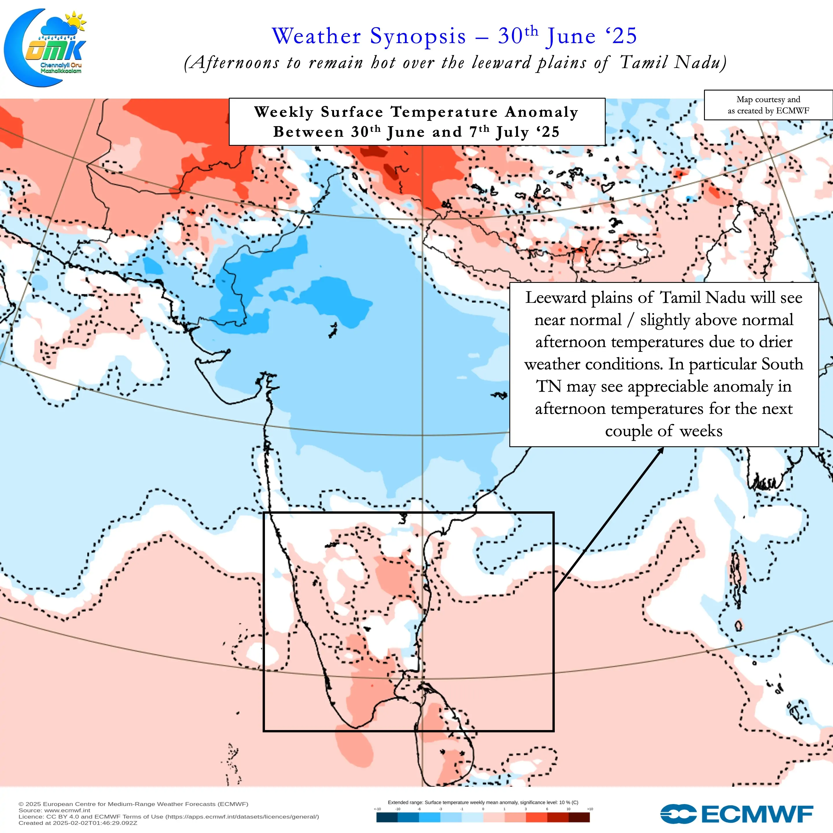
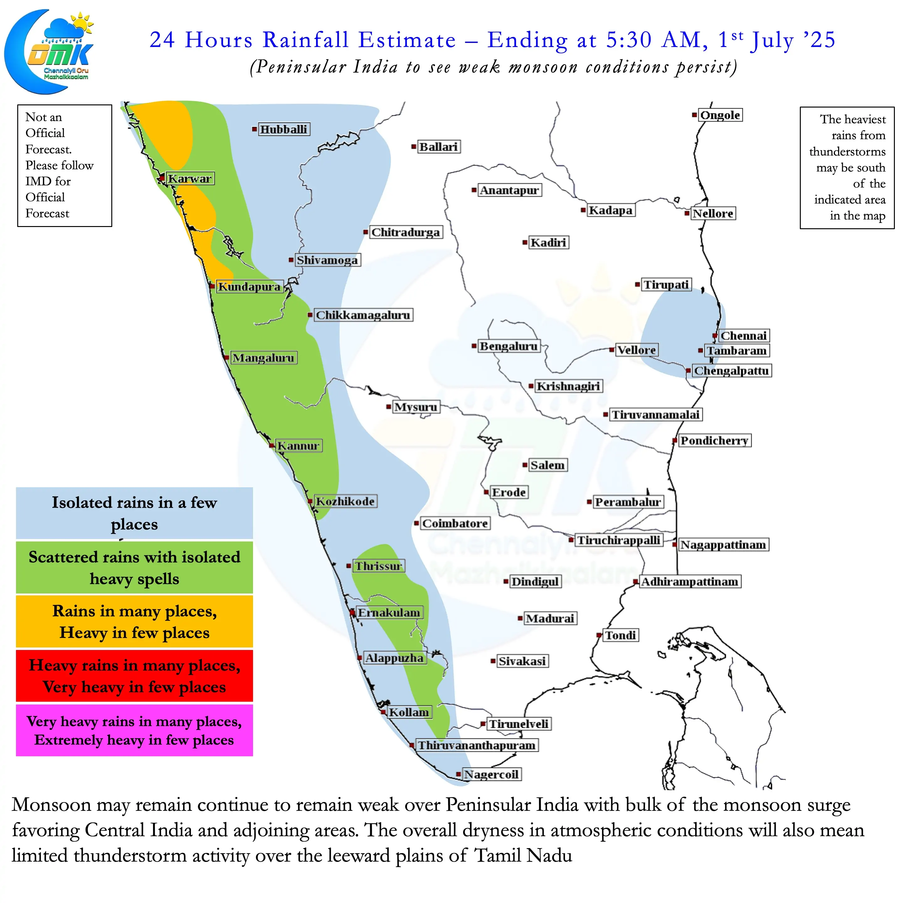
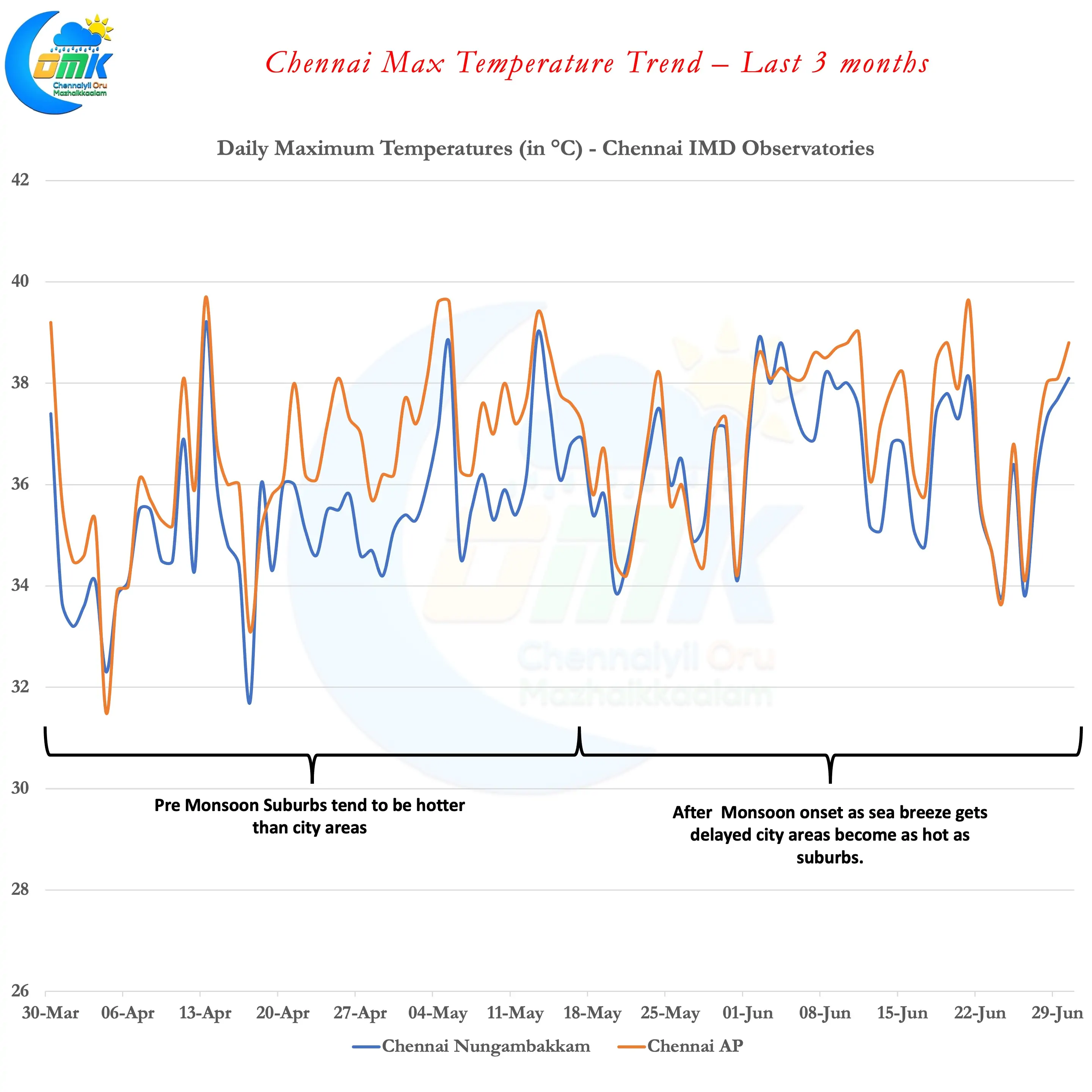
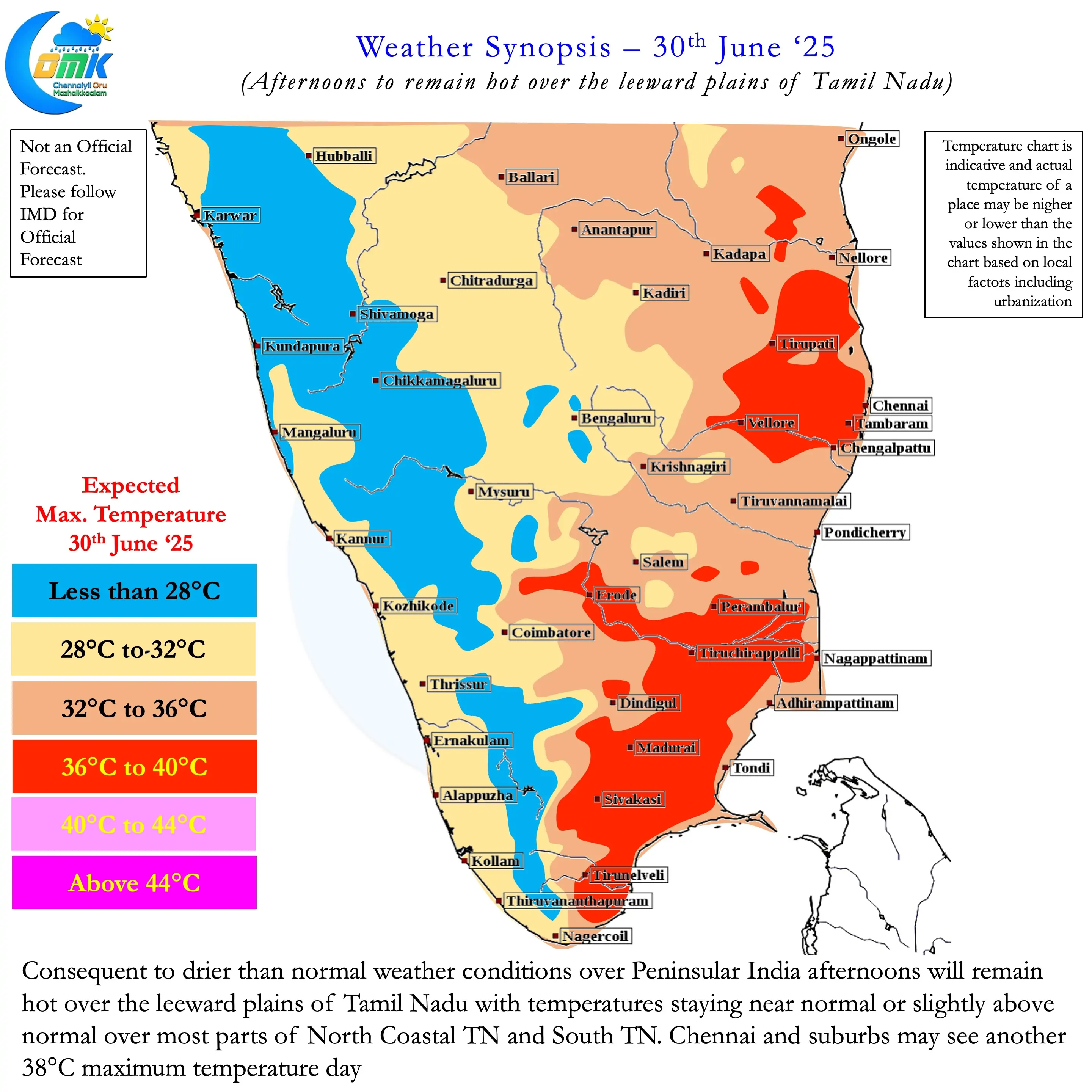
Over the next few days as monsoon remains weaker than normal over Peninsular India the afternoons may be hot in TN. This could mean temperatures in places like Chennai could peak to about 38°C. The stiff westerlies would mean sea breeze may set in only during the evening hours. This will make afternoons uncomfortable over most of the leeward plains of TN. While we may see some thunderstorm activity that may remain isolated overall it could be drier. Towards the second half of the week we may see thunderstorms at more places in TN. The current monsoon low may reach parts of Central India creating favourable convergence for places like Chennai in North TN. But overall we may continue to see hot afternoons for the next couple of weeks.
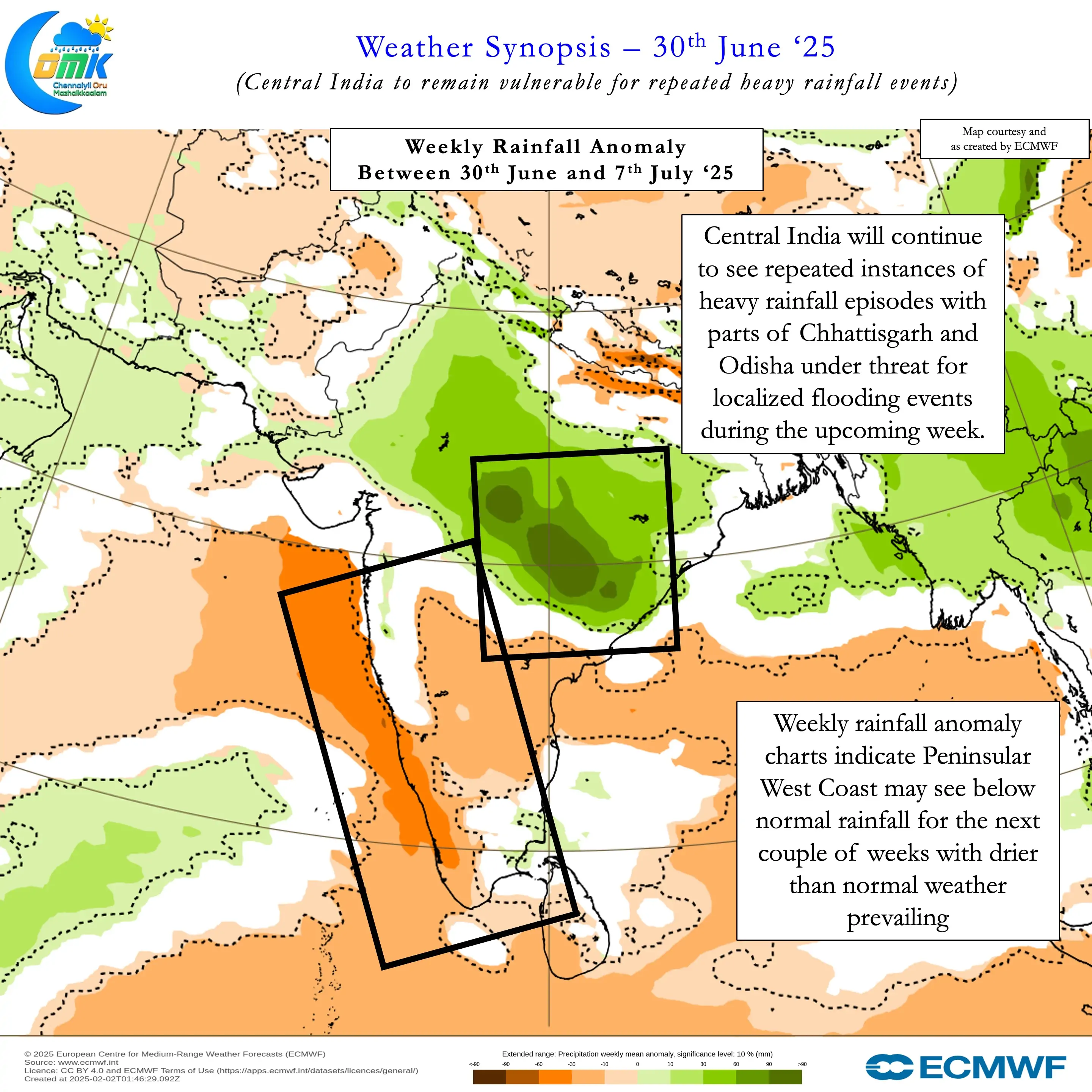
In the meanwhile rains along the Peninsular West Coast and the Ghats may be below par. The rains will continue and we are unlikely to see a complete halt. But overall the trend may be below par for the next couple of weeks. Parts of Central India and adjoining areas of East India may be vulnerable for localised flooding during this week.