
The active thunderstorm season continues to hold Tamil Nadu firmly under its grip. On Tuesday the daily mean rainfall for Tamil Nadu & Pondy crossed 10 mm for the 3rd time since 1st of June taking the overall rainfall for the season 2% above normal. The trend continued yesterday as well with many parts of the state receive rains with parts of Tiruvannamalai, Vellore, Salem & Krishnagiri districts getting good rains.
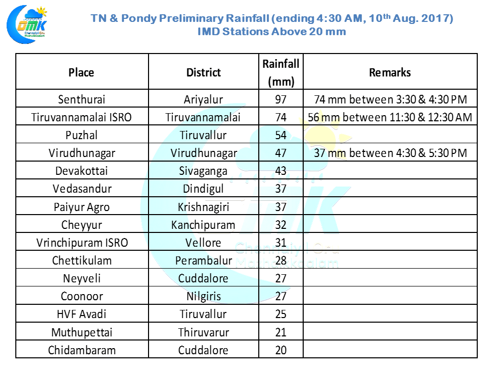
While rest of Tamil Nadu enjoys the rains Chennai has been seeing thunderstorms in bits and pieces. The irony in all this is Puzhal about 15 kms aerially from the city center recorded 54 mm of which 47 mm fell in one hour during the evening thunderstorms that played hide and seek with Chennai. Today morning was once again similar story with the storms bypassing Chennai moving about 40 kms to the North and staying stationary for nearly one hour over the Pulicat and Ponneri areas.
There is a fair bit of upper level moisture available over Peninsular India which is allowing these storms to sustain for longer periods and move for larger distances despite the poor wind speeds due to the monsoon nearly shutting down over South India. The Mid Tropospheric winds being Southerlies / Southeasterlies is also helping the storms to develop creating favorable shear environment in addition to providing additional moisture.
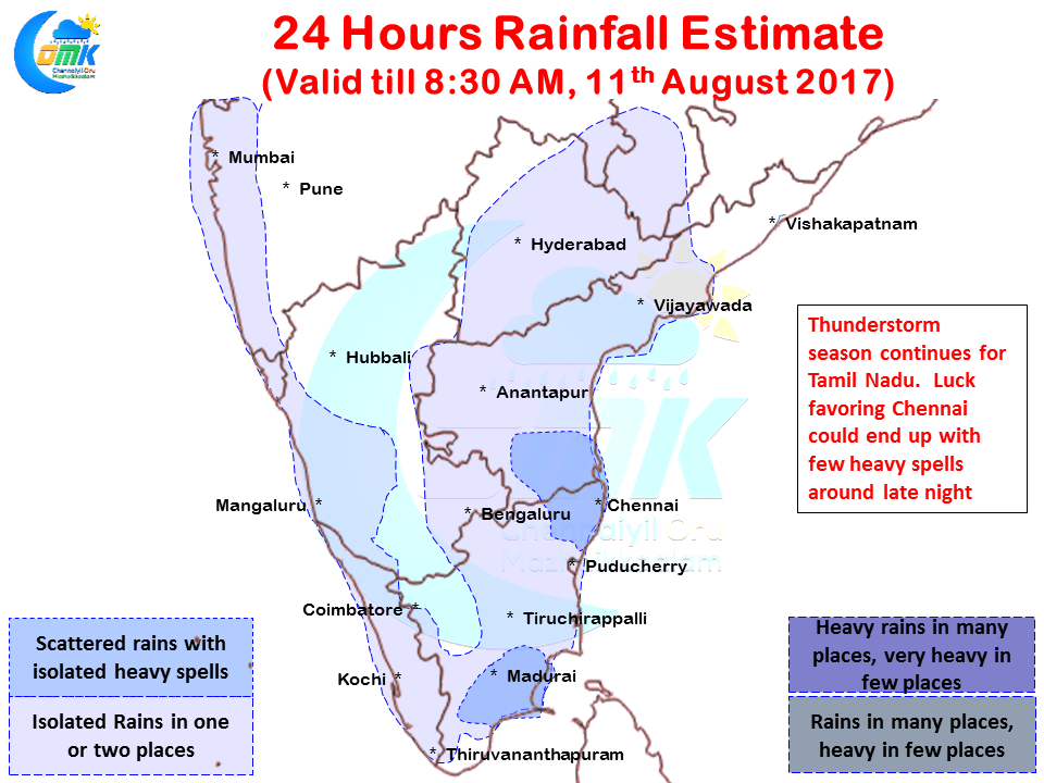
But luck indeed could finally favor Chennai today with possibly some late night thunderstorms heading for the city with some favorable wind pattern. As has been the case the wind speeds are going to be slow and the thunderstorms are expected to move very slowly which could mean moderate to heavy spells in those lucky places like how Puzhal got yesterday.
Things look good for the stretch between Pondy & SHAR along with Kanchipuram, Tiruvallur districts and adjoining parts of South AP to get some late night thunderstorms. Keeping fingers crossed for Chennai.
Powered by WPeMatico