
Like most weather events Southwest Monsoon also oscillates during the season. An active monsoon phase followed by a passive phase as the dynamics ebb and flow. The period of these active / passive phases depend on support from Tropical waves. At times larger scale atmospheric base state also plays a crucial role. Some of the biggest drought years have coincided with El Nino years. But in recent times warming of oceans, particularly closer home, is being looked closely for a more stronger influence on ISMR.
It is an understatement to say this year has been extremely good for Central India. Favourable intra seasonal oscillation has meant Central India seasonal rainfall stands at 22.4% excess. To the contrary Southern Peninsular India seasonal rainfall tally stands at -4.9%. Since the start of the season on 1st June the longest spell of active monsoon conditions for SPI has been between 11th and 17th June. For 13 days between 4th and 16th July the daily rainfall was lower than normal over SPI. This has been the pretty much the pattern all season long. Short bursts followed by longer spells of weak monsoon conditions.
Since 17th July monsoon over SPI has been above average daily. This spell is likely to continue and possibly provide the longest active phase of monsoon. Sub seasonal outlooks do indicate a possible break in monsoon as July turns to August. This is possibly corroborated by a more canonical propagation of MJO across Western Hemisphere. Nevertheless it may be prudent to wait and see if this indeed happens. Over the past few months base state has been interfering with MJO’s transit across Maritime Continent. With initial indications of an atmospheric flip to La Nina gets a positive feedback from the ocean we may see MJO get back on track.
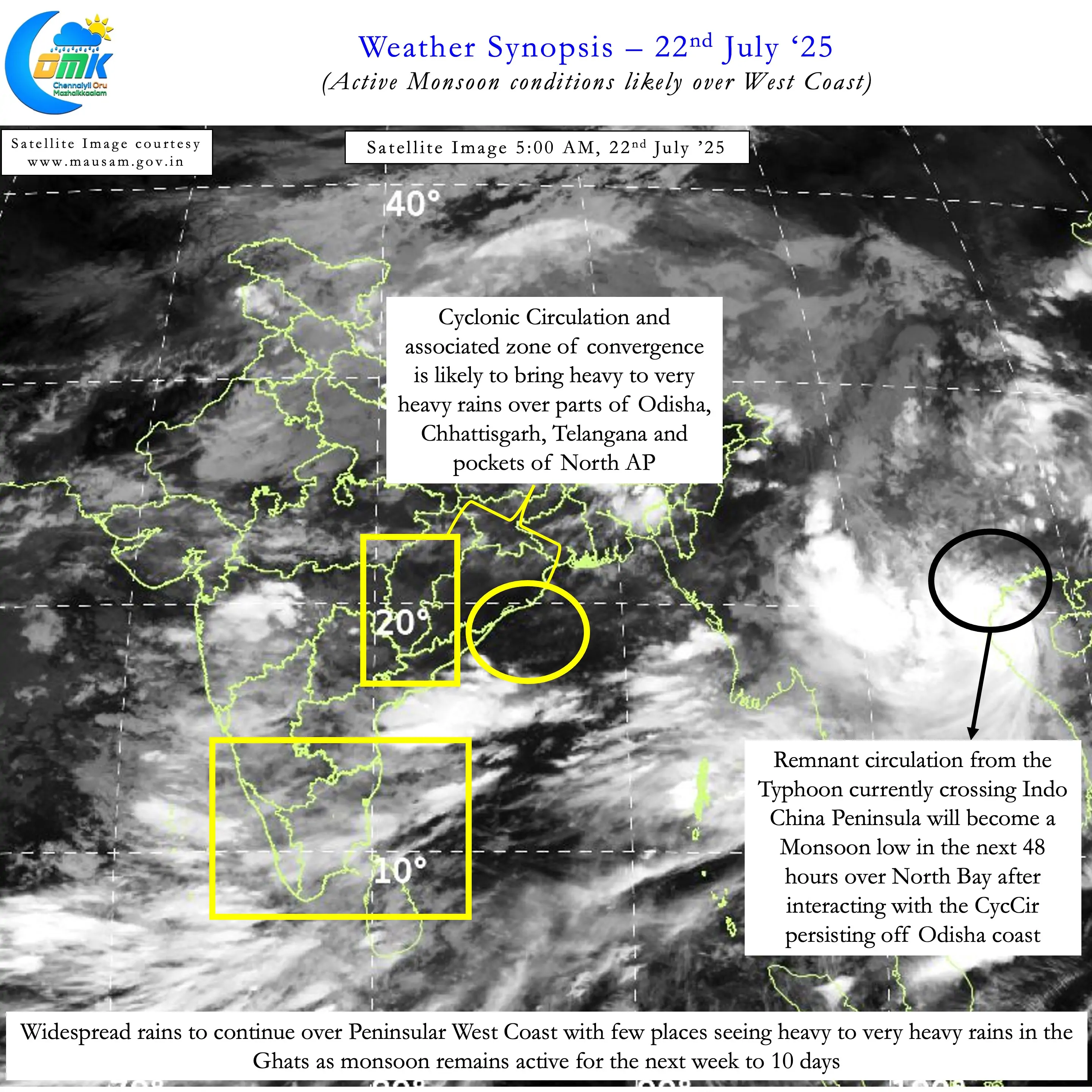
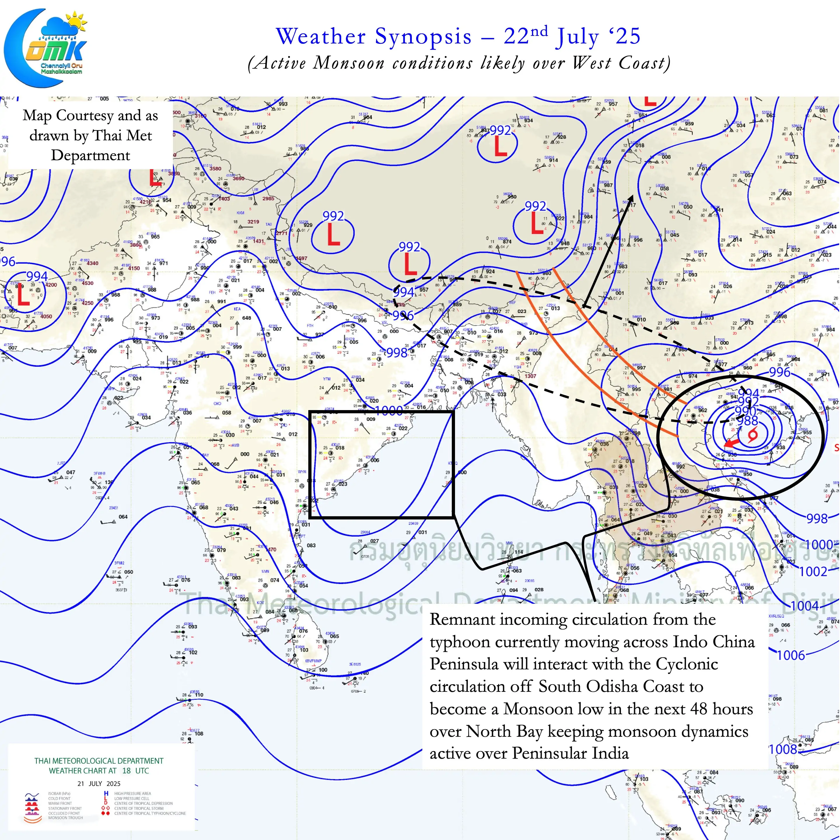
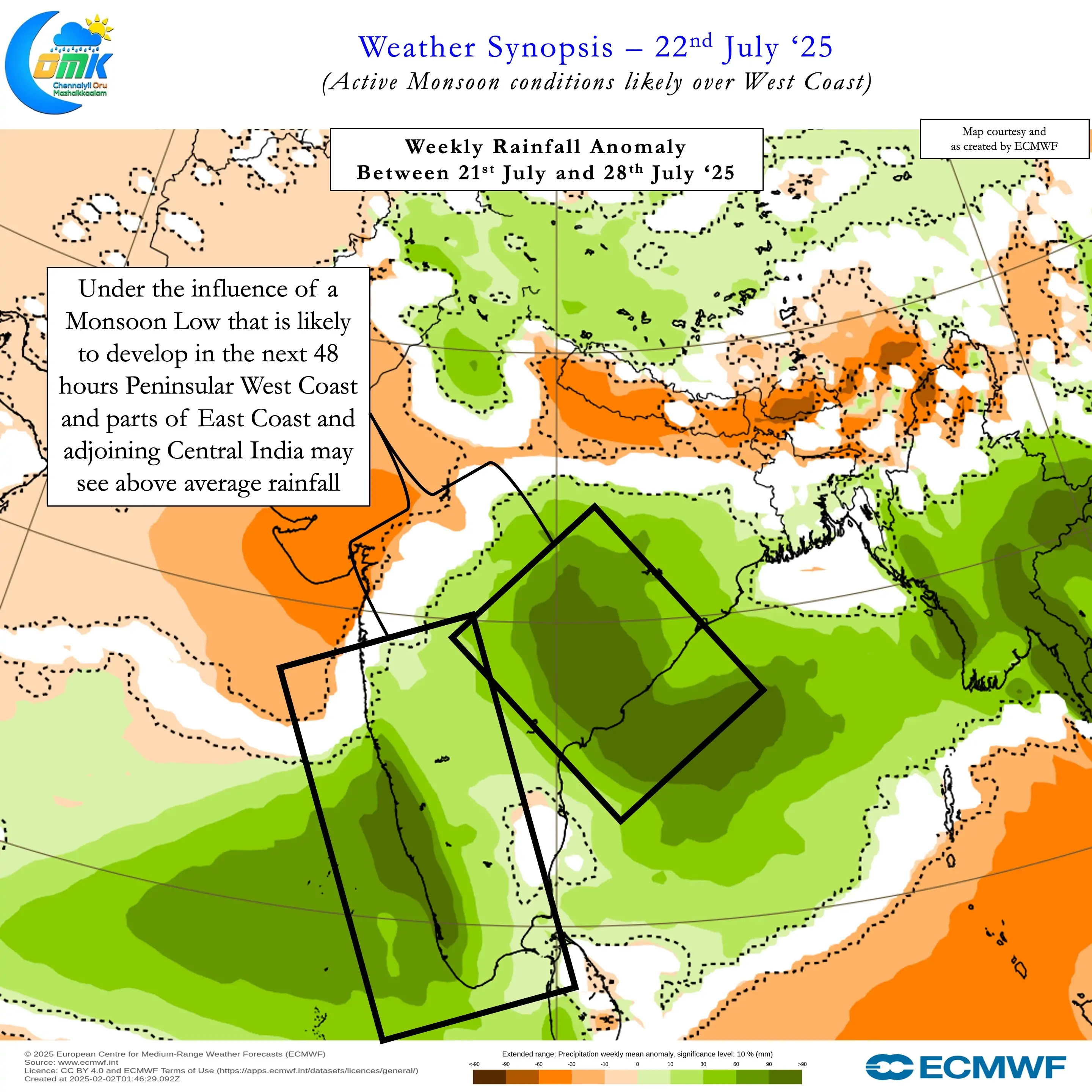
In the meantime over the next couple of weeks we can possibly see active monsoon over Peninsular West Coast. This phase will get support from the entry of the remnant circulation of Typhoon Wipha from Indo China Peninsula. With the cyclonic circulation over West Central Bay persisting we may see a Monsoon Low develop over North Bay in 48 hours or so. This Monsoon Low may develop through the merger of both the circulations.
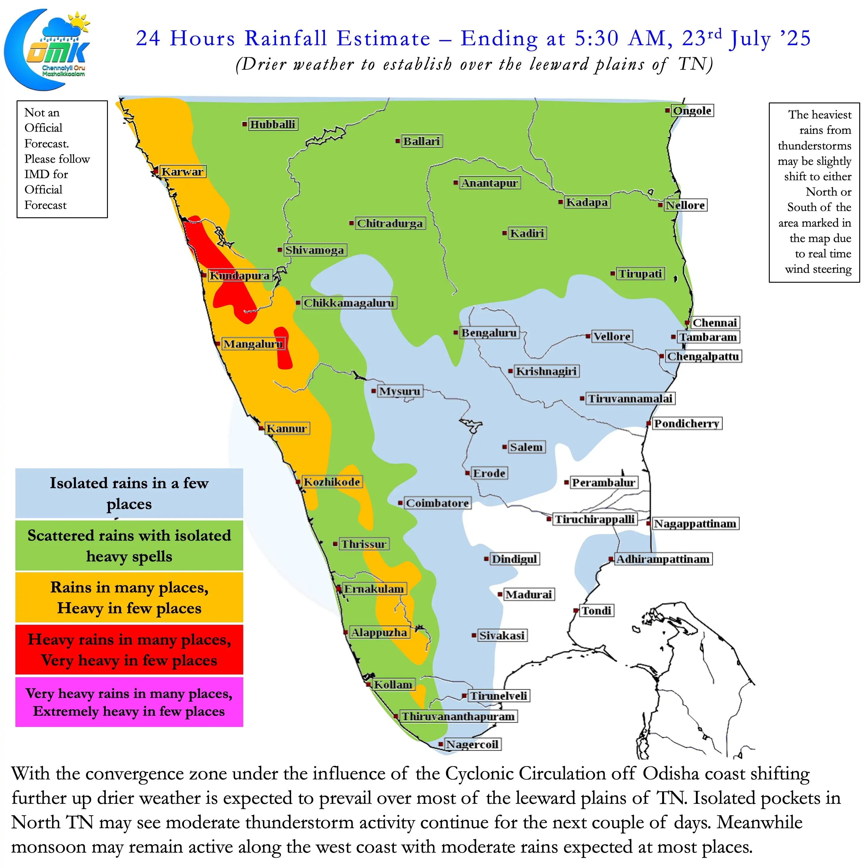
During this period Peninsular West coast is likely to see widespread rains daily. Ghats and few places along the coast may see heavy to very heavy rains depending on the conditions prevailing on a day to basis. Krishna, Godavari and Cauvery may see copious inflows continue for the next couple of weeks. The convergence zone associated with the cyclonic circulation off South Odisha Coast has now shifted to North AP / Telangana and adjoining areas.
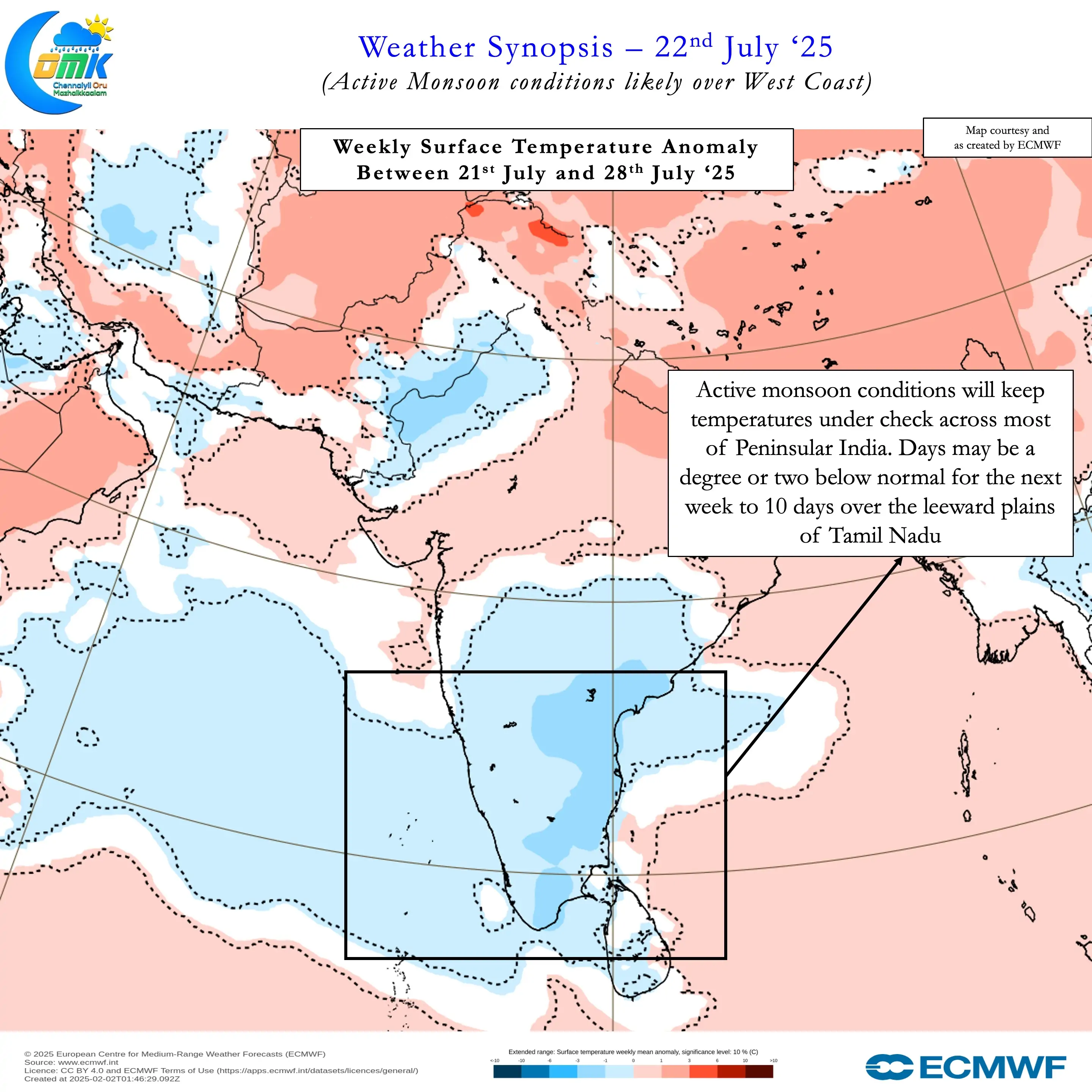
Consequently we may see a reduction in thunderstorms over the leeward plains of Tamil Nadu. The next couple of days we may see moderate thunderstorm activity over pockets of North TN. There is one bit of good news though. Day time temperatures may continue to trend below normal for the next couple of weeks.