
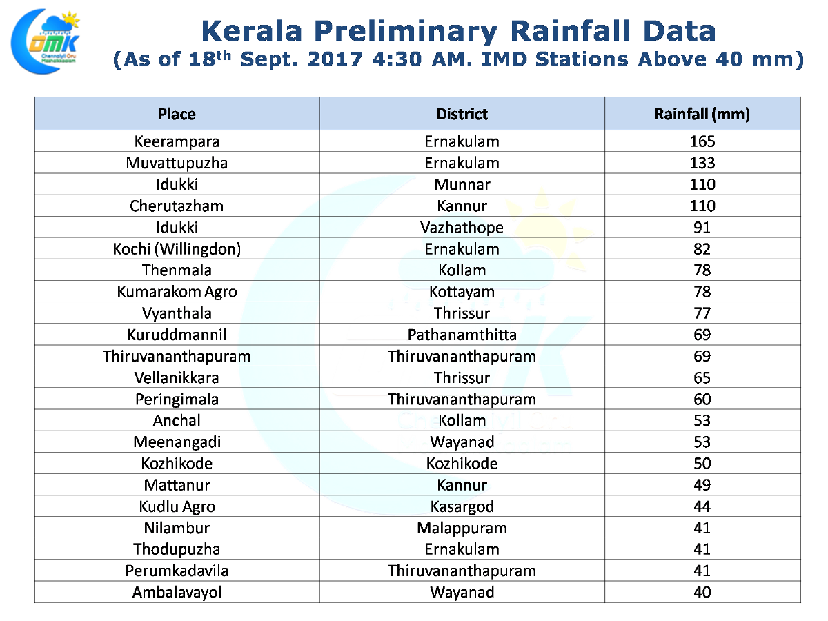
Southwest Monsoon continues to remain active over the West Coast with another good day of rains seen over most parts of Kerala yesterday. Places in the Western Ghats of Coimbatore like Valparai and in the Nilgirs as well have got very good rains too with Valparai crossing century by 5:30 PM yesterday. The heaviest rains possibly happened around Central Kerala & the adjoining High Ranges region.
The combination of an off shore trough that runs from Konkan to Kerala coast along with the churning Bay disturbance in North / Central Bay off the coast of Odisha has ensured the monsoon dynamics have fired up over the West Coast. During the next couple of days heavy rains are likely to continue over many parts of the West Coast with places in the Konkan coast around Mumbai / Ratnagiri expected to join the party today & tomorrow.
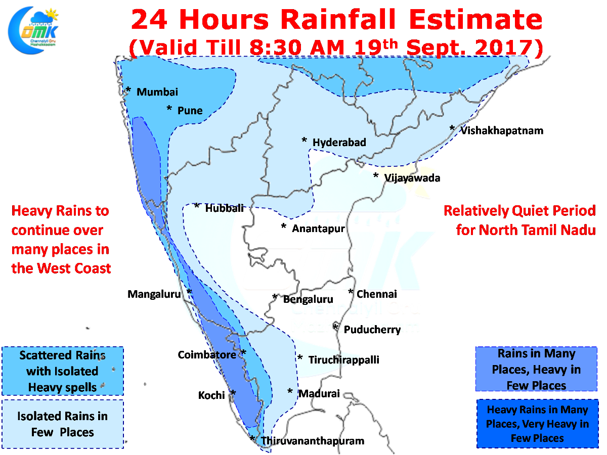
It is a given that the Southeast Coast & most of Tamil Nadu will remain quiet during this period of active West Coast. With such strong westerlies it is moot to expect any major thunderstorm activity to happen over North Tamil Nadu. The wind speeds at 1.5 kms above MSL is well in excess of 50 km/h creating extremely difficult environment for thunderstorms to develop. Also one needs to keep in mind the good moisture available at lower levels of atmosphere will act as a shield against possible ground radiation triggered convection as well.
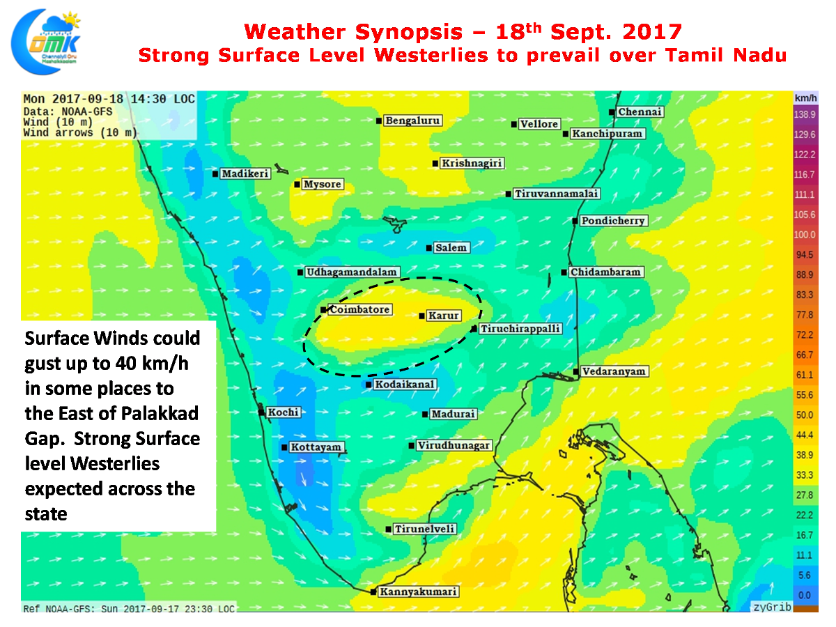 Surface winds over the Central Parts of Tamil Nadu particularly to the East of Palakkad gap could gust up to 40 km/h creating extremely blustery conditions over most parts of the state. Chennai could also see extremely windy conditions with strong surface level winds from the West almost right through the day making it difficult for the sea breeze to make any movement over the coast.
Powered by WPeMatico