
While a battered Chennai recovers from Cyclone Vardah as though up allow the city to recover the rains have pretty much stopped since yesterday morning. While isolated light rains may be possible at times due to the moisture drag created by the remnants of the Cyclone Vardah.

As though to allow the city to recover from the massive devastation as it crossed right over Chennai Vardah the rains are mostly expected to stay away.
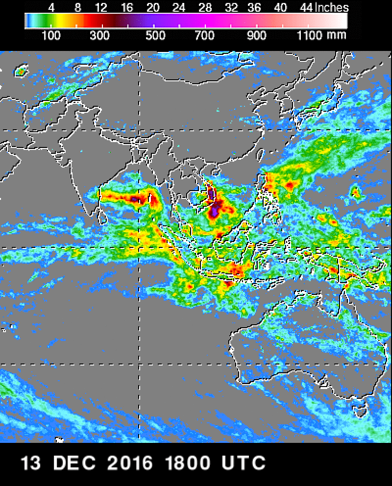
As one can observe from the Nasa TRMM observations it’s quite clear Cyclone Vardah was a high intensity rain bearing system even though in terms of size it has not been huge.

Also what is also obvious from the TRMM data is how just before landfall it had pretty much shown it’s cards in terms of the high intensity rainfall prospects. It was no wonder that southern suburbs like Kelambakkam recorded almost 10 cm an hour rain rate.
With regard to the likely disturbance expected in the coming days let us wait a day or two for models to recover from the sudden intensification of Vardah and it’s current path. Till then models may not present the right picture.
Powered by WPeMatico