
For the 3rd straight day Tamil Nadu got benefited from Convective thunderstorms yesterday as large parts of the state got rains. Some of the interior districts like Salem Dharmapuri, Krishnagiri enjoyed much needed rains while Chennai remained a spectator all along. Parts of Tiruppur, Coimbatore, Erode also recorded spells of rains while in South TN parts of Virudhunagar saw rains continue with even Thootukudi district recording rains in one or two places.

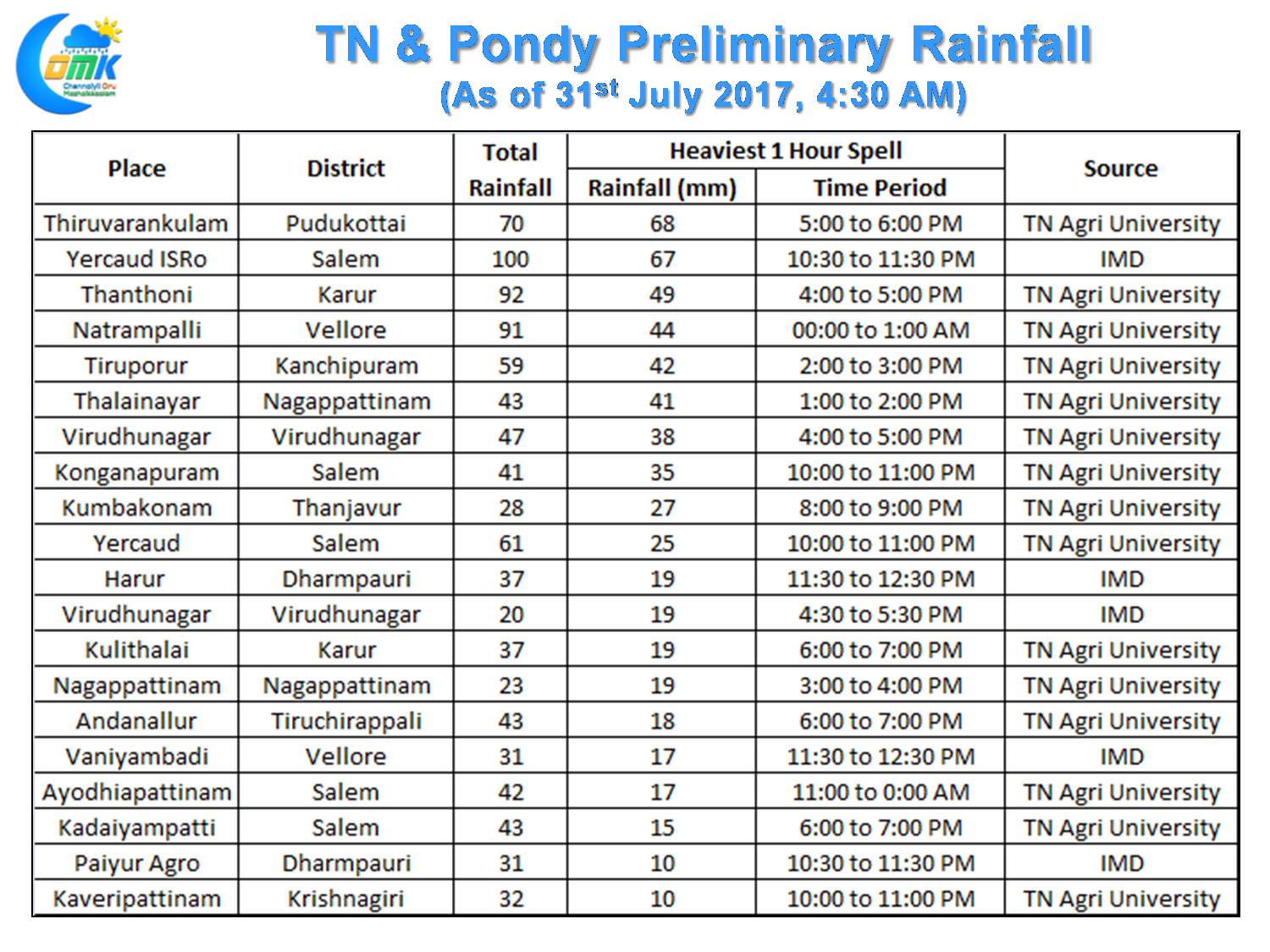
As has been the case this year yesterday also saw a few places receive intense bursts of rains at times with places like Thiruvarankulam in Pudukottai district, Yercaud, Thanthoni in Karur district, Natrampalli in Vellore district recording nearly 5 cms rains in one hour spells while closer home Tiruporur about 40 kms to South of Chennai recorded 4 cms of rains in one hour in the afternoon.
While overall the numbers for Tamil Nadu & Pondy is at -27% so far this Southwest Monsoon season the last few days of July has certainly ensured the -32% deficit that stared at the start of the week was pulled back to some extent. The dry spell between 15th July & 25th July though was too far a gap to cover.

Going by model outputs we are likely to see a slow down in rainfall from today with few days of weak rainfall activity expected before things once again pick up around Thursday for Tamil Nadu. Going by model outputs over the next few days the upper level winds are likely to be from NW bringing in a more dry air than the Southwesterlies which bring in moisture from the Arabian Sea.
Today we are likely to see rains continue in parts of South Tamil Nadu while isolated rains may happen in North TN as well. But the remnant thunderstorms that lingered around the North Tamil Nadu & adjoining parts of South AP could mean cloudy conditions during the early part of the day influencing the prospects of thunderstorm genesis.
Powered by WPeMatico