
As we get to the second week of February interior areas will start looking at the skies for possible thunderstorms developed through wind induced instabilities in the atmosphere. Commonly called Veppa Salanam Mazhai the scrambled wind pattern due to variety of factors provide possible thunderstorm opportunities.
As the early summer like conditions in interior areas of Tamil Nadu create its own instability into the thunderstorm equation through ground radiation the Veppa Salanam Rains are not very far off the mark in its inference.
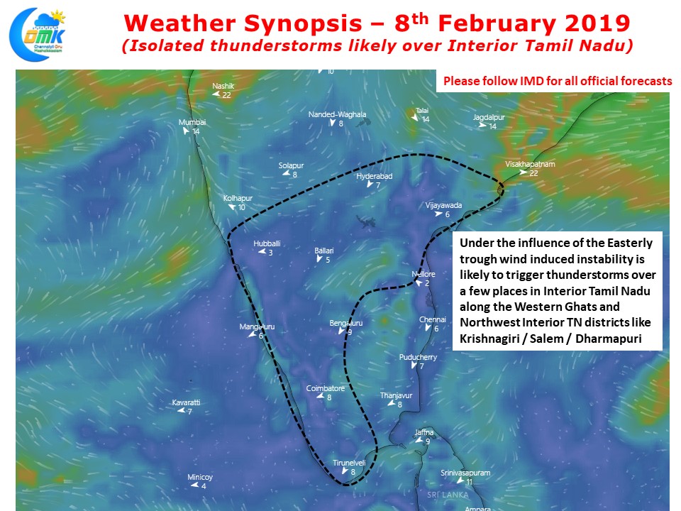
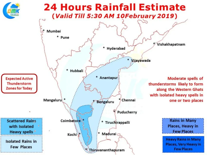
Influenced by the trough in Easterlies extending from Telengana region till the Maldive area there is a scrambled wind pattern prevailing over the interior areas of Tamil Nadu, South Interior Karnataka, Rayalaseema & parts of Kerala as well. This scrambled wind pattern will provide conducive conditions for the climbing air particles through ground radiation to interact with remnant moisture brought in by the Easterlies to trigger thunderstorms.

In particular the areas along the Western Ghats of Tamil Nadu & Kerala are likely to see moderate thunderstorms in few places with one or two places likely to see fairly heavy spell of short duration rains. Places adjoining Rayalaseema / South Interior Karnataka like Krishnagiri & Salem could also benefit from these later afternoon / evening thunderstorms.